Quitman, Arkansas
| Quitman, Arkansas | |
|---|---|
| City | |
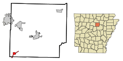 Location in Cleburne County and the state of Arkansas | |
| Coordinates: 35°22′52″N 92°13′5″W / 35.38111°N 92.21806°WCoordinates: 35°22′52″N 92°13′5″W / 35.38111°N 92.21806°W | |
| Country | United States |
| State | Arkansas |
| Counties | Cleburne, Faulkner |
| Area | |
| • Total | 2.0 sq mi (5.1 km2) |
| • Land | 2.0 sq mi (5.1 km2) |
| • Water | 0 sq mi (0 km2) |
| Elevation | 584 ft (178 m) |
| Population (2010) | |
| • Total | 762 |
| • Density | 385/sq mi (148.5/km2) |
| Time zone | Central (CST) (UTC-6) |
| • Summer (DST) | CDT (UTC-5) |
| ZIP code | 72131 |
| Area code(s) | 501 |
| FIPS code | 05-57950 |
| GNIS feature ID | 0053864 |
Quitman is a city in Cleburne and Faulkner counties in the U.S. state of Arkansas. Its population was 762 at the 2010 census.[1] The portion of the city in Faulkner County is part of the Little Rock–North Little Rock–Conway Metropolitan Statistical Area.
Geography
Quitman is located in southwestern Cleburne County at 35°22′52″N 92°13′5″W / 35.38111°N 92.21806°W (35.381231, -92.218190).[2] It extends southwest along Arkansas Highway 25 into Faulkner County. Highway 25 leads 15 miles (24 km) northeast to Heber Springs, the Cleburne County seat, and southwest 14 miles (23 km) to U.S. Route 65 north of Greenbrier.
According to the United States Census Bureau, Quitman has a total area of 2.0 square miles (5.1 km2), all land.[1]
Demographics
| Historical population | |||
|---|---|---|---|
| Census | Pop. | %± | |
| 1880 | 177 | — | |
| 1890 | 327 | 84.7% | |
| 1900 | 383 | 17.1% | |
| 1910 | 471 | 23.0% | |
| 1920 | 366 | −22.3% | |
| 1930 | 333 | −9.0% | |
| 1940 | 393 | 18.0% | |
| 1950 | 345 | −12.2% | |
| 1960 | 305 | −11.6% | |
| 1970 | 354 | 16.1% | |
| 1980 | 556 | 57.1% | |
| 1990 | 632 | 13.7% | |
| 2000 | 714 | 13.0% | |
| 2010 | 762 | 6.7% | |
| Est. 2015 | 742 | [3] | −2.6% |
As of the census[5] of 2000, there were 714 people, 316 households, and 204 families residing in the city. The population density was 378.2 people per square mile (145.9/km²). There were 358 housing units at an average density of 189.6/sq mi (73.1/km²). The racial makeup of the city was 98.88% White, 1.04% Native American, 0.14% Asian, and 0.84% from two or more races. 0.42% of the population were Hispanic or Latino of any race.
There were 316 households out of which 31.3% had children under the age of 18 living with them, 50.6% were married couples living together, 9.8% had a female householder with no husband present, and 35.4% were non-families. 32.6% of all households were made up of individuals and 20.6% had someone living alone who was 65 years of age or older. The average household size was 2.26 and the average family size was 2.84.
In the city the population was spread out with 25.6% under the age of 18, 8.3% from 18 to 24, 26.3% from 25 to 44, 17.9% from 45 to 64, and 21.8% who were 65 years of age or older. The median age was 38 years. For every 100 females there were 85.0 males. For every 100 females age 18 and over, there were 80.6 males.
The median income for a household in the city was $24,375, and the median income for a family was $31,964. Males had a median income of $28,750 versus $18,047 for females. The per capita income for the city was $15,537. About 11.8% of families and 14.0% of the population were below the poverty line, including 12.2% of those under age 18 and 23.2% of those age 65 or over.
Education
Public education of elementary and secondary school students is available from Quitman School District leading to graduation from Quitman High School.
References
- 1 2 "Geographic Identifiers: 2010 Demographic Profile Data (G001): Quitman city, Arkansas". U.S. Census Bureau, American Factfinder. Retrieved June 17, 2014.
- ↑ "US Gazetteer files: 2010, 2000, and 1990". United States Census Bureau. 2011-02-12. Retrieved 2011-04-23.
- ↑ "Annual Estimates of the Resident Population for Incorporated Places: April 1, 2010 to July 1, 2015". Retrieved July 2, 2016.
- ↑ "Census of Population and Housing". Census.gov. Archived from the original on May 11, 2015. Retrieved June 4, 2015.
- ↑ "American FactFinder". United States Census Bureau. Archived from the original on September 11, 2013. Retrieved 2008-01-31.
External links
Municipalities and communities of Cleburne County, Arkansas, United States | ||
|---|---|---|
| Cities | 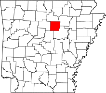 | |
| Towns | ||
| CDP | ||
| Unincorporated communities | ||
| Footnotes | ‡This populated place also has portions in an adjacent county or counties | |
Municipalities and communities of Faulkner County, Arkansas, United States | ||
|---|---|---|
| Cities | 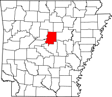 | |
| Towns | ||
| Unincorporated communities | ||
| Footnotes | ‡This populated place also has portions in an adjacent county or counties | |