Gattaran, Cagayan
| Gattaran | ||
|---|---|---|
| Municipality | ||
| ||
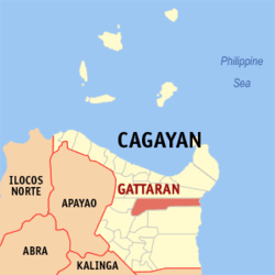 Map of Cagayan showing the location of Gattaran | ||
.svg.png) Gattaran Location within the Philippines | ||
| Coordinates: 18°04′N 121°39′E / 18.07°N 121.65°ECoordinates: 18°04′N 121°39′E / 18.07°N 121.65°E | ||
| Country | Philippines | |
| Region | Cagayan Valley (Region II) | |
| Province | Cagayan | |
| District | 1st District | |
| Barangays | 50 | |
| Government[1] | ||
| • Mayor | Matthew C. Nolasco | |
| Area[2] | ||
| • Total | 707.5 km2 (273.2 sq mi) | |
| Population (2015 census)[3] | ||
| • Total | 56,661 | |
| • Density | 80/km2 (210/sq mi) | |
| Time zone | PST (UTC+8) | |
| ZIP code | 3508 | |
| IDD : area code | +63 (0)78 | |
| Income class | 1st class | |

Gattaran is a first class municipality in the province of Cagayan, Philippines. According to the 2015 census, it has a population of 56,661 people.[3]
Gattaran's historic spots and tourist landmarks include the Lal-lo and Gattaran Shell Middens, Magapit Protected Landscape, Maduppaper Caves, the Mapaso Hot Spring and the Tanglagan Falls whose warm and cold waters meet and flow together on one bed to become the Dummun River. Another attraction of Gattaran is Bolos Point, a wildlife sanctuary.
History
In the place where Gattaran lies today were three former ecclesiastical towns: Nassiping, Dummun, and Gattaran proper. Nassiping is the oldest among the three, founded on June 15, 1596 with Santa Catalina as the patron saint; Dummun was founded on May 24, 1598 and Gattaran, May 20, 1623. Since each of these towns had few inhabitants and had only one priest to administer to their religious needs, they were merged for ecclesiastical convenience into one municipality in 1877 by virtue of a Diocesan Order from the Bishop of Nueva Segovia (Lallo). Fray Francisco Suejos, O.P. was the first Gobernadorcillo.
During the Spanish regime, the natives grew spiritually; but with the Americans, they grew educationally and the inhabitants assimilated a more sophisticated lifestyle. Under the Commonwealth Government, the first Municipal Mayor was Melencio Adviento, who begun the construction of the present municipal building. The building was finished during the term of the next mayor, Atty. Hipolito Mandac. The municipal building was inaugurated in September, 1941. Four months after its inauguration, World War II broke out, the Japanese Forces occupied the town and all records, cadastral titles and others were confiscated by the invading forces.
With the coming of the Americans, the whole province was liberated from the Japanese forces. The first election of the Republic in 1947 made Delfino Liban the mayor. The administration marked the building of roads in the barrios, improvements of streets and others.
In 1950, the barrios of Gattaran to the west of the Cagayan River was separated to form the town of Lasam.[4]
Barangays
Gattaran is politically subdivided into 50 barangays.[2]
- Abra
- Aguiguican
- Bangatan Ngagan
- Baracaoit
- Baraoidan
- Barbarit
- Basao
- Bolos Point
- Cabayu
- Calaoagan Bassit
- Calaoagan Dackel
- Capiddigan
- Capissayan Norte
- Capissayan Sur
- Casicallan Sur
- Casicallan Norte
- Centro Norte (Pob.)
- Centro Sur (Pob.)
- Cullit
- Cumao
- Cunig
- Dumon
- Fugu
- Ganzano
- Guising
- Langgan
- Lapogan
- L. Adviento
- Mabuno
- Nabaccayan
- Naddungan
- Nagatutuan
- Nassiping
- Newagac
- Palagao Norte
- Palagao Sur
- Piña Este
- Piña Weste
- San Vicente
- Santa Maria
- Sidem
- Santa Ana
- Tagumay
- Takiki
- Taligan
- Tanglagan
- T. Elizaga (Mabirbira)
- Tubungan Este
- Tubungan Weste
- San Carlos
Demographics
| Population census of Gattaran | ||
|---|---|---|
| Year | Pop. | ±% p.a. |
| 1990 | 41,565 | — |
| 1995 | 44,034 | +1.09% |
| 2000 | 47,804 | +1.78% |
| 2007 | 50,269 | +0.70% |
| 2010 | 54,848 | +3.22% |
| 2015 | 56,661 | +0.62% |
| Source: Philippine Statistics Authority[3][5] | ||
In the 2015 census, the population of Gattaran, Cagayan, was 56,661 people,[3] with a density of 80 inhabitants per square kilometre or 210 inhabitants per square mile.
References
- ↑ "Official City/Municipal 2013 Election Results". Intramuros, Manila, Philippines: Commission on Elections (COMELEC). 11 September 2013. Retrieved 24 January 2014.
- 1 2 "Province: CAGAYAN". PSGC Interactive. Makati City, Philippines: National Statistical Coordination Board. Retrieved 24 January 2014.
- 1 2 3 4 "Region II (CAGAYAN VALLEY)". Census of Population (2015): Total Population by Province, City, Municipality and Barangay (Report). PSA. Retrieved 20 June 2016.
- ↑ "An act to create the municipality of Lasam in the province of Cagayan". LawPH.com. Retrieved 2011-04-09.
- ↑ "Region II (CAGAYAN VALLEY)". Census of Population and Housing (2010): Total Population by Province, City, Municipality and Barangay (Report). NSO. Retrieved 29 June 2016.
External links
 |
Lal-Lo | | ||
| Lasam / Cagayan River | |
Philippine Sea | ||
| ||||
| | ||||
| Santo Niño / Cagayan River | Alcala / Baggao |
Tuguegarao (capital) | |
| Municipalities | |
| Component city | |
| Barangays | |