Amulung, Cagayan
| Amulung | ||
|---|---|---|
| Municipality | ||
| ||
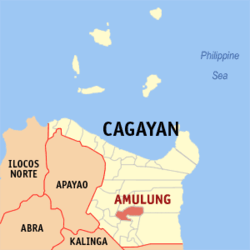 Map of Cagayan showing the location of Amulung | ||
.svg.png) Amulung Location within the Philippines | ||
| Coordinates: 17°50′N 121°44′E / 17.83°N 121.73°ECoordinates: 17°50′N 121°44′E / 17.83°N 121.73°E | ||
| Country | Philippines | |
| Region | Cagayan Valley (Region II) | |
| Province | Cagayan | |
| District | 3rd District | |
| Barangays | 47 | |
| Government[1] | ||
| • Mayor | Nicanor De La Cruz De Leon | |
| Area[2] | ||
| • Total | 242.2 km2 (93.5 sq mi) | |
| Population (2015 census)[3] | ||
| • Total | 47,860 | |
| • Density | 200/km2 (510/sq mi) | |
| Time zone | PST (UTC+8) | |
| ZIP code | 3505 | |
| IDD : area code | +63 (0)78 | |
| Income class | 2nd class | |

Amulung is a second class municipality in the province of Cagayan, Philippines. According to the 2015 census, it has a population of 47,860 people.[3]
Barangays
Amulung is politically subdivided into 48 barangays.[2]
- Abolo
- Agguirit
- Alitungtung
- Annabuculan
- Annafatan
- Anquiray
- Babayuan
- Baccuit
- Bacring
- Baculud
- Balauini
- Bauan
- Bayabat
- Calamagui
- Calintaan
- Caratacat
- Casingsingan Norte
- Casingsingan Sur
- Catarauan
- Centro
- Concepcion
- Cordova
- Dadda
- Dafunganay
- Dugayung
- Estefania
- Gabut
- Gangauan
- Goran
- Jurisdiccion
- La Suerte
- Logung
- Magogod
- Manalo
- Marobbob
- Masical
- Monte Alegre
- Nabbialan
- Nagsabaran
- Nangalasauan
- Nanuccauan
- Pacac-Grande
- Pacac-Pequeño
- Palacu
- Palayag
- San Juan
- Tana
- Unag
Demographics
| Population census of Amulung | ||
|---|---|---|
| Year | Pop. | ±% p.a. |
| 1990 | 35,116 | — |
| 1995 | 37,744 | +1.36% |
| 2000 | 42,754 | +2.71% |
| 2007 | 44,367 | +0.51% |
| 2010 | 45,182 | +0.66% |
| 2015 | 47,860 | +1.10% |
| Source: Philippine Statistics Authority[3][4] | ||
In the 2015 census, the population of Amulung was 47,860 people,[3] with a density of 200 inhabitants per square kilometre or 520 inhabitants per square mile.
References
- ↑ "Official City/Municipal 2013 Election Results". Intramuros, Manila, Philippines: Commission on Elections (COMELEC). 11 September 2013. Retrieved 24 January 2014.
- 1 2 "Province: CAGAYAN". PSGC Interactive. Makati City, Philippines: National Statistical Coordination Board. Retrieved 24 January 2014.
- 1 2 3 4 "Region II (CAGAYAN VALLEY)". Census of Population (2015): Total Population by Province, City, Municipality and Barangay (Report). PSA. Retrieved 20 June 2016.
- ↑ "Region II (CAGAYAN VALLEY)". Census of Population and Housing (2010): Total Population by Province, City, Municipality and Barangay (Report). NSO. Retrieved 29 June 2016.
External links
 |
Santo Niño | Alcala | Baggao | |
| |
||||
| ||||
| | ||||
| Piat | Solana / Iguig | Peñablanca |
Tuguegarao (capital) | |
| Municipalities | |
| Component city | |
| Barangays | |
This article is issued from Wikipedia - version of the 11/15/2016. The text is available under the Creative Commons Attribution/Share Alike but additional terms may apply for the media files.