Lasam, Cagayan
| Lasam | ||
|---|---|---|
| Municipality | ||
| ||
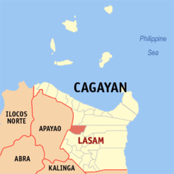 Map of Cagayan showing the location of Lasam | ||
.svg.png) Lasam Location within the Philippines | ||
| Coordinates: 18°04′N 121°36′E / 18.07°N 121.6°ECoordinates: 18°04′N 121°36′E / 18.07°N 121.6°E | ||
| Country | Philippines | |
| Region | Cagayan Valley (Region II) | |
| Province | Cagayan | |
| District | 2nd District | |
| Founded | June 13, 1950 | |
| Barangays | 30 | |
| Government[1] | ||
| • Mayor | Marjorie Apil Salazar | |
| Area[2] | ||
| • Total | 213.7 km2 (82.5 sq mi) | |
| Population (2015 census)[3] | ||
| • Total | 39,135 | |
| • Density | 180/km2 (470/sq mi) | |
| Time zone | PST (UTC+8) | |
| ZIP code | 3524 | |
| IDD : area code | +63 (0)78 | |
| Income class | 3rd class | |
| Website |
lasam | |

Lasam is a municipality in the Province of Cagayan in the Philippines. According to the 2015 census, it has a population of 39,135 people.[3] It is classified as a third class municipality in terms of income classification.[4]
The town was once a part of the Municipality of Gattaran, that stretches the width of the province and bisected by the Cagayan River. The barangays west of the river was established as the separate town of Lasam in 1950 by Republic Act No. 507. The new municipality of Lasam became part of the Second Representative District of the Province of Cagayan, while Gattaran is in the First District.[5]
Etymology
The Municipality of Lasam was named after the late Cagayan Governor Honorio Lasam.[6]
Barangays
Lasam is politically subdivided into 30 barangays.[4]
- Aggunetan
- Alannay
- Battalan
- Cabatacan East (Duldugan)
- Cabatacan West
- Calapangan Norte
- Calapangan Sur
- Callao Norte
- Callao Sur
- Cataliganan
- Centro I (Pob.)
- Centro II (Pob)
- Centro III (Pob)
- Finugo Norte
- Gabun
- Ignacio B. Jurado (Finugu Sur)
- Magsaysay
- Malinta
- Minanga Sur
- Minanga Norte
- Nabannagan East
- Nabannagan West
- New Orlins
- Nicolas Agatep
- Peru
- San Pedro
- Sicalao
- Tagao
- Tucalan Passing
- Viga
History
Lasam was once a part of Gattaran separated from the mother town by the wide Cagayan River with no bridges connecting the communities. As the population increased, the residents of the western part of the town asked to be created as a separate municipality.[6]
The town was established on June 13, 1950 by Republic Act No. 507 and signed by President Elpidio Quirino. Barrios (barangays) of Gattaran located west of the Cagayan River were formed into the new and regular Municipality of Lasam, with the old site of the Barrio Macatabang as the seat of the government.[5]
The town was officially inaugurated as independent from Gattaran in January 1951. Ignacio Jurado was appointed as its first mayor whose major task was to build the infrastructure of the new independent town of Lasam.[6]
Demographics
| Population census of Lasam | ||
|---|---|---|
| Year | Pop. | ±% p.a. |
| 1990 | 27,376 | — |
| 1995 | 30,235 | +1.88% |
| 2000 | 34,082 | +2.60% |
| 2007 | 36,646 | +1.01% |
| 2010 | 36,994 | +0.34% |
| 2015 | 39,135 | +1.08% |
| Source: Philippine Statistics Authority[3][7] | ||
In the 2015 census, the population of Lasam, Cagayan, was 39,135 people,[3] with a density of 180 inhabitants per square kilometre or 470 inhabitants per square mile.
Economy
Lasam is primarily an agricultural community and its people derive their income mainly from farming and livestock raising.[6]
References
- ↑ "Official City/Municipal 2013 Election Results". Intramuros, Manila, Philippines: Commission on Elections (COMELEC). 11 September 2013. Retrieved 24 January 2014.
- ↑ "Province: CAGAYAN". PSGC Interactive. Makati City, Philippines: National Statistical Coordination Board. Retrieved 24 January 2014.
- 1 2 3 4 "Region II (CAGAYAN VALLEY)". Census of Population (2015): Total Population by Province, City, Municipality and Barangay (Report). PSA. Retrieved 20 June 2016.
- 1 2 "City/Municipality: Lasam". PSGC Interactive. Retrieved on 2013-09-04.
- 1 2 "An act to create the municipality of Lasam in the province of Cagayan". PhiilippineLaw.info. Retrieved 2013-09-04.
- 1 2 3 4 "Lasam". Cagayan Province Official Website. Retrieved on 2013-09-04.
- ↑ "Region II (CAGAYAN VALLEY)". Census of Population and Housing (2010): Total Population by Province, City, Municipality and Barangay (Report). NSO. Retrieved 29 June 2016.
External links
 |
Allacapan | Lal-Lo | | |
| Flora, Apayao | |
Cagayan River / Gattaran | ||
| ||||
| | ||||
| Santo Niño |
Tuguegarao (capital) | |
| Municipalities | |
| Component city | |
| Barangays | |