Fort Seneca, Ohio
| Fort Seneca, Ohio | |
|---|---|
| CDP | |
|
Fort Seneca as seen from Fremont-Tiffin Road, looking north on State Route 53. | |
| Coordinates: 41°12′33″N 83°10′08″W / 41.20917°N 83.16889°W | |
| Country | United States |
| State | Ohio |
| County | Seneca County |
| Elevation[1] | 699 ft (213 m) |
| Time zone | Eastern (EST) (UTC-5) |
| • Summer (DST) | EDT (UTC-4) |
| ZIP code | 44883 |
| Area code(s) | 419 |
| GNIS feature ID | 1064666[1] |

Fort Seneca is a census-designated place in Pleasant Township, Seneca County, Ohio, United States.[2] It is located on State Route 53, approximately 6 miles (9.7 km) North of Tiffin. Although unincorporated, Fort Seneca had a post office, with the ZIP code of 44829 until 1998.[3] The post office was opened on December 15, 1821.[1]
The community of Fort Seneca was platted in 1836, and named after Old Fort Seneca, which was located 2 miles away from the present town site.[4]
References
- 1 2 3 "US Board on Geographic Names". United States Geological Survey. 2007-10-25. Retrieved 2008-01-31.
- ↑ U.S. Geological Survey Geographic Names Information System: Fort Seneca, Ohio
- ↑ Zip Code Lookup
- ↑ Baughman, Abraham J. (1911). History of Seneca County, Ohio: A Narrative Account of Its Historical Progress, Its People, and Its Principal Interests. Lewis Publishing Company. pp. 471–472.
Municipalities and communities of Seneca County, Ohio, United States | ||
|---|---|---|
| Cities | 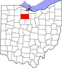 | |
| Villages | ||
| Townships | ||
| CDPs | ||
| Unincorporated communities | ||
| Ghost towns | ||
| Footnotes | ‡This populated place also has portions in an adjacent county or counties | |
Coordinates: 41°12′33″N 83°10′08″W / 41.20917°N 83.16889°W
This article is issued from Wikipedia - version of the 10/1/2016. The text is available under the Creative Commons Attribution/Share Alike but additional terms may apply for the media files.