Green Springs, Ohio
| Green Springs, Ohio | |
|---|---|
| Village | |
|
Aerial view of Green Springs and the surrounding countryside | |
 Location of Green Springs, Ohio | |
 Location of Green Springs in Seneca County | |
| Coordinates: 41°15′26″N 83°3′6″W / 41.25722°N 83.05167°WCoordinates: 41°15′26″N 83°3′6″W / 41.25722°N 83.05167°W | |
| Country | United States |
| State | Ohio |
| Counties | Sandusky, Seneca |
| Government[1] | |
| • Mayor | Adam Greenslade |
| Area[2] | |
| • Total | 1.21 sq mi (3.13 km2) |
| • Land | 1.21 sq mi (3.13 km2) |
| • Water | 0 sq mi (0 km2) |
| Elevation[3] | 709 ft (216 m) |
| Population (2010)[4] | |
| • Total | 1,368 |
| • Estimate (2012[5]) | 1,349 |
| • Density | 1,130.6/sq mi (436.5/km2) |
| Time zone | Eastern (EST) (UTC-5) |
| • Summer (DST) | EDT (UTC-4) |
| ZIP code | 44836 |
| Area code(s) | 419 |
| FIPS code | 39-32256[6] |
| GNIS feature ID | 1061115[3] |
| Website | http://villageofgreensprings.com/ |

Green Springs is a village in Sandusky and Seneca counties in the U.S. state of Ohio. The population was 1,368 at the 2010 census.
Its "claim to fame" is Mineral Springs, the largest natural sulfur spring in the world.[7] Elmwood at the Springs Healthcare Center, formerly St. Francis Health Care Centre, is located there.[8]
History
The Green Springs area was originally inhabited by the Seneca Indians. But in 1830, the Seneca were forced to move to reservations in the West because of a policy of Indian removal developed by the administration of Andrew Jackson. Then, in 1831, Jacob Stem, the founder of Green Springs, bought the land from the government. He purchased about 1,200 acres (4.9 km2) within Sandusky and Seneca counties, including the sulfur spring. It has been told by older citizens of that time that he really did not get the spring then, but later on bought it from the Indians for 12 bags of wheat, 12 bags of oats, 12 bags of corn, and a mule. The village was originally called Stemtown, named after the founder. It was later called Green Springs, named from the color of the water from the spring.
Geography
Green Springs is located at 41°15′26″N 83°03′06″W / 41.257152°N 83.051753°W (41.257152, -83.051753).[9]
According to the United States Census Bureau, the village has a total area of 1.21 square miles (3.13 km2), all land.[2]
State Route 19 passes through the community, the in-town portion of which is called Broadway Street.
Demographics
| Historical population | |||
|---|---|---|---|
| Census | Pop. | %± | |
| 1880 | 720 | — | |
| 1890 | 910 | 26.4% | |
| 1900 | 816 | −10.3% | |
| 1910 | 833 | 2.1% | |
| 1920 | 830 | −0.4% | |
| 1930 | 750 | −9.6% | |
| 1940 | 930 | 24.0% | |
| 1950 | 1,082 | 16.3% | |
| 1960 | 1,262 | 16.6% | |
| 1970 | 1,279 | 1.3% | |
| 1980 | 1,568 | 22.6% | |
| 1990 | 1,446 | −7.8% | |
| 2000 | 1,247 | −13.8% | |
| 2010 | 1,368 | 9.7% | |
| Est. 2015 | 1,332 | [10] | −2.6% |
2010 census
As of the census[4] of 2010, there were 1,368 people, 481 households, and 320 families residing in the village. The population density was 1,130.6 inhabitants per square mile (436.5/km2). There were 520 housing units at an average density of 429.8 per square mile (165.9/km2). The racial makeup of the village was 96.4% White, 0.6% African American, 0.7% Native American, 0.1% Asian, 0.9% from other races, and 1.4% from two or more races. Hispanic or Latino of any race were 8.4% of the population.
There were 481 households of which 36.2% had children under the age of 18 living with them, 47.8% were married couples living together, 11.2% had a female householder with no husband present, 7.5% had a male householder with no wife present, and 33.5% were non-families. 29.7% of all households were made up of individuals and 13.1% had someone living alone who was 65 years of age or older. The average household size was 2.51 and the average family size was 3.03.
The median age in the village was 40.4 years. 24.9% of residents were under the age of 18; 6.4% were between the ages of 18 and 24; 25.1% were from 25 to 44; 25% were from 45 to 64; and 18.6% were 65 years of age or older. The gender makeup of the village was 48.3% male and 51.7% female.
2000 census
As of the census[6] of 2000, there were 1,247 people, 443 households, and 317 families residing in the village. The population density was 1,163.1 people per square mile (450.0/km2). There were 467 housing units at an average density of 435.6 per square mile (168.5/km2). The racial makeup of the village was 95.11% White, 0.32% African American, 0.32% Native American, 0.56% Asian, 2.17% from other races, and 1.52% from two or more races. Hispanic or Latino of any race were 5.13% of the population.
There were 443 households out of which 35.7% had children under the age of 18 living with them, 55.3% were married couples living together, 10.4% had a female householder with no husband present, and 28.4% were non-families. 23.9% of all households were made up of individuals and 11.3% had someone living alone who was 65 years of age or older. The average household size was 2.54 and the average family size was 2.97.
In the village the population was spread out with 24.3% under the age of 18, 9.1% from 18 to 24, 27.3% from 25 to 44, 20.0% from 45 to 64, and 19.2% who were 65 years of age or older. The median age was 38 years. For every 100 females there were 92.1 males. For every 100 females age 18 and over, there were 88.0 males.
The median income for a household in the village was $33,553, and the median income for a family was $43,462. Males had a median income of $32,100 versus $19,659 for females. The per capita income for the village was $17,734. About 5.4% of families and 8.7% of the population were below the poverty line, including 12.5% of those under age 18 and 11.5% of those age 65 or over.
Education
Green Springs has one elementary school, Green Springs Elementary (grades K-5), which is part of Clyde-Green Springs Schools.[12]
The village is also home to one library, called Green Springs Public Library, which is a branch of the Birchard Public Library located in Fremont.[13]
Mineral Springs
Mineral Springs at Green Springs, the largest natural sulfur spring in the world, flows up from an underground river at a rate of 8 million gallons of water every 24 hours. The overflow runs into Green Creek and eventually into Sandusky Bay and Lake Erie. In the early 19th century, Jacob Stem used the water to establish the area's first saw and grist mills. However the springs became a source for "curing all ailments". In 1868, entrepreneur Robert Smith had the water analyzed for mineral content and found it high in calcium sulfate and magnesium sulfate. Robert Smith was a very successful business man and was married to Catherine Stem, Jacob Stem's daughter. The area was developed to include hotels and spas, and people from many parts of Ohio and elsewhere came to be near the water. The water was also bottled and sold until the 1930s.
Pollution
Green Springs is the site of dumping of toxic industrial waste by Whirlpool in a children's recreation area that some have tied to the Clyde cancer cluster. [14][15]
Notable person
- Rodger Wilton Young, Medal of Honor recipient, who along with his family moved to Green Springs when he was ten.[16]
References
- ↑ Lease, Clint (March 5, 2014). "Greenslade sworn in as Green Springs mayor". The Advertiser Tribune. Retrieved July 26, 2014.
- 1 2 "US Gazetteer files 2010". United States Census Bureau. Retrieved 2013-01-06.
- 1 2 "US Board on Geographic Names". United States Geological Survey. 2007-10-25. Retrieved 2008-01-31.
- 1 2 "American FactFinder". United States Census Bureau. Retrieved 2013-01-06.
- ↑ "Population Estimates". United States Census Bureau. Retrieved 2013-06-17.
- 1 2 "American FactFinder". United States Census Bureau. Retrieved 2008-01-31.
- ↑ "Welcome to Sandusky County, Ohio"
- ↑ Elmwood at the Springs Healthcare Center. Accessed 2014-03-22.
- ↑ "US Gazetteer files: 2010, 2000, and 1990". United States Census Bureau. 2011-02-12. Retrieved 2011-04-23.
- ↑ "Annual Estimates of the Resident Population for Incorporated Places: April 1, 2010 to July 1, 2015". Retrieved July 2, 2016.
- ↑ "Census of Population and Housing". Census.gov. Retrieved June 4, 2015.
- ↑ Clyde-Green Springs Schools. Accessed 2014-03-22.
- ↑ Birchard Public Library. Accessed 2014-03-22.
- ↑ November 14, 2012, "Whirlpool Park near Clyde, Ohio found to be toxic dumping ground", Newton Independent
- ↑ "SITE ASSESSMENT REPORT FOR THE WHIRLPOOL PARK SITE GREEN SPRINGS, SANDUSKY COUNTY, OHIO" (PDF).
- ↑ A boy named Rodger Young
Municipalities and communities of Sandusky County, Ohio, United States | ||
|---|---|---|
| Cities | 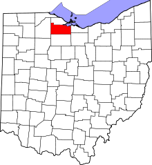 | |
| Villages | ||
| Townships | ||
| CDPs | ||
| Unincorporated communities | ||
| Footnotes | ‡This populated place also has portions in an adjacent county or counties | |
Municipalities and communities of Seneca County, Ohio, United States | ||
|---|---|---|
| Cities | 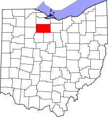 | |
| Villages | ||
| Townships | ||
| CDPs | ||
| Unincorporated communities | ||
| Ghost towns | ||
| Footnotes | ‡This populated place also has portions in an adjacent county or counties | |