New Riegel, Ohio
| New Riegel, Ohio | |
|---|---|
| Village | |
|
All Saints Catholic Church, a community landmark | |
 Location of New Riegel, Ohio | |
 Location of New Riegel in Seneca County | |
| Coordinates: 41°3′6″N 83°19′8″W / 41.05167°N 83.31889°WCoordinates: 41°3′6″N 83°19′8″W / 41.05167°N 83.31889°W | |
| Country | United States |
| State | Ohio |
| County | Seneca |
| Government | |
| • Type | Village council |
| • Mayor | Lawrence Raymond Bouillon |
| Area[1] | |
| • Total | 0.20 sq mi (0.52 km2) |
| • Land | 0.20 sq mi (0.52 km2) |
| • Water | 0 sq mi (0 km2) |
| Elevation[2] | 830 ft (253 m) |
| Population (2010)[3] | |
| • Total | 249 |
| • Estimate (2012[4]) | 246 |
| • Density | 1,245.0/sq mi (480.7/km2) |
| Time zone | Eastern (EST) (UTC-5) |
| • Summer (DST) | EDT (UTC-4) |
| ZIP code | 44853 |
| Area code(s) | 419 |
| FIPS code | 39-55398[5] |
| GNIS feature ID | 1043846[2] |

New Riegel is a village in Seneca County, Ohio, United States. The population was 249 at the 2010 census.
The village was named after Riegel, Germany, the native home of a large share of the early settlers.[6]
Geography
New Riegel is located at 41°3′6″N 83°19′8″W / 41.05167°N 83.31889°W (41.051536, -83.318946).[7]
According to the United States Census Bureau, the village has a total area of 0.20 square miles (0.52 km2), all land.[1]
Demographics
| Historical population | |||
|---|---|---|---|
| Census | Pop. | %± | |
| 1870 | 236 | — | |
| 1880 | 367 | 55.5% | |
| 1890 | 393 | 7.1% | |
| 1900 | 298 | −24.2% | |
| 1910 | 268 | −10.1% | |
| 1920 | 246 | −8.2% | |
| 1930 | 239 | −2.8% | |
| 1940 | 264 | 10.5% | |
| 1950 | 317 | 20.1% | |
| 1960 | 349 | 10.1% | |
| 1970 | 340 | −2.6% | |
| 1980 | 329 | −3.2% | |
| 1990 | 298 | −9.4% | |
| 2000 | 226 | −24.2% | |
| 2010 | 249 | 10.2% | |
| Est. 2015 | 246 | [8] | −1.2% |
2010 census
As of the census[3] of 2010, there were 249 people, 110 households, and 68 families residing in the village. The population density was 1,245.0 inhabitants per square mile (480.7/km2). There were 116 housing units at an average density of 580.0 per square mile (223.9/km2). The racial makeup of the village was 98.8% White, 0.8% African American, and 0.4% Pacific Islander. Hispanic or Latino of any race were 2.0% of the population.
There were 110 households of which 25.5% had children under the age of 18 living with them, 47.3% were married couples living together, 10.9% had a female householder with no husband present, 3.6% had a male householder with no wife present, and 38.2% were non-families. 36.4% of all households were made up of individuals and 16.3% had someone living alone who was 65 years of age or older. The average household size was 2.25 and the average family size was 2.90.
The median age in the village was 41.9 years. 22.1% of residents were under the age of 18; 8.3% were between the ages of 18 and 24; 24% were from 25 to 44; 25.6% were from 45 to 64; and 19.7% were 65 years of age or older. The gender makeup of the village was 49.4% male and 50.6% female.
2000 census
As of the census[5] of 2000, there were 226 people, 100 households, and 57 families residing in the village. The population density was 1,141.2 people per square mile (436.3/km²). There were 102 housing units at an average density of 515.1 per square mile (196.9/km²). The racial makeup of the village was 99.56% White, 0.44% from other races. Hispanic or Latino of any race were 0.88% of the population.
There were 100 households out of which 24.0% had children under the age of 18 living with them, 49.0% were married couples living together, 6.0% had a female householder with no husband present, and 43.0% were non-families. 40.0% of all households were made up of individuals and 22.0% had someone living alone who was 65 years of age or older. The average household size was 2.24 and the average family size was 2.98.
In the village the population was spread out with 21.7% under the age of 18, 11.1% from 18 to 24, 23.0% from 25 to 44, 21.2% from 45 to 64, and 23.0% who were 65 years of age or older. The median age was 39 years. For every 100 females there were 88.3 males. For every 100 females age 18 and over, there were 90.3 males.
The median income for a household in the village was $31,000, and the median income for a family was $46,667. Males had a median income of $32,500 versus $19,286 for females. The per capita income for the village was $17,409. About 1.9% of families and 4.1% of the population were below the poverty line, including none of those under the age of eighteen and 22.0% of those sixty-five or over.
References
- 1 2 "US Gazetteer files 2010". United States Census Bureau. Retrieved 2013-01-06.
- 1 2 "US Board on Geographic Names". United States Geological Survey. 2007-10-25. Retrieved 2008-01-31.
- 1 2 "American FactFinder". United States Census Bureau. Retrieved 2013-01-06.
- ↑ "Population Estimates". United States Census Bureau. Retrieved 2013-06-17.
- 1 2 "American FactFinder". United States Census Bureau. Retrieved 2008-01-31.
- ↑ Overman, William Daniel (1958). Ohio Town Names. Akron, OH: Atlantic Press. p. 99.
- ↑ "US Gazetteer files: 2010, 2000, and 1990". United States Census Bureau. 2011-02-12. Retrieved 2011-04-23.
- ↑ "Annual Estimates of the Resident Population for Incorporated Places: April 1, 2010 to July 1, 2015". Retrieved July 2, 2016.
- ↑ "Census of Population and Housing". Census.gov. Retrieved June 4, 2015.
Municipalities and communities of Seneca County, Ohio, United States | ||
|---|---|---|
| Cities | 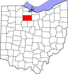 | |
| Villages | ||
| Townships | ||
| CDPs | ||
| Unincorporated communities | ||
| Ghost towns | ||
| Footnotes | ‡This populated place also has portions in an adjacent county or counties | |