Eito
EITO may also refer to the European Information Technology Observatory
| Eito | |
|---|---|
 | |
| Coordinates: 17°08′35″N 25°01′26″W / 17.143°N 25.024°WCoordinates: 17°08′35″N 25°01′26″W / 17.143°N 25.024°W | |
| Country | Cape Verde |
| Island | Santo Antão |
| Municipality | Paul |
| Civil parish | Santo António das Pombas |
| Population (2010)[1] | |
| • Total | 979 |
Eito is a settlement in the northeastern part of the island of Santo Antão, Cape Verde. It is situated 1 km southwest of Pombas and 15 km northeast of the island capital Porto Novo. Its name refers to a large quantity of agricultural land or large or extended land in the area as much of the land is agricultural and mountainous.
Population
- 2010: 979
Sporting club
- Os Foguetões
See also
References
- ↑ "2010 Census results". Instituto Nacional de Estatística Cabo Verde (in Portuguese). 17 March 2014.
Subdivisions of the island of Santo Antão | |||||||||||||||
|---|---|---|---|---|---|---|---|---|---|---|---|---|---|---|---|
| Paul |
|  | |||||||||||||
| Porto Novo | |||||||||||||||
| Ribeira Grande | |||||||||||||||
| Parish | 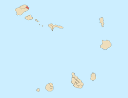 | |
|---|---|---|
| Communities and settlements | ||
| Geographical features |
| |
| Landmarks and points of Interests | ||
| Culture | ||
This article is issued from Wikipedia - version of the 12/1/2016. The text is available under the Creative Commons Attribution/Share Alike but additional terms may apply for the media files.