East Granby, Connecticut
| East Granby | ||
|---|---|---|
| Town | ||
| ||
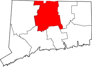
 Location within Hartford County, Connecticut | ||
| Coordinates: 41°56′48″N 72°44′28″W / 41.94667°N 72.74111°WCoordinates: 41°56′48″N 72°44′28″W / 41.94667°N 72.74111°W | ||
| Country | United States | |
| State | Connecticut | |
| NECTA | Hartford | |
| Region | Capitol Region | |
| Incorporated | 1858 | |
| Government | ||
| • Type | Selectman-town meeting | |
| • First selectman | James Hayden (D) | |
| • Selectman | M. Thomas Short (D) | |
| • Selectman | John Ziobro (R) | |
| Area | ||
| • Total | 17.7 sq mi (45.8 km2) | |
| • Land | 17.6 sq mi (45.5 km2) | |
| • Water | 0.1 sq mi (0.3 km2) | |
| Elevation | 308 ft (94 m) | |
| Population (2010)[1] | ||
| • Total | 5,148 | |
| • Density | 290/sq mi (110/km2) | |
| Time zone | Eastern (UTC-5) | |
| • Summer (DST) | Eastern (UTC-4) | |
| ZIP code | 06026 | |
| Area code(s) | 860 | |
| FIPS code | 09-22070 | |
| GNIS feature ID | 0213421 | |
| Website |
www | |

East Granby is a town in Hartford County, Connecticut, United States. The population was 5,148 at the 2010 census.[1]
About
Original inhabitants of the current East Granby area were Native American peoples, including the Algonquin/Poquonock, the Massaco, and the Agawam.[2]
The East Granby area was first settled by Europeans in 1664, which was one of the four Congregational parishes in Simsbury.[3] The Turkey Hills Ecclesiastical Society in 1786 became a section of Granby, and in 1858 was incorporated as the Town of East Granby.
The first incorporated copper mine in America resided in what is now East Granby. The mine later became Old Newgate Prison, a Revolutionary War jail and the first state prison in the United States (1790).
Farming was the mainstay of the town for much of its history. The early twentieth century saw local farmers specializing in dairy product and tobacco.
East Granby experienced a housing boom that started in 1951 and resulted in a rise in population.[4]
The town celebrated its 150th anniversary with a three-day festival on June 7, 8, and 9, 2008.
Geography


East Granby is in the Farmington valley, with the Farmington River passing along the southern border of the town. The Metacomet Ridge, a mountainous trap rock ridgeline that stretches from Long Island Sound to nearly the Vermont border, runs through the center of the town, cutting off Salisbury Plain to the east, which used to lie under the ancient, glacial Lake Hitchcock. High points on the Metacomet Ridge in East Granby include Hatchet Hill and Peak Mountain; the latter offers a bird's eye view of the historic Old Newgate Prison. The 51-mile (82 km) Metacomet Trail traverses the ridge.
Demographics
| Historical population | |||
|---|---|---|---|
| Census | Pop. | %± | |
| 1860 | 833 | — | |
| 1870 | 853 | 2.4% | |
| 1880 | 754 | −11.6% | |
| 1890 | 661 | −12.3% | |
| 1900 | 684 | 3.5% | |
| 1910 | 797 | 16.5% | |
| 1920 | 1,056 | 32.5% | |
| 1930 | 1,003 | −5.0% | |
| 1940 | 1,225 | 22.1% | |
| 1950 | 1,327 | 8.3% | |
| 1960 | 2,434 | 83.4% | |
| 1970 | 3,532 | 45.1% | |
| 1980 | 4,102 | 16.1% | |
| 1990 | 4,302 | 4.9% | |
| 2000 | 4,745 | 10.3% | |
| 2010 | 5,161 | 8.8% | |
| Est. 2020 | 5,341 | [5] | 3.5% |
As of the census[8] of 2014, there were 5,055 people (2012) and 2,129 households (2012). The population density was 289 people per square mile (104.8/km²) (2012). There were 2,186 housing units. The racial makeup of the town was 86.7% White, 5.28% African American, 0% Native American, 5.66% Asian, 2.35% from other races or multi-race residents. Hispanic or Latino of any race were 3.9% of the population.
The town the population was spread out with 22.5% under the age of 18, 4.85% from 18 to 24, 35.55% from 25 to 49, 22.5% from 50 to 64, and 6% who were 65 years of age or older. 47.85% of the population is female (52.15% male). Residents that were 18 years or older compromised 77.47% of the population. 49.46% of residents that were 18 years or older were female (50.52% male). For every 100 females age 18 and over, there were 95.8 males. In 2000,[9] the median age was 39 years.
As of 2000, there were 1,848 households out of which 35.6% had children under the age of 18 living with them, 62.8% were married couples living together, 7.5% had a female householder with no husband present, and 26.7% were non-families.[9] 22.1% of all households were made up of individuals and 8.1% had someone living alone who was 65 years of age or older. The average household size was 2.57 and the average family size was 3.04.
Income and Unemployment
As of 2000, the median income for a household in the town was $68,696, and the median income for a family was $77,621.[9] Males had a median income of $48,992 versus $37,450 for females. The per capita income for the town was $30,805. About 0.9% of families and 1.5% of the population were below the poverty line, including 0.6% of those under age 18 and 3.2% of those age 65 or over.
Unemployment rates in 2013 were at 5.8% for East Granby residents, which was less than the state's unemployment rate of 7.8%.[10] In 2014, 6 families were receiving temporary assistance and 154 individuals were receiving food stamps.
Education
As of 2012,[11] residents' educational attainment was: 23% high school graduate, 12% associate degree, and 37% bachelor's degree or higher.
During the 2010-2011 School Year,[12] total town school enrollment was at 939. Most public school students in East Granby attend the East Granby School District, which had 889 students.
Historic Sites and Buildings
Old Historical Buildings

East Granby has six historical buildings. The East Granby Historical Society can be found on North Main Street.[13]
- Clark Farm Tenant House
- Congregational Meetinghouse
- Ezekiel Phelps House
- Joseph Penney House
- Methodist-Episcopal Meetinghouse
- Old Newgate Prison
- Viets' Tavern - Newgate Road
- Whitfield Cowles House
Town Cemeteries
East Granby has seven cemeteries.[14] The oldest graves of East Granby can be found in the East Granby Center Cemetery, and dates back to 1737.
- East Granby Center Cemetery - Located Near East Granby Center On School Street. The East Granby Cemetery was established in 1722, and it is no longer active.[15]
- Copper Hill Cemetery - Located In The Northwest Part Of Town
- Elmwood Cemetery - Located On Windsor Locks Road, 3/4 Mile East Of Town Center
- Holcomb Cemetery - Located Near The Granby Railroad Station
- Prisoners' Cemetery - Located near Old Newgate Prison.
- Smallpox Cemetery - Located at the top of the hill off Tariffville Road. The cemetery is on top of the "Manitank Mt." between Turkey Hill and Hatchett Hill, the property is owned by Tilcon-Roncari.
- Viets Cemetery - Located Near Old Newgate Prison. This cemetery is in a clump of trees and bushes in a field in back of the farmhouse belonging to Jenny W. Kellogg. It is about a mile down the road leading from the prison towards 107-3. The plot is perhaps twenty feet square. There are about twenty stones in it. Not one of them is inscribed. The prisoners were taken down here from the prison and buried according to the story told around here.
Old Schoolhouses
East Granby has six old schoolhouses that are no longer in use.[16]
- Center District Schoolhouse
- Copper Hill Schoolhouse
- Falls Schoolhouse
- Hazelwood Schoolhouse
- North Schoolhouse
- South Schoolhouse
Government & Politics
| Voter Registration and Party Enrollment as of October 30, 2012[17] | |||||
|---|---|---|---|---|---|
| Party | Active Voters | Inactive Voters | Total Voters | Percentage | |
| Democratic | 995 | 19 | 1,014 | 27.24% | |
| Republican | 1,012 | 11 | 1,023 | 27.49% | |
| Unaffiliated | 1,504 | 46 | 1,550 | 41.64% | |
| Minor Parties | 32 | 3 | 35 | 0.94% | |
| Total | 3,543 | 79 | 3,622 | 100% | |
Voting
| Election results from statewide races | ||
|---|---|---|
| Year | Office | Results |
| 2012 | President | Romney 50.3 - 48.3% |
| Senator | McMahon 53.1 - 44.6% | |
Notable residents
- Walter Forward: (1783 - 1852) Lawyer and Secretary of the Treasury for President Tyler.
- Eunice Griswold Penney: (1770 - 1849) Well-known artist who worked watercolors.
- Walter Wick: (1953 - ) Author of the I Spy find-it-in-the-picture book series.
Education
Education in East Granby is through the East Granby Public School System, including East Granby High School, the smallest public high school in the state of Connecticut. The high school mascot is a crusader, and the middle school's is The Purple Wave. Both the high school's and the middle school's colors are purple and white.
Average class size for students in kindergarten in the East Granby school system was 13.8, second grade 23.7, fifth grade 23, seventh grade 20.5, and high school 17.1.[18] The students per computer ratios were: elementary 3.8, middle school 1.4, and secondary school 1.8. East Granby School students performed high on both the Connecticut Mastery Test (CMT) and SATs, where students' averages were higher than state averages in all grades (grade 4, 6, and 8 for CMT) and test subjects (Reading, Math, and Writing for both tests).
In popular culture
East Granby was noted in the book The Black Box, a record of airplane CVR recordings. East Granby was the site of the American Airlines Flight 1572 incident, which clipped the tops of trees in East Granby as it came in for a landing at Bradley International Airport.
References
- 1 2 "Geographic Identifiers: 2010 Demographic Profile Data (G001): East Granby town, Hartford County, Connecticut". U.S. Census Bureau, American Factfinder. Retrieved November 26, 2012.
- ↑ M.J., Patitucci. "General Archives". East Granby Historical Society. Retrieved 27 December 2015.
- ↑ Patitucci, M. J. "Home". East Granby Historical Society. Retrieved 27 December 2015.
- ↑ Springman, Mary Jane (1983). East Granby the Evolution of a Connecticut Town. NH: East Granby Historical Committee.
- ↑ "Annual Estimates of the Resident Population for Incorporated Places: April 1, 2010 to July 1, 2014". Retrieved June 4, 2015.
- ↑ "Census of Population and Housing". Census.gov. Retrieved June 4, 2015.
- ↑ "East Granby, CT CERC Town Profile 2014" (PDF). Connecticut Economic Resource Center. Retrieved 27 December 2015.
- ↑ "East Granby, CT CERC Town Profile 2014" (PDF). Connecticut Economic Resource Center. Retrieved 27 December 2015.
- 1 2 3 "American FactFinder". United States Census Bureau. Retrieved 2008-01-31.
- ↑ "East Granby, CT CERC Town Profile 2014" (PDF). Connecticut Economic Resource Center. Retrieved 27 December 2015.
- ↑ "East Granby, CT CERC Town Profile 2014" (PDF). Connecticut Economic Resource Center. Retrieved 27 December 2015.
- ↑ "East Granby, CT CERC Town Profile 2014" (PDF). Connecticut Economic Resource Center. Retrieved 27 December 2015.
- ↑ Patitucci, M.J. "Old Historical Buildings". East Granby Historical Society. Retrieved 27 December 2015.
- ↑ Patitucci, M. J. "Cemeteries of East Granby". East Granby Historical Society. Retrieved 27 December 2015.
- ↑ Santore, Beth. "East Granby Cemetery". Grave Addiction. Retrieved 27 December 2015.
- ↑ Patitucci, M. J. "Old Schoolhouses". East Granby Historical Society.
- ↑ "Registration and Party Enrollment Statistics as of October 30, 2012" (PDF). Connecticut Secretary of State. Archived from the original (PDF) on 2012-10-30. Retrieved 2006-10-02.
- ↑ "East Granby, CT CERC Town Profile 2014" (PDF). Connecticut Economic Resource Center. Retrieved 27 December 2015.