Duxbury, Minnesota
| Duxbury, Minnesota | |
|---|---|
| Unincorporated community | |
 Duxbury, Minnesota  Duxbury, Minnesota Location of the community of Duxbury | |
| Coordinates: 46°07′40″N 92°30′32″W / 46.12778°N 92.50889°WCoordinates: 46°07′40″N 92°30′32″W / 46.12778°N 92.50889°W | |
| Country | United States |
| State | Minnesota |
| County | Pine |
| Township | Wilma Township |
| Elevation | 1,063 ft (324 m) |
| Time zone | Central (CST) (UTC-6) |
| • Summer (DST) | CDT (UTC-5) |
| ZIP code | 55072 |
| Area code(s) | 320 |
| GNIS feature ID | 643002[1] |
Duxbury is an unincorporated community in Wilma Township, Pine County, Minnesota, United States.
The community is located east of Sandstone at the junction of Pine County Roads 24, 30, and 141 (Duxbury Road).
Nearby places include Askov, Sandstone, Bruno, Cloverton, and Markville.
Duxbury is located 17 miles east of Sandstone; and 18 miles southeast of Bruno. Duxbury is 28 miles east–northeast of Hinckley; and 15 miles northwest of Danbury, Wisconsin.
The Lower Tamarack River flows through the community. Duxbury is located within ZIP code 55072 based in Sandstone. The community is located on the edge of the St. Croix State Forest. The Nemadji State Forest is also nearby.
Local business establishments include the historic Duxbury Store, consisting of a general store and cafe. The Gandy Dancer Trail is also nearby.
References
- Rand McNally Road Atlas – 2007 edition – Minnesota entry
- Official State of Minnesota Highway Map – 2011/2012 edition
External links
- DuxburyNews.info – Community website
- DuxburyStore.com – Local Activities
- Two Creeks Campground – Active Clothing Optional Campground
- Wilma Township – Duxbury is in Wilma Township
Municipalities and communities of Pine County, Minnesota, United States | ||
|---|---|---|
| Cities | 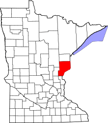 | |
| Townships | ||
| Unincorporated communities | ||
| Ghost towns | ||
| Indian reservation | ||