Cloverton, Minnesota
| Cloverton, Minnesota | |
|---|---|
| Unincorporated community | |
 Cloverton, Minnesota  Cloverton, Minnesota Location of the community of Cloverton | |
| Coordinates: 46°10′05″N 92°19′11″W / 46.16806°N 92.31972°WCoordinates: 46°10′05″N 92°19′11″W / 46.16806°N 92.31972°W | |
| Country | United States |
| State | Minnesota |
| County | Pine |
| Township | New Dosey Township |
| Elevation | 1,093 ft (333 m) |
| Time zone | Central (CST) (UTC-6) |
| • Summer (DST) | CDT (UTC-5) |
| ZIP code | 55072 |
| Area code(s) | 320 |
| GNIS feature ID | 641361[1] |
Cloverton is an unincorporated community in New Dosey Township, Pine County, Minnesota, United States.
The community is located east of Sandstone; at the junction of Cloverton Road (Pine County 31) and Rutabaga Road (County 32). The Gandy Dancer Trail passes through Cloverton. Hay Creek and the Upper Tamarack River are both nearby.
Cloverton is located near the Minnesota–Wisconsin state line. Nearby places in Minnesota include Markville, Kingsdale, and Duxbury. Nearby places in Wisconsin include Cozy Corner, Dairyland, and Danbury.
Cloverton is located 28 miles east of Sandstone; and 23 miles east of Askov. Cloverton is 4 miles west of Cozy Corner, WI; and 9 miles west–southwest of Dairyland, WI. Douglas County Road T is nearby.
The Nemadji State Forest and the Saint Croix State Forest are both nearby.
Cloverton is 32 miles northeast of Cloverdale; and 18 miles north of Danbury, WI.[2]
The community is located within ZIP code 55072 based in Sandstone.
History
Cloverton was named for wild clover in the area or for the Red Clover Land Company, a major landowner in the township in 1916. The Soo Line Railroad opened in the community in 1911.[3] A post office operated in Cloverton from 1912 until 1972.[4]
References
- ↑ "Cloverton, Minnesota". Geographic Names Information System. United States Geological Survey.
- ↑ Pine County, Minnesota (PDF) (Map). Minnesota Department of Transportation. 2012. Retrieved August 8, 2011.
- ↑ "Cloverton". Minnesota Historical Society. Retrieved August 12, 2011.
- ↑ "Pine County". Jim Forte Postal History. Archived from the original on 8 December 2015. Retrieved 30 July 2015.
- Rand McNally Road Atlas – 2007 edition – Minnesota entry
- Official State of Minnesota Highway Map – 2011/2012 edition
Municipalities and communities of Pine County, Minnesota, United States | ||
|---|---|---|
| Cities | 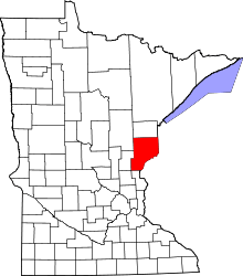 | |
| Townships | ||
| Unincorporated communities | ||
| Ghost towns | ||
| Indian reservation | ||