Pine County, Minnesota
| Pine County, Minnesota | |
|---|---|
 Pine County Courthouse, Pine City | |
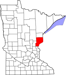 Location in the U.S. state of Minnesota | |
 Minnesota's location in the U.S. | |
| Founded |
March 1, 1856 (created) 1872 (organized)[1] |
| Named for | The abundant pine trees in the area[2] |
| Seat | Pine City |
| Largest city | Pine City |
| Area | |
| • Total | 1,435 sq mi (3,717 km2) |
| • Land | 1,411 sq mi (3,654 km2) |
| • Water | 23 sq mi (60 km2), 1.6% |
| Population (est.) | |
| • (2015) | 29,069 |
| • Density | 21/sq mi (8/km²) |
| Congressional district | 8th |
| Time zone | Central: UTC-6/-5 |
| Website |
www |
Pine County is a county located in the U.S. state of Minnesota. As of the 2010 census, the population was 29,750.[3] Its county seat is Pine City.[4] The county was formed in 1856 and organized in 1872.
A portion of the Mille Lacs Indian Reservation is in the county.
History
Pine County was organized on March 1, 1856, with Chisago County being its primary parent county. Other portions of the original Pine County originated from Ramsey County. The original county seat was Chengwatana.
In 1857, Buchanan County in full and southern portions of Aitkin and Carlton counties were formed from the original Pine County, with Kanabec County organized a year later. In 1861, Buchanan County was dissolved and folded into Pine County. Pine County was re-organized in 1872, with Pine City becoming the new county seat. Pine County has been featured in a series of Mysteries written by Dean Hovey. The titles include: Where Evil Hides, Hooker, Unforgettable, and Undeveloped.[5] Each of the Hovey books has been nominated for a Northeastern Minnesota Book Award (NEMBA) for their depiction of life in the area.
Geography
According to the U.S. Census Bureau, the county has a total area of 1,435 square miles (3,720 km2), of which 1,411 square miles (3,650 km2) is land and 23 square miles (60 km2) (1.6%) is water.[6]
Major highways
Adjacent counties
- Carlton County (north)
- Douglas County, Wisconsin (northeast)
- Burnett County, Wisconsin (east)
- Chisago County (south)
- Isanti County (southwest)
- Kanabec County (west)
- Aitkin County (northwest)
National protected area
Demographics
| Historical population | |||
|---|---|---|---|
| Census | Pop. | %± | |
| 1860 | 92 | — | |
| 1870 | 648 | 604.3% | |
| 1880 | 1,365 | 110.6% | |
| 1890 | 4,052 | 196.8% | |
| 1900 | 11,546 | 184.9% | |
| 1910 | 15,878 | 37.5% | |
| 1920 | 21,117 | 33.0% | |
| 1930 | 20,264 | −4.0% | |
| 1940 | 21,478 | 6.0% | |
| 1950 | 18,223 | −15.2% | |
| 1960 | 17,004 | −6.7% | |
| 1970 | 16,821 | −1.1% | |
| 1980 | 19,871 | 18.1% | |
| 1990 | 21,264 | 7.0% | |
| 2000 | 26,530 | 24.8% | |
| 2010 | 29,750 | 12.1% | |
| Est. 2015 | 29,069 | [7] | −2.3% |
| U.S. Decennial Census[8] 1790-1960[9] 1900-1990[10] 1990-2000[11] 2010-2015[3] | |||

As of the census of 2000,[12] there were 26,530 people, 9,939 households, and 6,917 families residing in the county. The population density was 19 people per square mile (7/km²). There were 15,353 housing units at an average density of 11 per square mile (4/km²). The racial makeup of the county was 91.9% White, 2.0% Black or African American, 3.1% Native American, 0.30% Asian, 0.03% Pacific Islander, 0.4% from other races, and 1.9% from two or more races. 2.4% of the population were Hispanic or Latino of any race. 32.3% were of German, 11.6% Swedish, 11.1% Norwegian and 5.5% American ancestry.
There were 17,276 households out of which 31.20% had children under the age of 18 living with them, 56.50% were married couples living together, 8.70% had a female householder with no husband present, and 30.40% were non-families. 25.10% of all households were made up of individuals and 10.90% had someone living alone who was 65 years of age or older. The average household size was 2.53 and the average family size was 3.02.
In the county the population was spread out with 25.50% under the age of 18, 7.70% from 18 to 24, 27.90% from 25 to 44, 23.90% from 45 to 64, and 15.00% who were 65 years of age or older. The median age was 38 years. For every 100 females there were 108.80 males. For every 100 females age 18 and over, there were 108.30 males.
The median income for a household in the county was $37,379, and the median income for a family was $44,058. Males had a median income of $31,600 versus $22,675 for females. The per capita income for the county was $17,445. About 7.80% of families and 11.30% of the population were below the poverty line, including 14.60% of those under age 18 and 10.00% of those age 65 or over.
Communities
Cities
Townships
- Arlone Township
- Arna Township
- Barry Township
- Birch Creek Township
- Bremen Township
- Brook Park Township
- Bruno Township
- Chengwatana Township
- Clover Township
- Crosby Township
- Danforth Township
- Dell Grove Township
- Finlayson Township
- Fleming Township
- Hinckley Township
- Kerrick Township
- Kettle River Township
- Mission Creek Township
- Munch Township
- New Dosey Township
- Nickerson Township
- Norman Township
- Ogema Township
- Park Township
- Partridge Township
- Pine City Township
- Pine Lake Township
- Pokegama Township
- Royalton Township
- Sandstone Township
- Sturgeon Lake Township
- Wilma Township
- Windemere Township
Unincorporated communities
Ghost towns
- Belden
- Banning
- Big Spring
- Blomskog
- Chengwatana
- Cornell
- Clint
- Danewood
- Eaglehead
- Harlis
- Midway
- Milburn
- Mission Creek
- Outflow
- Tozer Camp
- Turpville
- Tuxedo
- Villstad
- Wareham
See also
References
- ↑ "Minnesota Place Names". Minnesota Historical Society. Retrieved March 19, 2014.
- ↑ Upham, Warren (1920). Minnesota Geographic Names: Their Origin and Historic Significance. Minnesota Historical Society. p. 410.
- 1 2 "State & County QuickFacts". United States Census Bureau. Retrieved September 1, 2013.
- ↑ "Find a County". National Association of Counties. Archived from the original on May 10, 2015. Retrieved 2011-06-07.
- ↑ Hovey, Dean (2012). Create Space Independent Publishing Platform. ISBN 1475052545
- ↑ "2010 Census Gazetteer Files". United States Census Bureau. August 22, 2012. Retrieved October 24, 2014.
- ↑ "County Totals Dataset: Population, Population Change and Estimated Components of Population Change: April 1, 2010 to July 1, 2015". Retrieved July 2, 2016.
- ↑ "U.S. Decennial Census". United States Census Bureau. Archived from the original on May 11, 2015. Retrieved October 24, 2014.
- ↑ "Historical Census Browser". University of Virginia Library. Retrieved October 24, 2014.
- ↑ "Population of Counties by Decennial Census: 1900 to 1990". United States Census Bureau. Retrieved October 24, 2014.
- ↑ "Census 2000 PHC-T-4. Ranking Tables for Counties: 1990 and 2000" (PDF). United States Census Bureau. Retrieved October 24, 2014.
- ↑ "American FactFinder". United States Census Bureau. Retrieved 2008-01-31.
External links
- Pine County Government's Website
- Mn/DOT Official Map of Southern Pine County
- Mn/DOT Official Map of Northern Pine County
 |
Aitkin County | Carlton County | Douglas County, Wisconsin | |
| Kanabec County | |
Burnett County, Wisconsin | ||
| ||||
| | ||||
| Isanti County | Chisago County | Polk County, Wisconsin |
Municipalities and communities of Pine County, Minnesota, United States | ||
|---|---|---|
| Cities | | |
| Townships | ||
| Unincorporated communities | ||
| Ghost towns | ||
| Indian reservation | ||
Coordinates: 46°08′N 92°44′W / 46.14°N 92.74°W