Driscoll, North Dakota
| Driscoll | |
|---|---|
| Census-designated place & unincorporated community | |
|
Norm's Grocery in Driscoll | |
 Driscoll Location within the state of North Dakota | |
| Coordinates: 46°50′39″N 100°08′29″W / 46.84417°N 100.14139°WCoordinates: 46°50′39″N 100°08′29″W / 46.84417°N 100.14139°W | |
| Country | United States |
| State | North Dakota |
| County | Burleigh |
| Area[1] | |
| • Total | 0.577 sq mi (1.49 km2) |
| • Land | 0.577 sq mi (1.49 km2) |
| • Water | 0 sq mi (0 km2) |
| Elevation | 1,867 ft (569 m) |
| Population (2010)[2] | |
| • Total | 82 |
| • Density | 140/sq mi (55/km2) |
| Time zone | Central (CST) (UTC-6) |
| • Summer (DST) | CDT (UTC-5) |
| ZIP codes | 58532 |
| FIPS code[3] | 38-20500 |
| GNIS feature ID[3] | 2628574 |
.jpg)
Driscoll is a census-designated place in southeastern Burleigh County, North Dakota, United States. An unincorporated community, it was designated as part of the U.S. Census Bureau's Participant Statistical Areas Program on June 10, 2010.[4] It was not counted separately during the 2000 Census,[5] but was included in the 2010 Census,[6] where a population of 82 was reported.[2]
Driscoll lies just off Interstate 94 east of the city of Bismarck, the county seat of Burleigh County.[4] Although it is unincorporated, it has a post office, with the ZIP code of 58532.[7]
History
Driscoll was named for Frederick Driscoll, a newspaper manager.[8]
Driscoll is also home to "TnT Tavern, Norm's Grocery and Coal Car Diner.".
References
- ↑ "US Gazetteer files: 2010, 2000, and 1990". United States Census Bureau. 2011-02-12. Retrieved 2011-04-23.
- 1 2 "2010 Census Redistricting Data (Public Law 94-171) Summary File". American FactFinder. United States Census Bureau. Retrieved May 2, 2011.
- 1 2 "US Board on Geographic Names". United States Geological Survey. 2007-10-25. Retrieved 2008-01-31.
- 1 2 "Driscoll Census Designated Place". Geographic Names Information System. United States Geological Survey. Retrieved 2010-07-13.
- ↑ U.S. Census Bureau (2003). "Population and Housing Unit Counts, North Dakota" (PDF). 2000 Census of Population and Housing. Government Printing Office. Retrieved 2008-07-20.
- ↑ U.S. Census Bureau (February 13, 2008). "Census Designated Place (CDP) Program for the 2010 Census—Final Criteria" (PDF). Federal Register. Retrieved 2010-07-13.
- ↑ Zip Code Lookup
- ↑ "Profile for Driscoll, North Dakota". ePodunk. Retrieved 2010-06-21.
External links
Municipalities and communities of Burleigh County, North Dakota, United States | ||
|---|---|---|
| Cities | 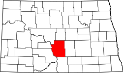 | |
| Townships |
| |
| CDPs | ||
| Unorganized territories |
| |
| Unincorporated communities | ||
| Footnotes | ‡This populated place also has portions in an adjacent county or counties | |
| Counties | 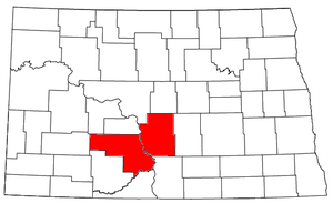 | |
|---|---|---|
| Core cities | ||
| Surrounding areas |
| |