Solen, North Dakota
| Solen, North Dakota | |
|---|---|
| City | |
 | |
 Location of Solen, North Dakota | |
| Coordinates: 46°23′16″N 100°47′45″W / 46.38778°N 100.79583°WCoordinates: 46°23′16″N 100°47′45″W / 46.38778°N 100.79583°W | |
| Country | United States |
| State | North Dakota |
| County | Sioux |
| Area[1] | |
| • Total | 0.30 sq mi (0.78 km2) |
| • Land | 0.30 sq mi (0.78 km2) |
| • Water | 0 sq mi (0 km2) |
| Elevation | 1,670 ft (509 m) |
| Population (2010)[2] | |
| • Total | 83 |
| • Estimate (2014)[3] | 89 |
| • Density | 276.7/sq mi (106.8/km2) |
| Time zone | Central (CST) (UTC-6) |
| • Summer (DST) | CDT (UTC-5) |
| ZIP code | 58570 |
| Area code(s) | 701 |
| FIPS code | 38-73820 |
| GNIS feature ID | 1032166[4] |
Solen is a city in Sioux County, North Dakota, United States and on the Standing Rock Indian Reservation. The population was 83 at the 2010 census.[5]
Solen was founded in 1910 along a Northern Pacific Railway branch line that ran from Mandan to Mott. The name comes from Mary Louise Van Solen, a pioneer settler who was the first schoolteacher on the Standing Rock Indian Reservation.[6]
Solen has one high school, Solen Public High School, nicknamed the "Solen Sioux".[7] The town has a gas station and automotive repair shop called Hoffman's Garage[8] which has been family owned and operated since the early 1900s as well as a local bar, Last Chance Saloon.
Geography
Solen is located along the Cannonball River, west of the Missouri, at 46°23′16″N 100°47′45″W / 46.38778°N 100.79583°W (46.387758, -100.795812).[9]
According to the United States Census Bureau, the city has a total area of 0.30 square miles (0.78 km2), all of it land.[1]
Demographics
| Historical population | |||
|---|---|---|---|
| Census | Pop. | %± | |
| 1970 | 180 | — | |
| 1980 | 138 | −23.3% | |
| 1990 | 92 | −33.3% | |
| 2000 | 86 | −6.5% | |
| 2010 | 83 | −3.5% | |
| Est. 2015 | 88 | [10] | 6.0% |
| U.S. Decennial Census[11] 2014 Estimate[3] | |||
2010 census
As of the census[2] of 2010, there were 83 people, 33 households, and 21 families residing in the city. The population density was 276.7 inhabitants per square mile (106.8/km2). There were 44 housing units at an average density of 146.7 per square mile (56.6/km2). The racial makeup of the city was 36.1% White, 51.8% Native American, and 12.0% from two or more races.
There were 33 households of which 21.2% had children under the age of 18 living with them, 36.4% were married couples living together, 24.2% had a female householder with no husband present, 3.0% had a male householder with no wife present, and 36.4% were non-families. 30.3% of all households were made up of individuals and 9.1% had someone living alone who was 65 years of age or older. The average household size was 2.52 and the average family size was 3.00.
The median age in the city was 44.3 years. 18.1% of residents were under the age of 18; 8.3% were between the ages of 18 and 24; 25.2% were from 25 to 44; 33.7% were from 45 to 64; and 14.5% were 65 years of age or older. The gender makeup of the city was 51.8% male and 48.2% female.
2000 census
As of the census of 2000, there were 86 people, 36 households, and 23 families residing in the city. The population density was 287.0 people per square mile (110.7/km²). There were 43 housing units at an average density of 143.5 per square mile (55.3/km²). The racial makeup of the city was 34.88% White and 65.12% Native American. Hispanic or Latino of any race were 3.49% of the population.
There were 36 households out of which 30.6% had children under the age of 18 living with them, 36.1% were married couples living together, 22.2% had a female householder with no husband present, and 36.1% were non-families. 27.8% of all households were made up of individuals and 2.8% had someone living alone who was 65 years of age or older. The average household size was 2.39 and the average family size was 2.65.
In the city the population was spread out with 25.6% under the age of 18, 5.8% from 18 to 24, 26.7% from 25 to 44, 31.4% from 45 to 64, and 10.5% who were 65 years of age or older. The median age was 36 years. For every 100 females there were 87.0 males. For every 100 females age 18 and over, there were 100.0 males.
The median income for a household in the city was $21,042, and the median income for a family was $21,250. Males had a median income of $33,750 versus $16,250 for females. The per capita income for the city was $9,649. There were 41.7% of families and 40.0% of the population living below the poverty line, including 66.7% of under eighteens and 50.0% of those over 64.
Climate
This climatic region is typified by large seasonal temperature differences, with warm to hot (and often humid) summers and cold (sometimes severely cold) winters. According to the Köppen Climate Classification system, Solen has a humid continental climate, abbreviated "Dfb" on climate maps.[12]
References
- 1 2 "US Gazetteer files 2010". United States Census Bureau. Retrieved 2012-06-14.
- 1 2 "American FactFinder". United States Census Bureau. Retrieved 2012-06-14.
- 1 2 "Population Estimates". United States Census Bureau. Retrieved July 9, 2015.
- ↑ "US Board on Geographic Names". United States Geological Survey. 2007-10-25. Retrieved 2008-01-31.
- ↑ "2010 Census Redistricting Data (Public Law 94-171) Summary File". American FactFinder. United States Census Bureau. Retrieved 2 May 2011.
- ↑ Wick, Douglas A. "Solen (Sioux County)". North Dakota Place Names. Retrieved 7 May 2011.
- ↑ http://www.solen.k12.nd.us/Solen.html
- ↑ http://www.yelp.com/biz/hoffmans-garage-solen
- ↑ "US Gazetteer files: 2010, 2000, and 1990". United States Census Bureau. 2011-02-12. Retrieved 2011-04-23.
- ↑ "Annual Estimates of the Resident Population for Incorporated Places: April 1, 2010 to July 1, 2015". Retrieved July 2, 2016.
- ↑ United States Census Bureau. "Census of Population and Housing". Retrieved January 21, 2014.
- ↑ Climate Summary for Solen, North Dakota
Municipalities and communities of Sioux County, North Dakota, United States | ||
|---|---|---|
| Cities | 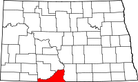 | |
| CDPs | ||
| Unorganized territory |
| |
| Unincorporated community |
| |
| Indian reservations | ||
| Footnotes | ‡This populated place also has portions in an adjacent county or counties | |