Porcupine, North Dakota
| Porcupine, North Dakota | |
|---|---|
| Census-designated place & Unincorporated community | |
|
Street in Porcupine | |
 Porcupine, North Dakota | |
| Coordinates: 46°13′08″N 101°05′55″W / 46.21889°N 101.09861°W | |
| Country | United States |
| State | North Dakota |
| County | Sioux |
| Area[1] | |
| • Total | 0.202 sq mi (0.52 km2) |
| • Land | 0.202 sq mi (0.52 km2) |
| • Water | 0 sq mi (0 km2) |
| Elevation | 1,811 ft (552 m) |
| Population (2010)[2] | |
| • Total | 146 |
| • Density | 720/sq mi (280/km2) |
| Time zone | Central (CST) (UTC-6) |
| • Summer (DST) | CDT (UTC-5) |
| Area code(s) | 701 |
| GNIS feature ID | 1030781[3] |

This article is about the census-designated place in North Dakota. It is not to be confused with Porcupine, South Dakota.
Porcupine is a census-designated place in Sioux County, North Dakota, United States. It lies only a few minutes' drive from the city of Selfridge. The community includes the headquarters of the Selfridge/Porcupine district.
An unincorporated community, it was designated as part of the U.S. Census Bureau's Participant Statistical Areas Program on March 22, 2010.[4] It was not counted separately during the 2000 Census,[5] but was included in the 2010 Census,[6] where a population of 146 was reported.[7]
Geography
Porcupine is located at 46°13′08″N 101°05′55″W / 46.21889°N 101.09861°WCoordinates: 46°13′08″N 101°05′55″W / 46.21889°N 101.09861°W.[3]
Transportation
The only access to the town is B.I.A Road 7 from North Dakota State Highway 6.
References
| Wikimedia Commons has media related to Porcupine, North Dakota. |
- ↑ "US Gazetteer files: 2010, 2000, and 1990". United States Census Bureau. 2011-02-12. Retrieved 2011-04-23.
- ↑ "American FactFinder". United States Census Bureau. Retrieved 2011-05-14.
- 1 2 "Porcupine". Geographic Names Information System. United States Geological Survey.
- ↑ "Porcupine Census Designated Place". Geographic Names Information System. United States Geological Survey. Retrieved 2010-07-13.
- ↑ U.S. Census Bureau (2003). "Population and Housing Unit Counts, North Dakota" (PDF). 2000 Census of Population and Housing. Government Printing Office. Retrieved 2008-07-20.
- ↑ U.S. Census Bureau (February 13, 2008). "Census Designated Place (CDP) Program for the 2010 Census—Final Criteria" (PDF). Federal Register. Retrieved 2010-07-13.
- ↑ "2010 Census Redistricting Data (Public Law 94-171) Summary File". American FactFinder. United States Census Bureau. Retrieved 2 May 2011.
Municipalities and communities of Sioux County, North Dakota, United States | ||
|---|---|---|
| Cities | 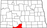 | |
| CDPs | ||
| Unorganized territory |
| |
| Unincorporated community |
| |
| Indian reservations | ||
| Footnotes | ‡This populated place also has portions in an adjacent county or counties | |
This article is issued from Wikipedia - version of the 7/20/2015. The text is available under the Creative Commons Attribution/Share Alike but additional terms may apply for the media files.