Day Heights, Ohio
| Day Heights, Ohio | |
|---|---|
| Census-designated place | |
 Location of Day Heights, Ohio | |
| Coordinates: 39°10′25″N 84°13′47″W / 39.17361°N 84.22972°WCoordinates: 39°10′25″N 84°13′47″W / 39.17361°N 84.22972°W | |
| Country | United States |
| State | Ohio |
| County | Clermont |
| Township | Miami |
| Area | |
| • Total | 1.2 sq mi (3.1 km2) |
| • Land | 1.2 sq mi (3.1 km2) |
| • Water | 0.0 sq mi (0.0 km2) |
| Elevation[1] | 863 ft (263 m) |
| Population (2010) | |
| • Total | 2,620 |
| • Density | 2,224/sq mi (858.6/km2) |
| Time zone | Eastern (EST) (UTC-5) |
| • Summer (DST) | EDT (UTC-4) |
| ZIP code | 45150 |
| Area code(s) | 513 |
| FIPS code | 39-20366[2] |
| GNIS feature ID | 1867451[1] |
Day Heights is a census-designated place (CDP) in Clermont County, Ohio, United States. The population was 2,620 at the 2010 census.[3]
Gallery
-
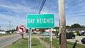
Day Heights community sign
-
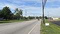
Looking west on Ohio Highway 131 in Day Heights
Geography
Day Heights is located in northwestern Clermont County, south of the geographic center of Miami Township. It is bordered to the north by the community of Mount Repose. Ohio State Route 131 passes through the center of Day Heights, leading west 3.5 miles (5.6 km) down the hill into Milford. Downtown Cincinnati is 19 miles (31 km) west of Day Heights.
According to the United States Census Bureau, the CDP has a total area of 1.2 square miles (3.1 km2), all land.[3]
Demographics
As of the census[2] of 2000, there were 2,823 people, 1,006 households, and 844 families residing in the CDP. The population density was 2,347.0 people per square mile (908.3/km²). There were 1,020 housing units at an average density of 848.0/sq mi (328.2/km²). The racial makeup of the CDP was 97.48% White, 0.99% African American, 0.11% Native American, 0.25% Asian, 0.50% from other races, and 0.67% from two or more races. Hispanic or Latino of any race were 0.50% of the population.
There were 1,006 households out of which 35.0% had children under the age of 18 living with them, 73.0% were married couples living together, 7.5% had a female householder with no husband present, and 16.1% were non-families. 14.1% of all households were made up of individuals and 6.5% had someone living alone who was 65 years of age or older. The average household size was 2.81 and the average family size was 3.09.
In the CDP the population was spread out with 25.6% under the age of 18, 7.2% from 18 to 24, 27.2% from 25 to 44, 28.7% from 45 to 64, and 11.3% who were 65 years of age or older. The median age was 39 years. For every 100 females there were 99.5 males. For every 100 females age 18 and over, there were 97.4 males.
The median income for a household in the CDP was $64,375, and the median income for a family was $70,229. Males had a median income of $41,362 versus $27,270 for females. The per capita income for the CDP was $25,267. About 1.0% of families and 2.3% of the population were below the poverty line, including 3.3% of those under age 18 and 6.3% of those age 65 or over.
References
- 1 2 "US Board on Geographic Names". United States Geological Survey. 2007-10-25. Retrieved 2008-01-31.
- 1 2 "American FactFinder". United States Census Bureau. Retrieved 2008-01-31.
- 1 2 "Geographic Identifiers: 2010 Demographic Profile Data (G001): Day Heights CDP, Ohio". U.S. Census Bureau, American Factfinder. Retrieved January 16, 2015.
Municipalities and communities of Clermont County, Ohio, United States | ||
|---|---|---|
| Cities | 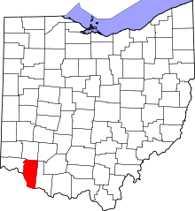 | |
| Villages | ||
| Townships | ||
| CDPs | ||
| Unincorporated communities |
| |
| Ghost towns | ||
| Footnotes | ‡This populated place also has portions in an adjacent county or counties | |