Summerside, Ohio
| Summerside, Ohio | |
|---|---|
| Census-designated place | |
 Location of Summerside, Ohio | |
| Coordinates: 39°7′2″N 84°17′27″W / 39.11722°N 84.29083°WCoordinates: 39°7′2″N 84°17′27″W / 39.11722°N 84.29083°W | |
| Country | United States |
| State | Ohio |
| County | Clermont |
| Township | Union |
| Area | |
| • Total | 2.09 sq mi (5.42 km2) |
| • Land | 2.08 sq mi (5.40 km2) |
| • Water | 0.008 sq mi (0.02 km2) |
| Elevation[1] | 879 ft (268 m) |
| Population (2010) | |
| • Total | 5,083 |
| • Density | 2,436/sq mi (940.5/km2) |
| Time zone | Eastern (EST) (UTC-5) |
| • Summer (DST) | EDT (UTC-4) |
| FIPS code | 39-75434[2] |
| GNIS feature ID | 1049226[1] |
Summerside is a census-designated place (CDP) in Union Township, Clermont County, Ohio, United States. The population was 5,083 at the 2010 census.[3]
History
Originally known as "East Mount Carmel", the name of the community was changed around the time a post office was established in August 1887.[4]
Geography
Summerside is located in western Clermont County at 39°7′2″N 84°17′27″W / 39.11722°N 84.29083°W (39.117261, -84.290728),[5] in the western part of Union Township. It is bordered to the south by Mount Carmel. Ohio State Route 32 forms part of the southern boundary of the CDP, and Interstate 275 forms the eastern boundary, with access to Summerside from Exit 63, where it intersects Route 32. Downtown Cincinnati is 16 miles (26 km) to the west via Route 32 and U.S. Route 50.
According to the United States Census Bureau, the CDP has a total area of 2.1 square miles (5.4 km2), of which 0.008 square miles (0.02 km2), or 0.32%, is water.[3]
Demographics
As of the census[2] of 2000, there were 5,523 people, 2,195 households, and 1,536 families residing in the CDP. The population density was 2,425.2 people per square mile (935.3/km²). There were 2,277 housing units at an average density of 999.9/sq mi (385.6/km²). The racial makeup of the CDP was 96.13% White, 1.14% African American, 0.25% Native American, 1.01% Asian, 0.45% from other races, and 1.01% from two or more races. Hispanic or Latino of any race were 1.10% of the population.
There were 2,195 households out of which 36.7% had children under the age of 18 living with them, 53.8% were married couples living together, 12.9% had a female householder with no husband present, and 30.0% were non-families. 24.6% of all households were made up of individuals and 6.2% had someone living alone who was 65 years of age or older. The average household size was 2.52 and the average family size was 3.02.
In the CDP the population was spread out with 26.8% under the age of 18, 9.1% from 18 to 24, 34.4% from 25 to 44, 21.0% from 45 to 64, and 8.7% who were 65 years of age or older. The median age was 32 years. For every 100 females there were 91.8 males. For every 100 females age 18 and over, there were 86.6 males.
The median income for a household in the CDP was $43,138, and the median income for a family was $51,662. Males had a median income of $40,335 versus $26,220 for females. The per capita income for the CDP was $20,190. About 4.3% of families and 6.2% of the population were below the poverty line, including 7.8% of those under age 18 and 6.0% of those age 65 or over.
References
- 1 2 "US Board on Geographic Names". United States Geological Survey. 2007-10-25. Retrieved 2008-01-31.
- 1 2 "American FactFinder". United States Census Bureau. Retrieved 2008-01-31.
- 1 2 "Geographic Identifiers: 2010 Demographic Profile Data (G001): Summerside CDP, Ohio". U.S. Census Bureau, American Factfinder. Retrieved January 21, 2015.
- ↑ Karle, Tina. 120 Waterfall Hikes Around Cincinnati Ohio. Lulu.com. p. 19. Retrieved 27 November 2013.
- ↑ "US Gazetteer files: 2010, 2000, and 1990". United States Census Bureau. 2011-02-12. Retrieved 2011-04-23.
Municipalities and communities of Clermont County, Ohio, United States | ||
|---|---|---|
| Cities | 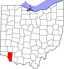 | |
| Villages | ||
| Townships | ||
| CDPs | ||
| Unincorporated communities |
| |
| Ghost towns | ||
| Footnotes | ‡This populated place also has portions in an adjacent county or counties | |