Newtonsville, Ohio
| Newtonsville, Ohio | |
|---|---|
| Village | |
 Location of Newtonsville, Ohio | |
 Location of Newtonsville in Clermont County | |
| Coordinates: 39°10′52″N 84°5′6″W / 39.18111°N 84.08500°WCoordinates: 39°10′52″N 84°5′6″W / 39.18111°N 84.08500°W | |
| Country | United States |
| State | Ohio |
| County | Clermont |
| Township | Wayne |
| Government | |
| • Mayor | Kevin Pringle |
| Area[1] | |
| • Total | 0.25 sq mi (0.65 km2) |
| • Land | 0.25 sq mi (0.65 km2) |
| • Water | 0 sq mi (0 km2) |
| Elevation[2] | 899 ft (274 m) |
| Population (2010)[3] | |
| • Total | 392 |
| • Estimate (2012[4]) | 393 |
| • Density | 1,568.0/sq mi (605.4/km2) |
| Time zone | Eastern (EST) (UTC-5) |
| • Summer (DST) | EDT (UTC-4) |
| ZIP code | 45158 |
| Area code(s) | 513 |
| FIPS code | 39-55664[5] |
| GNIS feature ID | 1065150[2] |
Newtonsville is a village in Clermont County, Ohio, United States. The population was 392 at the 2010 census.
Gallery
 Newtonsville corporation limit sign.
 Looking north towards the intersection of West Main Street, Cross and Wright Streets in Newtonsville.
History
Newtonsville was platted in 1838.[6] A post office called Newtonsville has been in operation since 1847.[7]
Geography
Newtonsville is located at 39°10′52″N 84°5′6″W / 39.18111°N 84.08500°W (39.181156, -84.084977).[8]
According to the United States Census Bureau, the village has a total area of 0.25 square miles (0.65 km2), all land.[1]
Demographics
| Historical population | |||
|---|---|---|---|
| Census | Pop. | %± | |
| 1880 | 160 | — | |
| 1910 | 142 | — | |
| 1920 | 120 | −15.5% | |
| 1930 | 148 | 23.3% | |
| 1940 | 166 | 12.2% | |
| 1950 | 182 | 9.6% | |
| 1960 | 339 | 86.3% | |
| 1970 | 385 | 13.6% | |
| 1980 | 434 | 12.7% | |
| 1990 | 427 | −1.6% | |
| 2000 | 492 | 15.2% | |
| 2010 | 392 | −20.3% | |
| Est. 2015 | 393 | [9] | 0.3% |
2010 census
As of the census[3] of 2010, there were 392 people, 132 households, and 103 families residing in the village. The population density was 1,568.0 inhabitants per square mile (605.4/km2). There were 144 housing units at an average density of 576.0 per square mile (222.4/km2). The racial makeup of the village was 99.0% White, 0.3% Native American, and 0.8% from two or more races. Hispanic or Latino of any race were 1.0% of the population.
There were 132 households of which 49.2% had children under the age of 18 living with them, 57.6% were married couples living together, 12.1% had a female householder with no husband present, 8.3% had a male householder with no wife present, and 22.0% were non-families. 18.2% of all households were made up of individuals and 6% had someone living alone who was 65 years of age or older. The average household size was 2.97 and the average family size was 3.37.
The median age in the village was 32.6 years. 30.9% of residents were under the age of 18; 8.4% were between the ages of 18 and 24; 26.8% were from 25 to 44; 23.5% were from 45 to 64; and 10.5% were 65 years of age or older. The gender makeup of the village was 48.0% male and 52.0% female.
2000 census
As of the census[5] of 2000, there were 492 people, 175 households, and 137 families residing in the village. The population density was 2,021.8 people per square mile (791.5/km²). There were 180 housing units at an average density of 739.7 per square mile (289.6/km²). The racial makeup of the village was 99.59% White, 0.20% Asian, and 0.20% from two or more races. Hispanic or Latino of any race were 0.41% of the population.
There were 175 households out of which 37.7% had children under the age of 18 living with them, 65.7% were married couples living together, 5.7% had a female householder with no husband present, and 21.7% were non-families. 17.1% of all households were made up of individuals and 6.3% had someone living alone who was 65 years of age or older. The average household size was 2.81 and the average family size was 3.15.
In the village the population was spread out with 28.0% under the age of 18, 7.5% from 18 to 24, 34.6% from 25 to 44, 21.7% from 45 to 64, and 8.1% who were 65 years of age or older. The median age was 34 years. For every 100 females there were 100.0 males. For every 100 females age 18 and over, there were 104.6 males.
The median income for a household in the village was $42,000, and the median income for a family was $49,167. Males had a median income of $37,500 versus $20,893 for females. The per capita income for the village was $18,715. About 11.8% of families and 15.5% of the population were below the poverty line, including 18.8% of those under age 18 and 12.9% of those age 65 or over.
References
- 1 2 "US Gazetteer files 2010". United States Census Bureau. Retrieved 2013-01-06.
- 1 2 "US Board on Geographic Names". United States Geological Survey. 2007-10-25. Retrieved 2008-01-31.
- 1 2 "American FactFinder". United States Census Bureau. Retrieved 2013-01-06.
- ↑ "Population Estimates". United States Census Bureau. Retrieved 2013-06-17.
- 1 2 "American FactFinder". United States Census Bureau. Retrieved 2008-01-31.
- ↑ Everts, Louis H. (1880). History of Clermont County, Ohio, with Illustrations and Biographical Sketches of Its Prominent Men and Pioneers. Philadelphia: J.B. Lippincott & Co. p. 508.
- ↑ "Clermont County". Jim Forte Postal History. Retrieved 16 January 2016.
- ↑ "US Gazetteer files: 2010, 2000, and 1990". United States Census Bureau. 2011-02-12. Retrieved 2011-04-23.
- ↑ "Annual Estimates of the Resident Population for Incorporated Places: April 1, 2010 to July 1, 2015". Retrieved July 2, 2016.
- ↑ "Census of Population and Housing". Census.gov. Retrieved June 4, 2015.
Municipalities and communities of Clermont County, Ohio, United States | ||
|---|---|---|
| Cities | 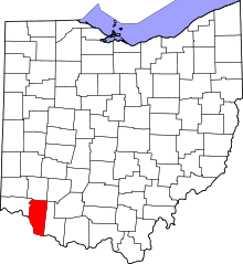 | |
| Villages | ||
| Townships | ||
| CDPs | ||
| Unincorporated communities |
| |
| Ghost towns | ||
| Footnotes | ‡This populated place also has portions in an adjacent county or counties | |