Davis Creek, California
| Davis Creek | |
|---|---|
| Unincorporated community | |
 Davis Creek  Davis Creek Location in California | |
| Coordinates: 41°44′00″N 120°22′19″W / 41.73333°N 120.37194°WCoordinates: 41°44′00″N 120°22′19″W / 41.73333°N 120.37194°W | |
| Country | United States |
| State | California |
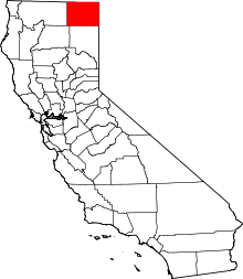
| County | Modoc County |
| Elevation[1] | 4,846 ft (1,477 m) |
Davis Creek is an unincorporated community in Modoc County, California.[1] It is located on the 19 miles (31 km) north-northeast of Alturas,[2] at an elevation of 4846 feet (1477 m).[1] The town's population is at least 100. There is a post office, service station, and mini-mart housed in a single structure. The ZIP Code is 96108. The community is inside area code 530.
History
Settlement of Goose Lake Valley at Davis Creek began with a single log cabin in 1869.[3] The Davis Creek post office opened in 1877, and changed its name to Davis Creek in 1879.[2]
During Goose Lake's high-water years, at least from 1908 to 1912, Davis Creek served as the southern port on the lake to and from which the ferry, Lakeview carried passengers and cargo for the town of Lakeview, Oregon at the north end of the lake. The Nevada-California-Oregon Railway from Reno reached Davis Creek in 1911. The port fell into disuse as lake waters receded and the railroad was completed to Lakeview.[3]
A 1913 book described Davis Creek as being on Goose Lake and having a population of 150.[4]
In the early 1960s, U.S. Route 395 was realigned, bypassing Davis Creek's business section, leading to the closure of most businesses there, and the construction of a newer general store on the new highway.[3]
Politics
In the state legislature, Davis Creek is in the 1st Senate District, represented by Republican Dave Cox, and in the 2nd Assembly District, represented by Republican Jim Nielsen.
Federally, Davis Creek is in California's 1st congressional district, represented by Republican Doug LaMalfa.[5]
Climate
This region experiences warm (but not hot) and dry summers, with no average monthly temperatures above 71.6 °F.
Month Avg.HighAvg.Low Mean Avg.Precip RecordHigh RecordLow
Jan 39 °F 23 °F 31 °F 2.42 in. 65 °F (1971) -26 °F (1962)
Feb 43 °F 25 °F 34 °F 2.17 in. 69 °F (1986) -22 °F (1949)
Mar 51 °F 30 °F 41 °F 2.08 in. 80 °F (1966) -5 °F (1971)
Apr 57 °F 34 °F 46 °F 1.68 in. 83 °F (1987) 10 °F (1964)
May 66 °F 40 °F 53 °F 1.33 in. 97 °F (1983) 19 °F (1968)
Jun 75 °F 46 °F 61 °F 0.85 in. 97 °F (1988) 26 °F (1962)
Jul 84 °F 52 °F 68 °F 0.24 in. 103 °F (2003) 32 °F (1976)
Aug 84 °F 51 °F 68 °F 0.31 in. 100 °F (1992) 30 °F (1999)
Sep 76 °F 44 °F 60 °F 0.48 in. 102 °F (1950) 17 °F (1970)
Oct 64 °F 36 °F 50 °F 1.15 in. 90 °F (2010) 5 °F (1971)
Nov 47 °F 29 °F 38 °F 2.39 in. 78 °F (1949) -4 °F (1993)
Dec 38 °F 23 °F 31 °F 3.10 in. 66 °F (1958) -26 °F (1972)
References
- 1 2 3 U.S. Geological Survey Geographic Names Information System: Davis Creek, California
- 1 2 Durham, David L. (1998). California's Geographic Names: A Gazetteer of Historic and Modern Names of the State. Clovis, Calif.: Word Dancer Press. p. 370. ISBN 1-884995-14-4.
- 1 2 3 Pease, Robert W. (1965). Modoc County; University of California Publications in Geography, Volume 17. Berkeley and Los Angeles: University of California Press. pp. 82,108,147.
- ↑ Drury, Wells; Aubrey Drury (1913). California tourist guide and handbook: authentic description of routes of travel and points of interest in California. Western guidebook company. p. 248. Retrieved 2009-06-16.
- ↑ "California's 1st Congressional District - Representatives & District Map". Civic Impulse, LLC. Retrieved March 3, 2013.