Daphnedale Park, California
| Daphnedale Park | |
|---|---|
| census-designated place | |
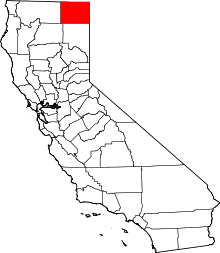
 Daphnedale Park Location in California | |
| Coordinates: 41°30′33″N 120°32′42″W / 41.50917°N 120.54500°WCoordinates: 41°30′33″N 120°32′42″W / 41.50917°N 120.54500°W | |
| Country |
|
| State |
|
| County | Modoc |
| Area[1] | |
| • Total | 1.333 sq mi (3.451 km2) |
| • Land | 1.331 sq mi (3.447 km2) |
| • Water | 0.002 sq mi (0.005 km2) 0.13% |
| Elevation[2] | 4,449 ft (1,356 m) |
| Population (2010) | |
| • Total | 184 |
| • Density | 140/sq mi (53/km2) |
| Time zone | Pacific (PST) (UTC-8) |
| • Summer (DST) | PDT (UTC-7) |
| Area code(s) | 530 |
| GNIS feature IDs | 1658375; 2582990 |
| U.S. Geological Survey Geographic Names Information System: Daphnedale Park, California; U.S. Geological Survey Geographic Names Information System: Daphnedale Park, California | |
Daphnedale Park is a census-designated place[3] in Modoc County, California.[2] It is located 1.5 miles (2.4 km) north of Alturas,[4] at an elevation of 4449 feet (1356 m).[2] The population was 184 at the 2010 census.
Geography
Two parallel primary streets, Saralane and Lucilane, access the Daphnedale subdivision from the northern boundary of the city of Alturas at W. 19th St.[5]
According to the United States Census Bureau, the CDP covers an area of 1.3 square miles (3.5 km²), 99.87% of it land, and 0.13% of it water.
Demographics
The 2010 United States Census[6] reported that Daphnedale Park had a population of 184. The population density was 138.1 people per square mile (53.3/km²). The racial makeup of Daphnedale Park was 166 (90.2%) White, 2 (1.1%) African American, 6 (3.3%) Native American, 0 (0.0%) Asian, 4 (2.2%) Pacific Islander, 2 (1.1%) from other races, and 4 (2.2%) from two or more races. Hispanic or Latino of any race were 18 persons (9.8%).
The Census reported that 184 people (100% of the population) lived in households.
There were 76 households, out of which 23 (30.3%) had children under the age of 18 living in them, 37 (48.7%) were opposite-sex married couples living together, 7 (9.2%) had a female householder with no husband present, 2 (2.6%) had a male householder with no wife present. There were 4 (5.3%) unmarried opposite-sex partnerships, and 0 (0%) same-sex married couples or partnerships. 23 households (30.3%) were made up of individuals and 8 (10.5%) had someone living alone who was 65 years of age or older. The average household size was 2.42. There were 46 families (60.5% of all households); the average family size was 3.09.
The population was spread out with 40 people (21.7%) under the age of 18, 15 people (8.2%) aged 18 to 24, 34 people (18.5%) aged 25 to 44, 72 people (39.1%) aged 45 to 64, and 23 people (12.5%) who were 65 years of age or older. The median age was 45.8 years. For every 100 females there were 121.7 males. For every 100 females age 18 and over, there were 97.3 males.
There were 83 housing units at an average density of 62.3 per square mile (24.0/km²), of which 55 (72.4%) were owner-occupied, and 21 (27.6%) were occupied by renters. The homeowner vacancy rate was 1.8%; the rental vacancy rate was 4.5%. 130 people (70.7% of the population) lived in owner-occupied housing units and 54 people (29.3%) lived in rental housing units.
Politics
In the state legislature, Daphnedale Park is in the 1st Senate District, represented by Republican Ted Gaines,[7] and the 1st Assembly District, represented by Republican Brian Dahle.[8]
Federally, Daphnedale Park is in California's 1st congressional district, represented by Republican Doug LaMalfa.[9]
References
- ↑ U.S. Census
- 1 2 3 U.S. Geological Survey Geographic Names Information System: Daphnedale Park, California
- ↑ U.S. Geological Survey Geographic Names Information System: Daphnedale Park, California
- ↑ Durham, David L. (1998). California's Geographic Names: A Gazetteer of Historic and Modern Names of the State. Clovis, Calif.: Word Dancer Press. p. 370. ISBN 1-884995-14-4.
- ↑ "Daphnedale Park, a Populated Place in Modoc County, California". CA HomeTownLocator. 2007-12-06. Retrieved 2010-02-11.
- ↑ "2010 Census Interactive Population Search: CA - Daphnedale Park CDP". U.S. Census Bureau. Retrieved July 12, 2014.
- ↑ "Senators". State of California. Retrieved March 10, 2013.
- ↑ "Members Assembly". State of California. Retrieved March 2, 2013.
- ↑ "California's 1st Congressional District - Representatives & District Map". Civic Impulse, LLC. Retrieved March 2, 2013.