Fort Bidwell, California
| Fort Bidwell | |
|---|---|
| census-designated place | |
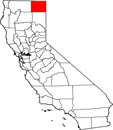
 Fort Bidwell Location in California | |
| Coordinates: 41°51′38″N 120°09′05″W / 41.86056°N 120.15139°WCoordinates: 41°51′38″N 120°09′05″W / 41.86056°N 120.15139°W | |
| Country |
|
| State |
|
| County | Modoc |
| Area[1] | |
| • Total | 3.217 sq mi (8.332 km2) |
| • Land | 3.200 sq mi (8.288 km2) |
| • Water | 0.017 sq mi (0.044 km2) 0.52% |
| Elevation[2] | 4,564 ft (1,391 m) |
| Population (2010) | |
| • Total | 173 |
| • Density | 54/sq mi (21/km2) |
| Time zone | Pacific (PST) (UTC-8) |
| • Summer (DST) | PDT (UTC-7) |
| ZIP Code | 96112 |
| Area code(s) | 530 |
| GNIS feature IDs | 1656026; 2583014 |
|
U.S. Geological Survey Geographic Names Information System: Fort Bidwell, California; U.S. Geological Survey Geographic Names Information System: Fort Bidwell, California | |
| Reference no. | 430[3] |
Fort Bidwell is a census-designated place[4] in Modoc County, California.[2] It is located 32 miles (51 km) northeast of Alturas,[5] at an elevation of 4564 feet (1391 m).[2] The population was 173 at the 2010 census.
Geography
Fort Bidwell is located near the north end of the Surprise Valley. The community's ZIP Code is 96112 and elevation is about 4,564 feet (1,391 m). The coordinates for the town are 41°51′38″N 120°09′05″W / 41.86056°N 120.15139°W. The airport, (FAA identifier: A28), is about 1-mile (1.6 km) north of the center of the community at 41°52′34″N 120°08′48″W / 41.87611°N 120.14667°W. The Fort Bidwell Indian Community is affiliated with the Paiute nation.
According to the United States Census Bureau, the CDP covers an area of 3.2 square miles (8.3 km²), 99.48% of it land, and 0.52% of it water.
Climate
This region experiences warm (but not hot) and dry summers, with no average monthly temperatures above 71.6 °F. According to the Köppen Climate Classification system, Fort Bidwell has a warm-summer Mediterranean climate, abbreviated "Csb" on climate maps.[6]
| Climate data for Ft. Bidwell (1911-2012) | |||||||||||||
|---|---|---|---|---|---|---|---|---|---|---|---|---|---|
| Month | Jan | Feb | Mar | Apr | May | Jun | Jul | Aug | Sep | Oct | Nov | Dec | Year |
| Record high °F (°C) | 75 (24) |
85 (29) |
87 (31) |
85 (29) |
97 (36) |
105 (41) |
106 (41) |
105 (41) |
102 (39) |
90 (32) |
78 (26) |
66 (19) |
106 (41) |
| Average high °F (°C) | 39 (4) |
44 (7) |
51.8 (11) |
59.6 (15.3) |
68.5 (20.3) |
76.7 (24.8) |
86.7 (30.4) |
85.8 (29.9) |
77.6 (25.3) |
65.2 (18.4) |
49.5 (9.7) |
40.5 (4.7) |
62.1 (16.7) |
| Average low °F (°C) | 20 (−7) |
23.8 (−4.6) |
28.1 (−2.2) |
32.4 (0.2) |
38.5 (3.6) |
44.3 (6.8) |
49.9 (9.9) |
48.3 (9.1) |
41.6 (5.3) |
33.9 (1.1) |
26.9 (−2.8) |
21.4 (−5.9) |
34.1 (1.2) |
| Record low °F (°C) | −26 (−32) |
−22 (−30) |
−6 (−21) |
10 (−12) |
19 (−7) |
25 (−4) |
27 (−3) |
27 (−3) |
17 (−8) |
5 (−15) |
−4 (−20) |
−26 (−32) |
−26 (−32) |
| Average precipitation inches (mm) | 2.34 (59.4) |
1.91 (48.5) |
1.73 (43.9) |
1.32 (33.5) |
1.17 (29.7) |
0.87 (22.1) |
0.3 (8) |
0.33 (8.4) |
0.52 (13.2) |
1.07 (27.2) |
1.98 (50.3) |
2.38 (60.5) |
15.91 (404.1) |
| Average snowfall inches (cm) | 15 (38) |
9.4 (23.9) |
7.6 (19.3) |
3.4 (8.6) |
1 (3) |
0 (0) |
0 (0) |
0 (0) |
0 (0) |
0.8 (2) |
6 (15) |
11.6 (29.5) |
54.9 (139.4) |
| Average precipitation days | 11 | 10 | 10 | 8 | 7 | 5 | 2 | 2 | 3 | 5 | 9 | 11 | 83 |
| Source: WRCC[7] | |||||||||||||
Communications
Wired telephone numbers in the community follow the format (530) 279-2xxx or 279-6xxx and appear to be served out of the Cedarville central office. Wired telephone service is provided by Citizens Utilities.
History
In 1865, General John Bidwell backed a petition from settlers at Red Bluff, California to protect Red Bluff's trail to the Owhyhee Mines of Idaho. The U.S. Army commissioned seven forts for this purpose, and dispatched a Major Williamson in April to explore a site for a fort in either Goose Lake Valley or Surprise Valley, from which he selected a site near Fandango Pass at the base of the Warner Mountains in the north end of Surprise Valley, and orders to build the fort were issued on June 10, 1865.[8][9] Although Surprise Valley settlers desired Army protection, ranchers dispossessed of lands for the fort complained, and claimed damages from the Army.[8][10]
The fort was built in 1865 amid escalating fighting with the Snake Indians of eastern Oregon and southern Idaho.[5] It was a base for operations in the Snake War that lasted until 1868, the Battle of Infernal Caverns in 1867 with General George Crook, the Modoc War of 1872–73 and the Bannock and Nez Perce campaigns.[9] Although traffic dwindled on the Red Bluff route once the Central Pacific Railroad extended into Nevada in 1868, the Army staffed Fort Bidwell to quell various uprisings and disturbances until 1890.[8]
Both Fort Bidwell and Camp Bidwell, near Chico were named for General John Bidwell. However, Camp Bidwell was commissioned in 1863, renamed Camp Chico by the time Fort Bidwell was commissioned in 1865, and was decommissioned in 1893.[10] Observing confusion between the two,[5] Robert W. Pease explained that such a transfer of name between outposts was a common Army practice of the time.[8]
The Fort Bidwell post office opened in 1868.[5] A 1913 book described Fort Bidwell as having a population of about 200, and containing a school and reservation for the Northern Paiute Kidütökadö band (Gidu Ticutta - ‘Yellow-bellied marmot-Eaters’, also called “Northern California Paiute”).[11]
Fort Bidwell is now registered as California Historical Landmark #430.[3]
Demographics
The 2010 United States Census[12] reported that Fort Bidwell had a population of 173. The population density was 53.8 people per square mile (20.8/km²). The racial makeup of Fort Bidwell was 75 (43.4%) White, 2 (1.2%) African American, 76 (43.9%) Native American, 0 (0.0%) Asian, 0 (0.0%) Pacific Islander, 10 (5.8%) from other races, and 10 (5.8%) from two or more races. Hispanic or Latino of any race were 23 persons (13.3%).
The Census reported that 173 people (100% of the population) lived in households.
There were 79 households, out of which 17 (21.5%) had children under the age of 18 living in them, 24 (30.4%) were opposite-sex married couples living together, 16 (20.3%) had a female householder with no husband present, 3 (3.8%) had a male householder with no wife present. There were 7 (8.9%) unmarried opposite-sex partnerships, and 0 (0%) same-sex married couples or partnerships. 30 households (38.0%) were made up of individuals and 14 (17.7%) had someone living alone who was 65 years of age or older. The average household size was 2.19. There were 43 families (54.4% of all households); the average family size was 2.95.
The population was spread out with 35 people (20.2%) under the age of 18, 26 people (15.0%) aged 18 to 24, 29 people (16.8%) aged 25 to 44, 51 people (29.5%) aged 45 to 64, and 32 people (18.5%) who were 65 years of age or older. The median age was 41.5 years. For every 100 females there were 80.2 males. For every 100 females age 18 and over, there were 86.5 males.
There were 126 housing units at an average density of 39.2 per square mile (15.1/km²), of which 45 (57.0%) were owner-occupied, and 34 (43.0%) were occupied by renters. The homeowner vacancy rate was 14.5%; the rental vacancy rate was 12.8%. 80 people (46.2% of the population) lived in owner-occupied housing units and 93 people (53.8%) lived in rental housing units.
Politics
In the state legislature, Fort Bidwell is in the 1st Senate District, represented by Republican Ted Gaines,[13] and the 1st Assembly District, represented by Republican Brian Dahle.[14]
Federally, Fort Bidwell is in California's 1st congressional district, represented by Republican Doug LaMalfa.[15]
See also
References
- ↑ U.S. Census
- 1 2 3 U.S. Geological Survey Geographic Names Information System: Fort Bidwell, California
- 1 2 "Fort Bidwell". Office of Historic Preservation, California State Parks. Retrieved 2012-10-10.
- ↑ U.S. Geological Survey Geographic Names Information System: Fort Bidwell, California
- 1 2 3 4 Durham, David L. (1998). California's Geographic Names: A Gazetteer of Historic and Modern Names of the State. Clovis, Calif.: Word Dancer Press. p. 378. ISBN 1-884995-14-4.
- ↑ Climate Summary for Fort Bidwell, California
- ↑ "FT BIDWELL, CA (043157)". Western Regional Climate Center. Retrieved November 29, 2015.
- 1 2 3 4 Pease, Robert W. (1965). Modoc County; University of California Publications in Geography, Volume 17. Berkeley and Los Angeles: University of California Press. pp. 75–78, 97.
- 1 2 Hart, USMC, Colonel Herbert M. (1965). "Historic California Posts: Fort Bidwell(Camp Bidwell)". Pioneer Forts of the Far West. The California State Military Museum. Retrieved 2010-04-06.
- 1 2 War Department, United States; John Sheldon Moody; Calvin Duvall Cowles; Frederick Caryton Ainsworth; Robert N. Scott; Henry Martyn Lazelle; George Breckenridge Davis; Leslie J. Perry; Joseph William Kirkley (1897). The War of the Rebellion: a Compilation of the Official Records of the Union and Confederate Armies. I. L (part II). Washington: Government Printing Office. pp. 593–594, 1125, 1214–1215.
- ↑ Drury, Wells; Drury, Aubrey (1913). California tourist guide and handbook: authentic description of routes of travel and points of interest in California. Western guidebook company. p. 249. Retrieved 2009-06-16.
- ↑ "2010 Census Interactive Population Search: CA - Fort Bidwell CDP". U.S. Census Bureau. Retrieved July 12, 2014.
- ↑ "Senators". State of California. Retrieved March 10, 2013.
- ↑ "Members Assembly". State of California. Retrieved March 2, 2013.
- ↑ "California's 1st Congressional District - Representatives & District Map". Civic Impulse, LLC. Retrieved March 3, 2013.