Coalmont, Colorado
| Coalmont, Colorado | |
|---|---|
| Unincorporated community | |
 Coalmont, Colorado Location within the state of Colorado | |
| Coordinates: 40°33′43″N 106°26′44″W / 40.56194°N 106.44556°WCoordinates: 40°33′43″N 106°26′44″W / 40.56194°N 106.44556°W | |
| Country |
|
| State |
|
| County | Jackson County[1] |
| Elevation[1] | 8,215 ft (2,504 m) |
| Time zone | MST (UTC-7) |
| • Summer (DST) | MDT (UTC-6) |
| ZIP Code[2] | 80430 |
Coalmont is an unincorporated community and U.S. Post Office in Jackson County, Colorado, United States. The Coalmont Post Office has the ZIP Code 80430.[2] The area is named for the strip mine located there, soft coal was shipped out on the Union Pacific Coalmont branch to the mainline at Laramie, Wy.
Geography
Coalmont is located at 40°33′43″N 106°26′44″W / 40.56194°N 106.44556°W (40.562069,-106.445675).
See also
References
- 1 2 "US Board on Geographic Names". United States Geological Survey. 2007-10-25. Retrieved 2008-01-31.
- 1 2 "ZIP Code Lookup". United States Postal Service. December 15, 2006. Archived from the original (JavaScript/HTML) on September 3, 2007. Retrieved December 15, 2006.
External links
| Wikimedia Commons has media related to Coalmont, Colorado. |
Municipalities and communities of Jackson County, Colorado, United States | ||
|---|---|---|
| Town | 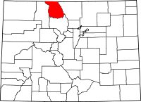 | |
| Unincorporated communities | ||

This article is issued from Wikipedia - version of the 11/27/2016. The text is available under the Creative Commons Attribution/Share Alike but additional terms may apply for the media files.