Cape Shirreff

Cape Shirreff is a prominent cape at the north end of the rocky peninsula which separates Hero Bay and Barclay Bay on the north coast of Livingston Island, in the South Shetland Islands of Antarctica. The cape was named by Edward Bransfield in 1820 after Captain William H. Shirreff, the British commanding officer in the Pacific at that time.
Description
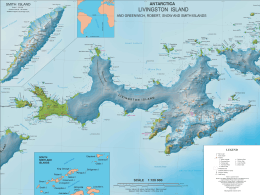
Situated on a small, 3.22 km2 (1.24 sq mi)[1] ice-free peninsula forming the northern extremity of Ioannes Paulus II Peninsula, which is protected by the Convention on the Conservation of Antarctic Marine Living Resources Ecosystem Monitoring Programme and requires a permit to enter.[2] It is 24 km north-east of Essex Point, 34 km west-south-west of Williams Point and 21 km north-west of Siddins Point. Lying also 809 km south-south-east of Cape Horn, Cape Shirreff is the locality in the Antarctic Treaty area that is closest to a non-Antarctic territory.[3]
Fauna

The cape has been identified as an Important Bird Area (IBA) by BirdLife International because it supports a large breeding colony of up to about 10,000 pairs of chinstrap penguins. Other birds nesting at the site in smaller numbers include gentoo penguins, kelp gulls, brown skuas, snowy sheathbills, Antarctic terns, imperial shags, Wilson's and black-bellied storm petrels, and Cape petrels. The site also contains the largest number of breeding Antarctic fur seals in the Antarctic Peninsula region.[4]
Antarctic Specially Protected Area
The cape, with nearby San Telmo Island, has also been designated an Antarctic Specially Protected Area (ASPA 149) for the diversity of its plant and animal life, especially its penguin and fur seal breeding colonies.[5]
See also
References
Notes
- ↑ L.L. Ivanov. Antarctica: Livingston Island and Greenwich, Robert, Snow and Smith Islands. Scale 1:120000 topographic map. Troyan: Manfred Wörner Foundation, 2009. ISBN 978-954-92032-6-4
- ↑ Management Plan for Antarctic Specially Protected Area No. 149 Cape Shirreff and San Telmo Island
- ↑ British mapping in 1920, 1922, 1931 and 1968, American in 1821, Spanish in 1861, Argentine in 1953, 1957 and 1980, Chilean in 1971 and detailed mapping in 2004. Bulgarian mapping in 2005 and 2009
- ↑ "Cape Robertson, Laurie Island". BirdLife data zone: Important Bird Areas. BirdLife International. 2012. Archived from the original on 2007-07-10. Retrieved 2012-12-11.
- ↑ "Cape Shirreff and San Telmo Island, Livingston Island, South Shetland Islands" (PDF). Management Plan for Antarctic Specially Protected Area No. 149: Measure 2, Annex H. Antarctic Treaty Secretariat. 2005. Retrieved 2013-10-02.
Sources
- SCAR Composite Antarctic Gazetteer.
-
 This article incorporates public domain material from the United States Geological Survey document "Shirreff, Cape" (content from the Geographic Names Information System).
Maps
- Chart of South Shetland including Coronation Island, &c. from the exploration of the sloop Dove in the years 1821 and 1822 by George Powell Commander of the same. Scale ca. 1:200000. London: Laurie, 1822.
- L.L. Ivanov et al. Antarctica: Livingston Island and Greenwich Island, South Shetland Islands. Scale 1:100000 topographic map. Sofia: Antarctic Place-names Commission of Bulgaria, 2005.
Coordinates: 62°27′32″S 60°47′19″W / 62.45889°S 60.78861°W