Byers Peninsula

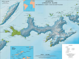
Byers Peninsula is a mainly ice-free peninsula forming the west end of Livingston Island in the South Shetland Islands of Antarctica. It occupies 60 km2 (23 sq mi),[1] and includes the small freshwater Basalt Lake. Byers Peninsula has a regime of special environmental protection under the Antarctic Treaty System and requires a permit to enter.[2]
History
The feature was named by the UK Antarctic Place-names Committee in 1958 for James Byers, a New York shipowner who tried unsuccessfully in August 1820 to induce the United States Government to found a settlement in and take possession of the South Shetland Islands. Byers organized and sent out a fleet of American sealers from New York to the South Shetland Islands in 1820–21. It was visited by early 19th century American and British sealers who came almost exclusively from New England, New York and England. They operated on President Beaches, Robbery Beaches and South Beaches, and built dwellings and shelter such as those still preserved at Sealer Hill and Lair Point.[3]
Antarctic Specially Protected Area
The peninsula has been designated an Antarctic Specially Protected Area (ASPA 126) for, as well as its birdlife, several additional scientific and historical values. It has diverse and well-developed vegetation, numerous lakes and freshwater pools which support the restricted-range insects Parochlus steinenii and Belgica antarctica, and well-preserved sub-fossil whale bones in raised beaches. It also has the greatest concentration of historical sites in Antarctica, containing the remains of refuges, with their contemporary artefacts, and shipwrecks of early 19th century sealing expeditions.[4]
Important Bird Area
The site has been identified as an Important Bird Area (IBA) by BirdLife International because it supports breeding colonies of Antarctic terns (1760 pairs) and kelp gulls (450 pairs). Other birds nesting on the peninsula include chinstrap and gentoo penguins, Wilson's and black-bellied storm petrels, Cape petrels, southern giant petrels, imperial shags, brown skuas and snowy sheathbills. Large numbers of southern elephant seals haul out during their breeding season.[5]
See also
Maps
- Península Byers, Isla Livingston. Mapa topográfico a escala 1:25000. Madrid: Servicio Geográfico del Ejército, 1992.
- L.L. Ivanov et al. Antarctica: Livingston Island and Greenwich Island, South Shetland Islands. Scale 1:100000 topographic map. Sofia: Antarctic Place-names Commission of Bulgaria, 2005.
- L.L. Ivanov. Antarctica: Livingston Island and Greenwich, Robert, Snow and Smith Islands. Scale 1:120000 topographic map. Troyan: Manfred Wörner Foundation, 2010. ISBN 978-954-92032-9-5 (First edition 2009. ISBN 978-954-92032-6-4)
References
- ↑ L.L. Ivanov. Antarctica: Livingston Island and Greenwich, Robert, Snow and Smith Islands. Scale 1:120000 topographic map. Troyan: Manfred Wörner Foundation, 2010. ISBN 978-954-92032-9-5 (First edition 2009. ISBN 978-954-92032-6-4)
- ↑ Management Plan for Antarctic Specially Protected Area No. 126 Byers Peninsula, Livingston Island, South Shetland Islands. SCAR Bulletin 150, July 2003.
- ↑ Ivanov, L. General Geography and History of Livingston Island. In: Bulgarian Antarctic Research: A Synthesis. Eds. C. Pimpirev and N. Chipev. Sofia: St. Kliment Ohridski University Press, 2015. pp. 17-28. ISBN 978-954-07-3939-7
- ↑ "Byers Peninsula, Livingston Island, South Shetland Islands" (PDF). Management Plan for Antarctic Specially Protected Area No. 126: Measure 1. Antarctic Treaty Secretariat. 2002. Retrieved 2013-10-02.
- ↑ "Byers Peninsula, Livingston Island". BirdLife data zone: Important Bird Areas. BirdLife International. 2012. Archived from the original on 2007-07-10. Retrieved 2012-12-10.
- SCAR Composite Antarctic Gazetteer.
-
 This article incorporates public domain material from the United States Geological Survey document "Byers Peninsula" (content from the Geographic Names Information System).
Coordinates: 62°38′S 61°05′W / 62.633°S 61.083°W