Cambria, Virginia
| Cambria | |
|---|---|
| Neighborhood | |
 Cambria  Cambria Location within the state of Virginia | |
| Coordinates: 37°8′35″N 80°23′45″W / 37.14306°N 80.39583°WCoordinates: 37°8′35″N 80°23′45″W / 37.14306°N 80.39583°W | |
| Country | United States |
| State | Virginia |
| County | Montgomery |
| Elevation | 2,100 ft (600 m) |
| Time zone | Eastern (EST) (UTC-5) |
| • Summer (DST) | EDT (UTC-4) |
| GNIS feature ID | 1674492[1] |
Cambria is a neighborhood of the town of Christiansburg in Montgomery County, Virginia. Originally, an independent town from Christiansburg, Cambria stretches along Cambria Road, extending north of the Train Depot on Depot Street. It is part of the Blacksburg-Christiansburg-Radford Metropolitan Statistical Area which encompasses all of Montgomery County, Virginia and the Virginia cities of Blacksburg, Christiansburg, and Radford for statistical purposes.[2][3][4]
A post office was established at Cambria in 1890, and remained in operation until it was discontinued in 1965.[5]
References
- ↑ "Cambria". Geographic Names Information System. United States Geological Survey. Retrieved February 25, 2014.
- ↑ "Cambria Historic District". historiccambria.com. Retrieved 5 February 2014.
- ↑ "Cambria Depot Museum". newriverheritage.org. Retrieved 5 February 2014.
- ↑ "] Cambria Historic District 154-0048 - Virginia Department of Historic ." (PDF). .cambriaplanninggroup.com. Retrieved 5 February 2014.
- ↑ "Montgomery County". Jim Forte Postal History. Archived from the original on 6 October 2014. Retrieved 30 September 2014.
Municipalities and communities of Montgomery County, Virginia, United States | ||
|---|---|---|
| Towns | 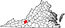 | |
| CDPs | ||
| Unincorporated communities | ||
| Footnotes | ‡This populated place also has portions in an adjacent county or counties | |
This article is issued from Wikipedia - version of the 11/13/2016. The text is available under the Creative Commons Attribution/Share Alike but additional terms may apply for the media files.