Basham, Virginia
| Basham, Virginia | |
|---|---|
| Unincorporated community | |
 Basham, Virginia  Basham, Virginia | |
| Coordinates: 37°02′10″N 80°20′33″W / 37.03611°N 80.34250°WCoordinates: 37°02′10″N 80°20′33″W / 37.03611°N 80.34250°W | |
| Country | United States |
| State | Virginia |
| County | Montgomery |
| Elevation | 2,425 ft (739 m) |
| Time zone | Eastern (EST) (UTC-5) |
| • Summer (DST) | EDT (UTC-4) |
| Area code(s) | 540 |
| GNIS feature ID | 1477097[1] |
Basham is an unincorporated community in Montgomery County, Virginia, United States. Basham is located at the junction of State Routes 615 and 726, 7.4 miles (11.9 km) south-southeast of Christiansburg.
A post office was established at Basham in 1882, and remained in operation until it was discontinued in 1955.[2] The Frank Lawrence House was listed on the National Register of Historic Places in 1989.[3]
References
- ↑ "Basham". Geographic Names Information System. United States Geological Survey.
- ↑ "Montgomery County". Jim Forte Postal History. Retrieved 30 September 2014.
- ↑ National Park Service (2010-07-09). "National Register Information System". National Register of Historic Places. National Park Service.
Municipalities and communities of Montgomery County, Virginia, United States | ||
|---|---|---|
| Towns | 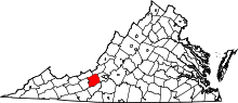 | |
| CDPs | ||
| Unincorporated communities | ||
| Footnotes | ‡This populated place also has portions in an adjacent county or counties | |
This article is issued from Wikipedia - version of the 7/27/2016. The text is available under the Creative Commons Attribution/Share Alike but additional terms may apply for the media files.