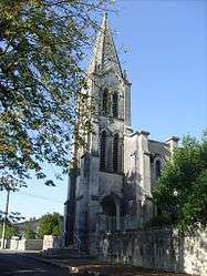
Brives-sur-Charente
| Brives-sur-Charente | |
|---|---|
 | |
 Brives-sur-Charente | |
|
Location within Nouvelle-Aquitaine region  Brives-sur-Charente | |
| Coordinates: 45°40′16″N 0°27′39″W / 45.6711°N 0.4608°WCoordinates: 45°40′16″N 0°27′39″W / 45.6711°N 0.4608°W | |
| Country | France |
| Region | Nouvelle-Aquitaine |
| Department | Charente-Maritime |
| Arrondissement | Saintes |
| Canton | Pons |
| Intercommunality | Région de Pons |
| Government | |
| • Mayor (2008–2014) | Philippe Guillot |
| Area1 | 5.94 km2 (2.29 sq mi) |
| Population (2008)2 | 226 |
| • Density | 38/km2 (99/sq mi) |
| Time zone | CET (UTC+1) |
| • Summer (DST) | CEST (UTC+2) |
| INSEE/Postal code | 17069 / 17800 |
| Elevation | 2–37 m (6.6–121.4 ft) |
|
1 French Land Register data, which excludes lakes, ponds, glaciers > 1 km² (0.386 sq mi or 247 acres) and river estuaries. 2 Population without double counting: residents of multiple communes (e.g., students and military personnel) only counted once. | |
Brives-sur-Charente is a commune in the Charente-Maritime department in the Nouvelle-Aquitaine region in southwestern France.
Population
| Historical population | ||
|---|---|---|
| Year | Pop. | ±% |
| 1793 | 313 | — |
| 1800 | 337 | +7.7% |
| 1806 | 310 | −8.0% |
| 1821 | 315 | +1.6% |
| 1831 | 362 | +14.9% |
| 1836 | 370 | +2.2% |
| 1841 | 371 | +0.3% |
| 1846 | 367 | −1.1% |
| 1851 | 354 | −3.5% |
| 1856 | 381 | +7.6% |
| 1861 | 357 | −6.3% |
| 1866 | 378 | +5.9% |
| 1872 | 384 | +1.6% |
| 1876 | 422 | +9.9% |
| 1881 | 357 | −15.4% |
| 1886 | 347 | −2.8% |
| 1891 | 351 | +1.2% |
| 1896 | 398 | +13.4% |
| 1901 | 369 | −7.3% |
| 1906 | 307 | −16.8% |
| 1911 | 318 | +3.6% |
| 1921 | 317 | −0.3% |
| 1926 | 296 | −6.6% |
| 1931 | 248 | −16.2% |
| 1936 | 203 | −18.1% |
| 1946 | 226 | +11.3% |
| 1954 | 235 | +4.0% |
| 1962 | 219 | −6.8% |
| 1968 | 198 | −9.6% |
| 1975 | 210 | +6.1% |
| 1982 | 208 | −1.0% |
| 1990 | 176 | −15.4% |
| 1999 | 197 | +11.9% |
| 2008 | 226 | +14.7% |
See also
References
| Wikimedia Commons has media related to Brives-sur-Charente. |
This article is issued from Wikipedia - version of the 11/11/2016. The text is available under the Creative Commons Attribution/Share Alike but additional terms may apply for the media files.