Port-des-Barques
| Port-des-Barques | ||
|---|---|---|
|
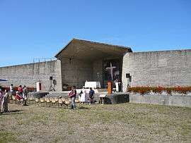
Open-air chapel | ||
| ||
 Port-des-Barques | ||
|
Location within Nouvelle-Aquitaine region  Port-des-Barques | ||
| Coordinates: 45°57′00″N 1°04′59″W / 45.95°N 1.083°WCoordinates: 45°57′00″N 1°04′59″W / 45.95°N 1.083°W | ||
| Country | France | |
| Region | Nouvelle-Aquitaine | |
| Department | Charente-Maritime | |
| Arrondissement | Rochefort | |
| Canton | Saint-Agnant | |
| Intercommunality | Pays Rochefortais | |
| Government | ||
| • Mayor (2008–2014) | Jacky Laugraud | |
| Area1 | 5.66 km2 (2.19 sq mi) | |
| Population (2008)2 | 1,851 | |
| • Density | 330/km2 (850/sq mi) | |
| Time zone | CET (UTC+1) | |
| • Summer (DST) | CEST (UTC+2) | |
| INSEE/Postal code | 17484 / 17730 | |
| Elevation | 0–10 m (0–33 ft) | |
|
1 French Land Register data, which excludes lakes, ponds, glaciers > 1 km² (0.386 sq mi or 247 acres) and river estuaries. 2 Population without double counting: residents of multiple communes (e.g., students and military personnel) only counted once. | ||

Port-des-Barques is a commune in the Charente-Maritime department in southwestern France.
Population
| Historical population | ||
|---|---|---|
| Year | Pop. | ±% |
| 1968 | 1,181 | — |
| 1975 | 1,234 | +4.5% |
| 1982 | 1,330 | +7.8% |
| 1990 | 1,455 | +9.4% |
| 1999 | 1,534 | +5.4% |
| 2008 | 1,851 | +20.7% |
See also
References
| Wikimedia Commons has media related to Port-des-Barques. |
This article is issued from Wikipedia - version of the 2/11/2016. The text is available under the Creative Commons Attribution/Share Alike but additional terms may apply for the media files.