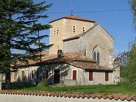
Sainte-Colombe, Charente-Maritime
For other uses, see Sainte-Colombe (disambiguation).
| Sainte-Colombe | |
|---|---|
 | |
 Sainte-Colombe | |
|
Location within Nouvelle-Aquitaine region  Sainte-Colombe | |
| Coordinates: 45°17′02″N 0°16′46″W / 45.2839°N 0.2794°WCoordinates: 45°17′02″N 0°16′46″W / 45.2839°N 0.2794°W | |
| Country | France |
| Region | Nouvelle-Aquitaine |
| Department | Charente-Maritime |
| Arrondissement | Jonzac |
| Canton | Montlieu-la-Garde |
| Intercommunality | Haute-Saintonge |
| Government | |
| • Mayor (2008–2014) | Bernard Pourteau |
| Area1 | 4.38 km2 (1.69 sq mi) |
| Population (2008)2 | 120 |
| • Density | 27/km2 (71/sq mi) |
| Time zone | CET (UTC+1) |
| • Summer (DST) | CEST (UTC+2) |
| INSEE/Postal code | 17319 / 17220 |
| Elevation |
75–143 m (246–469 ft) (avg. 125 m or 410 ft) |
|
1 French Land Register data, which excludes lakes, ponds, glaciers > 1 km² (0.386 sq mi or 247 acres) and river estuaries. 2 Population without double counting: residents of multiple communes (e.g., students and military personnel) only counted once. | |
Sainte-Colombe is a commune in the Charente-Maritime department in the Nouvelle-Aquitaine region in southwestern France.
Geography
The Seugne forms most of the commune's southwestern border.
Population
| Historical population | ||
|---|---|---|
| Year | Pop. | ±% |
| 1962 | 116 | — |
| 1968 | 139 | +19.8% |
| 1975 | 123 | −11.5% |
| 1982 | 137 | +11.4% |
| 1990 | 120 | −12.4% |
| 1999 | 114 | −5.0% |
| 2008 | 120 | +5.3% |
See also
References
External links
| Wikimedia Commons has media related to Sainte-Colombe (Charente-Maritime). |
This article is issued from Wikipedia - version of the 11/11/2016. The text is available under the Creative Commons Attribution/Share Alike but additional terms may apply for the media files.