Thénac, Charente-Maritime
| Thénac | ||
|---|---|---|
 | ||
| ||
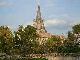
 Thénac | ||
|
Location within Nouvelle-Aquitaine region  Thénac | ||
| Coordinates: 45°40′07″N 0°39′10″W / 45.6686°N 0.6528°WCoordinates: 45°40′07″N 0°39′10″W / 45.6686°N 0.6528°W | ||
| Country | France | |
| Region | Nouvelle-Aquitaine | |
| Department | Charente-Maritime | |
| Arrondissement | Saintes | |
| Canton | Saintes-Ouest | |
| Intercommunality | Pays Santon | |
| Government | ||
| • Mayor (2008–2014) | Danielle Giraud | |
| Area1 | 19.17 km2 (7.40 sq mi) | |
| Population (2008)2 | 1,609 | |
| • Density | 84/km2 (220/sq mi) | |
| Time zone | CET (UTC+1) | |
| • Summer (DST) | CEST (UTC+2) | |
| INSEE/Postal code | 17444 / 17460 | |
| Elevation |
7–67 m (23–220 ft) (avg. 54 m or 177 ft) | |
|
1 French Land Register data, which excludes lakes, ponds, glaciers > 1 km² (0.386 sq mi or 247 acres) and river estuaries. 2 Population without double counting: residents of multiple communes (e.g., students and military personnel) only counted once. | ||

Thénac is a commune in the Charente-Maritime department in southwestern France.
Population
| Historical population | ||
|---|---|---|
| Year | Pop. | ±% |
| 1962 | 673 | — |
| 1968 | 705 | +4.8% |
| 1975 | 710 | +0.7% |
| 1982 | 807 | +13.7% |
| 1990 | 922 | +14.3% |
| 1999 | 1,082 | +17.4% |
| 2008 | 1,609 | +48.7% |
See also
References
| Wikimedia Commons has media related to Thénac (Charente-Maritime). |
This article is issued from Wikipedia - version of the 3/11/2013. The text is available under the Creative Commons Attribution/Share Alike but additional terms may apply for the media files.