Bologovsky District
| Bologovsky District Бологовский район (Russian) | |
|---|---|
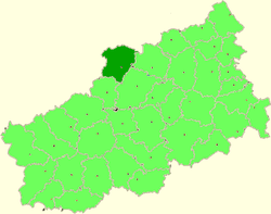 Location of Bologovsky District in Tver Oblast | |
| Coordinates: 57°52′N 34°03′E / 57.867°N 34.050°ECoordinates: 57°52′N 34°03′E / 57.867°N 34.050°E | |
.png) | |
|
| |
| Location | |
| Country | Russia |
| Federal subject | Tver Oblast[1] |
| Administrative structure (as of 2012) | |
| Administrative center | town of Bologoye[1] |
| Administrative divisions: | |
| Urban settlements (towns) | 1 |
| Urban settlements (urban-type settlements) | 1 |
| Rural settlements | 9 |
| Inhabited localities: | |
| Cities/towns | 1 |
| Urban-type settlements[2] | 1 |
| Rural localities | 159 |
| Municipal structure (as of July 2009) | |
| Municipally incorporated as | Bologovsky Municipal District[3] |
| Municipal divisions:[4] | |
| Urban settlements | 2 |
| Rural settlements | 9 |
| Statistics | |
| Area | 2,463.7 km2 (951.2 sq mi)[5] |
| Population (2010 Census) | 38,557 inhabitants[6] |
| • Urban | 68.3% |
| • Rural | 31.7% |
| Density | 15.65/km2 (40.5/sq mi)[7] |
| Time zone | MSK (UTC+03:00)[8] |
| Official website | |
| Bologovsky District on WikiCommons | |
Bologovsky District (Russian: Болого́вский райо́н) is an administrative[1] and municipal[3] district (raion), one of the thirty-six in Tver Oblast, Russia. It is located in the north of the oblast and borders with Borovichsky District of Novgorod Oblast in the north, Udomelsky District in the east, Vyshnevolotsky District in the southeast, Firovsky District and the urban-type settlement of Ozyorny in the south, Valdaysky District of Novgorod Oblast in the west, and with Okulovsky District, also of Novgorod Oblast, to the northwest. The area of the district is 2,463.7 square kilometers (951.2 sq mi).[5] Its administrative center is the town of Bologoye.[1] Population: 38,557 (2010 Census);[6] 18,757 (2002 Census);[9] 32,790 (1989 Census).[10] The population of Bologoye accounts for 60.9% of the district's total population.[6]
Geography
The district is located in the eastern part of the Valdai Hills. The whole area of the district belongs to the drainage basin of the Msta River, a major tributary of Lake Ilmen, which, in its turn, belongs to the basin of the Baltic Sea. A strecth of the Msta makes a border between Bologovsky and Udomelsky Districts, and Msta also crosses the northeast corner of the district. The biggest tributary of the Msta within the district is the Berezayka River, with its tributary, the Valdayka River. The rivers in the south of the district drain into the Shlina River, a tributary of the Tsna River, also in the basin of the Msta. The Shlina crosses the southern part of the district.
The Valdai Hills are notable by its large lake district, of which a part belongs to Bologovsky District. The largest lakes within the district are Lake Piros and Lake Kaftino, which belong to the basin of the Berezayka. Much of the area of the district is covered by forest.
History
.JPG)
The area from the Middle Ages was dependent on Novgorod and in the 15th century was a part of Derevskaya Pyatina of Novgorod. In the course of the administrative reform carried out in 1708 by Peter the Great, it was included into Ingermanland Governorate (known since 1710 as Saint Petersburg Governorate). In 1727, separate Novgorod Governorate was split off. In 1770, it became a part of Valdaysky Uyezd of Novgorod Viceroyalty. In 1796, the viceroyalty was transformed into Novgorod Governorate.[11] The area was located along the road connecting Moscow and St. Petersburg; in 1851, the railway between Moscow and Saint Petersburg was opened, and Bologoye started to develop as a railway station. On June 3, 1917 Bologoye was granted a town status.[5] Between April 1, 1919 and October 1920, the uyezd center was transferred from Valday to Bologoye, but soon after it was moved back to Valday again.[12]
In August 1927, the governorates and uyezds were abolished. Bologovsky District, with the administrative center in the town of Bologoye, was established within Borovichi Okrug of Leningrad Oblast effective October 1, 1927. It included parts of former Valdaysky Uyezd. On July 23, 1930, the okrugs were abolished, and the districts were directly subordinated to the oblast. On January 29, 1935 Bologovsky District was transferred to newly established Kalinin Oblast.[5][13][14] In February 1963, during the abortive administrative reform by Nikita Khrushchev, Udomelsky District was merged into Bologovsky District, but in January 1965 it was re-established.[15] In 1990, Kalinin Oblast was renamed Tver Oblast.
In 1938, Berezayka, and in 1939, Kuzhenkino and Vypolzovo were granted urban-type settlement status.[16] In 2005, Vypolzovo and Berezayka were downgraded to the status of rural localities.[17]
Effective October 1, 1927[18] Uglovsky District was established as well, with the administrative center in the railway station of Uglovka. It was a part of Borovichi Okrug of Leningrad Oblast.[19] On January 1, 1932, Uglovsky District was abolished and split between Borovichsky, Okulovsky, and Bologovsky Districts.[20]
Economy
Industry
The industry of the district mainly serves the railways.[5] Additionally, there are a pipe production factory, a glass-making factory, a metal production plant, as well as enterprises of construction and food industries.[21]
Agriculture
The main agricultural specialization in the district is cattle breeding with meat and milk production.[5]
Transportation

Bologoye is a major railway hub, where four railway lines cross: One connects Moscow and Saint Petersburg, and three more connect Bologoye with Rybinsk via Bezhetsk and Sonkovo, with Pskov via Valday and Staraya Russa, and with Velikiye Luki via Andreapol. There is passenger traffic along all these lines. The principal stations (all on the Moscow – Saint Petersburg Railway) are Bologoye, Berezayka, and Lykoshino.
The M10 highway, which connects Moscow and St. Petersburg, crosses the district from southeast to northwest, passing just north of the urban-type settlement of Kuzhenkino. Bologoye has access to this road. There are local roads as well.
Culture and recreation
The district contains six cultural heritage monuments of federal significance and additionally thirty-three objects classified as cultural and historical heritage of local significance. The federal monuments are the wooden Transfiguration Church in the village of Beryozovy Ryadok, built in the first half of the 19th century, as well as the ensemble of the Kemtsy Estate in the selo Kemtsy.[22]
Bologoye hosts Nikolay Dubravitsky Bologoye District Museum which specializes on the history of the district.[23]
References
Notes
- 1 2 3 4 Государственный комитет Российской Федерации по статистике. Комитет Российской Федерации по стандартизации, метрологии и сертификации. №ОК 019-95 1 января 1997 г. «Общероссийский классификатор объектов административно-территориального деления. Код 28 208», в ред. изменения №259/2014 от 12 декабря 2014 г.. (State Statistics Committee of the Russian Federation. Committee of the Russian Federation on Standardization, Metrology, and Certification. #OK 019-95 January 1, 1997 Russian Classification of Objects of Administrative Division . Code 28 208, as amended by the Amendment #259/2014 of December 12, 2014. ).
- ↑ The count of urban-type settlements may include the work settlements, the resort settlements, the suburban (dacha) settlements, as well as urban-type settlements proper.
- 1 2 Law #4-ZO
- ↑ Law #20-ZO
- 1 2 3 4 5 6 Район в цифрах (in Russian). Администрация МО Бологовский район. Retrieved 31 October 2013.
- 1 2 3 Russian Federal State Statistics Service (2011). "Всероссийская перепись населения 2010 года. Том 1" [2010 All-Russian Population Census, vol. 1]. Всероссийская перепись населения 2010 года (2010 All-Russia Population Census) (in Russian). Federal State Statistics Service. Retrieved June 29, 2012.
- ↑ The value of density was calculated automatically by dividing the 2010 Census population by the area specified in the infobox. Please note that this value is only approximate as the area specified in the infobox does not necessarily correspond to the area of the entity proper or is reported for the same year as the population.
- ↑ Правительство Российской Федерации. Федеральный закон №107-ФЗ от 3 июня 2011 г. «Об исчислении времени», в ред. Федерального закона №271-ФЗ от 03 июля 2016 г. «О внесении изменений в Федеральный закон "Об исчислении времени"». Вступил в силу по истечении шестидесяти дней после дня официального опубликования (6 августа 2011 г.). Опубликован: "Российская газета", №120, 6 июня 2011 г. (Government of the Russian Federation. Federal Law #107-FZ of June 31, 2011 On Calculating Time, as amended by the Federal Law #271-FZ of July 03, 2016 On Amending Federal Law "On Calculating Time". Effective as of after sixty days following the day of the official publication.).
- ↑ Russian Federal State Statistics Service (May 21, 2004). "Численность населения России, субъектов Российской Федерации в составе федеральных округов, районов, городских поселений, сельских населённых пунктов – районных центров и сельских населённых пунктов с населением 3 тысячи и более человек" [Population of Russia, Its Federal Districts, Federal Subjects, Districts, Urban Localities, Rural Localities—Administrative Centers, and Rural Localities with Population of Over 3,000] (XLS). Всероссийская перепись населения 2002 года [All-Russia Population Census of 2002] (in Russian). Retrieved August 9, 2014.
- ↑ Demoscope Weekly (1989). "Всесоюзная перепись населения 1989 г. Численность наличного населения союзных и автономных республик, автономных областей и округов, краёв, областей, районов, городских поселений и сёл-райцентров" [All Union Population Census of 1989: Present Population of Union and Autonomous Republics, Autonomous Oblasts and Okrugs, Krais, Oblasts, Districts, Urban Settlements, and Villages Serving as District Administrative Centers]. Всесоюзная перепись населения 1989 года [All-Union Population Census of 1989] (in Russian). Институт демографии Национального исследовательского университета: Высшая школа экономики [Institute of Demography at the National Research University: Higher School of Economics]. Retrieved August 9, 2014.
- ↑ Snytko et al., p. 22
- ↑ Snytko et al., p. 35
- ↑ Бологовский район (август 1927 г . – январь 1935 г .) (in Russian). Система классификаторов исполнительных органов государственной власти Санкт-Петербурга. Retrieved November 20, 2013.
- ↑ Справка об изменениях в административно-территориальном делении Тверской губернии - Калининской области (in Russian). Архивы России. Retrieved 30 October 2013.
- ↑ город Удомля (городское поселение) (in Russian). Муниципальное Образование Удомельский район. Retrieved 30 October 2013.
- ↑ USSR. Administrative-Territorial Divisions of Union Republic, p. 143
- ↑ Яковлева, С. И. Этнические ареалы расселения в транзитных регионах (PDF) (in Russian). Tver State University. Retrieved 20 November 2013.
- ↑ Snytko et al., p. 85
- ↑ Snytko et al., p. 38
- ↑ Snytko et al., p. 138
- ↑ Информация о предприятиях и организациях МО "Бологовский район" (in Russian). Администрация МО Бологовский район. Retrieved 13 November 2013.
- ↑ Памятники истории и культуры народов Российской Федерации (in Russian). Russian Ministry of Culture. Retrieved 2 June 2016.
- ↑ Бологовский краеведческий музей имени Н.И. Дубравицкого (in Russian). Bologoye Town Library. Retrieved 19 November 2013.
Sources
- Законодательное Собрание Тверской области. Закон №4-ЗО от 18 января 2005 г. «Об установлении границ муниципальных образований Тверской области и наделении их статусом городских округов, муниципальных районов», в ред. Закона №65-ЗО от 24 июля 2012 г. «О внесении изменения в статью 2 Закона Тверской области "Об установлении границ муниципальных образований Тверской области и наделении их статусом городских округов, муниципальных районов"». Вступил в силу через десять дней после официального опубликования. Опубликован: "Тверские ведомости", №3, 21–27 января 2005 г. (Legislative Assembly of Tver Oblast. Law #4-ZO of January 18, 2005 On Establishing the Borders of the Municipal Formations of Tver Oblast and on Granting Them the Status of Urban Okrugs, Municipal Districts, as amended by the Law #65-ZO of July 24, 2012 On Amending Article 2 of the Law of Tver Oblast "On Establishing the Borders of the Municipal Formations of Tver Oblast and on Granting Them the Status of Urban Okrugs, Municipal Districts". Effective as of the day which is ten days after the official publication.).
- Законодательное Собрание Тверской области. Закон №20-ЗО от 28 февраля 2005 г. «Об установлении границ муниципальных образований, входящих в состав территории муниципального образования Тверской области "Бологовский район", и наделении их статусом городского, сельского поселения», в ред. Закона №57-ЗО от 13 июля 2009 г. «О внесении изменений в Приложение №1 к Закону Тверской области "Об установлении границ муниципальных образований, входящих в состав территории муниципального образования Тверской области "Бологовский район", и наделении их статусом городского, сельского поселения"». Вступил в силу со дня официального опубликования. Опубликован: "Тверские ведомости", №10, 11–17 марта 2005 г. (Legislative Assembly of Tver Oblast. Law #20-ZO of February 28, 2005 On Establishing the Borders of the Municipal Formations Comprised by the Territory of the Municipal Formation of "Bologovsky District" and on Granting Them the Status of Urban and Rural Settlements, as amended by the Law #57-ZO of July 13, 2009 On Amending Appendix 1 of the Law of Tver Oblast "On Establishing the Borders of the Municipal Formations Comprised by the Territory of the Municipal Formation of "Bologovsky District" and on Granting Them the Status of Urban and Rural Settlements". Effective as of the day of the official publication.).
- Снытко, О. В.; et al. (2009). С. Д. Трифонов; Т. Б. Чуйкова; Л. В. Федина; А. Э. Дубоносова, eds. Административно-территориальное деление Новгородской губернии и области 1727-1995 гг. Справочник (PDF) (in Russian). Saint Petersburg. Retrieved June 21, 2012.
- Дударев, В. А.; Евсеева, Н. А. (1987). И. Каманина, ed. СССР. Административно-территориальное деление союзных республик (in Russian). Moscow.
| Cities and towns (all levels) | |||
|---|---|---|---|
| Closed administrative-territorial formations | |||
| Districts |
| ||