Andreapolsky District
| Andreapolsky District Андреапольский район (Russian) | |
|---|---|
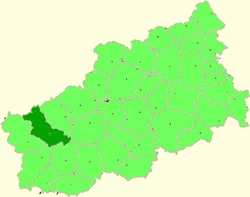 Location of Andreapolsky District in Tver Oblast | |
| Coordinates: 56°39′N 32°16′E / 56.650°N 32.267°ECoordinates: 56°39′N 32°16′E / 56.650°N 32.267°E | |
.png) |
.png) |
|
| |
| Location | |
| Country | Russia |
| Federal subject | Tver Oblast[1] |
| Administrative structure (as of 2012) | |
| Administrative center | town of Andreapol[1] |
| Administrative divisions: | |
| Urban settlements | 1 |
| Rural settlements | 7 |
| Inhabited localities: | |
| Cities/towns | 1 |
| Rural localities | 251 |
| Municipal structure (as of February 2005) | |
| Municipally incorporated as | Andreapolsky Municipal District[2] |
| Municipal divisions:[3] | |
| Urban settlements | 1 |
| Rural settlements | 7 |
| Statistics | |
| Area | 3,051 km2 (1,178 sq mi)[4] |
| Population (2010 Census) | 13,756 inhabitants[5] |
| • Urban | 60.2% |
| • Rural | 39.8% |
| Density | 4.51/km2 (11.7/sq mi)[6] |
| Time zone | MSK (UTC+03:00)[7] |
| Official website | |
| Andreapolsky District on WikiCommons | |
Andreapolsky District (Russian: Андреа́польский райо́н) is an administrative[1] and municipal[2] district (raion), one of the thirty-six in Tver Oblast, Russia. It is located in the Valdai Hills in the west of the oblast and borders with Maryovsky District of Novgorod Oblast in the north, Penovsky District in the northeast, Selizharovsky District in the east, Nelidovsky District in the south, Zapadnodvinsky District in the southwest, Toropetsky District in the west, and with Kholmsky District of Novgorod Oblast in the northwest. The area of the district is 3,051 square kilometers (1,178 sq mi).[4] Its administrative center is the town of Andreapol.[1] Population: 13,756 (2010 Census);[5] 16,213 (2002 Census);[8] 17,900 (1989 Census).[9] The population of Andreapol accounts for 60.2% of the district's total population.[5]
Geography
The area of Andreapolsky District is shared between the drainage basins of the Neva, the Western Dvina, and the Volga, and thus the divide between the basins of the Atlantic Ocean and the Caspian Sea runs through the district. The northwestern part of the district belongs to the drainage basin of the Lovat River, a major tributary of Lake Ilmen. The rivers in the central part of the district drain into the Daugava, or the Western Dvina as it is known in Russia. The source of the Western Dvina is located in the district. This area contains a large lake district in the southwestern outskirts of the Valdai Hills. The biggest lakes are Lake Luchanskoye and Lake Brosno. The southeastern part of the district belongs to the drainage basin of the Zhukopa River, a tributary of the Volga.
The southern part of the district belongs to the Central Forest Nature Reserve, a protected area created to preserve conifer forest with the corresponding plants and animals, including the Eurasian brown bear, in the upper course of the Western Dvina.[10]
History
The area of the district in the Middle Ages was interchangeably under control of the Novgorod Republic, Principality of Smolensk, and the Lithuania. In 1335, the war between Lithuania and the Grand Duchy of Moscow started, and in the beginning of the 15th century the area was transferred to the Grand Duchy of Moscow. The Dubna Volost, currently a part of the town of Andreapol, was mentioned in the chronicles in 1489. After several wars between Moscow and Lithuania, during which the area was transferred to Lithuania and back, it was in 1508 again included to the Grand Duchy of Moscow.[11]
In the course of the administrative reform carried out in 1708 by Peter the Great, most of the area was included into Ingermanlandia Governorate (since 1710 known as Saint Petersburg Governorate), and in 1727 Novgorod Governorate split off. In 1772, Ostashkov was granted town status, and Ostashkovsky Uyezd of Novgorod Governorate was established, with the seat in Ostashkov. The area on the left bank of the Western Dvina was included into Ostashkovsky Uyezd. In 1775, Tver Viceroyalty was formed from the lands which previously belonged to Moscow and Novgorod Governorates, and this area was transferred to Tver Viceroyalty, which in 1796 was transformed to Tver Governorate.[12] Also in 1772, as a result of the First Partition of Poland, Pskov Governorate was created, and the areas on the right bank of the Western Dvina were included into Toropetsky and Kholmsky Uyezds of Pskov Governorate. In 1777, Pskov Governorate was transformed into Pskov Viceroyalty, and in 1796, the viceroyalty was abolished, and Pskov Governorate was restored.[13]
The lands in the south of the district, on the left bank of the Western Dvin,a in 1708 was included into Belsky Uyezd of Smolensk Governorate and remained there until 1929, with the exception of the brief periods between 1713 and 1726, when it belonged to Riga Governorate, and between 1775 and 1796, when Smolensk Governorate was transformed into Smolensk Viceroyalty.
Between 1810 and 1843, a spa resort was operating in Andreapol, at the time Adreyano Pole.[11] Between 1904 and 1907, the construction of the railroad to Bologoye was completed. In 1906, the station of Andreapol was opened, and the selo of Andreapol, which included villages of Dubna, Andreyano Pole, and Gorka, was established.[14]
On August 1, 1927 Pskov Governorate was abolished, and Leningrad Oblast was established. Toropetsky Uyezd was abolished as well, and Leninsky District, with the administrative center in the selo of Khotilitsy was established. It belonged to Velikiye Luki Okrug of Leningrad Oblast. In 1928, the district center was moved to Andreapol.[14] On June 17, 1929, the district was transferred to Western Oblast. On August 1, 1930 the okrugs were abolished, and the districts were subordinated directly to the oblast. On January 29, 1935 Kalinin Oblast was established, and Leninsky District was transferred to Kalinin Oblast.[15][16] In 1938, Andreapol was granted urban-type settlement status. Between September 1941 and January 1942, during World War II, the district was occupied by German troops.[14] On August 22, 1944, the district was transferred to newly established Velikiye Luki Oblast. On October 2, 1957, Velikiye Luki Oblast was abolished, and Leninsky District was transferred back to Kalinin Oblast. In February 1963, during the abortive administrative reform by Nikita Khrushchev, Leninsky District was merged into Toropetsky District. On January 12, 1965 Andreapolsky District was established in the areas which previously belonged to Toropetsky and Ostashkovsky Districts.[16] In 1967, Andreapol was granted town status.[14] In 1990, Kalinin Oblast was renamed Tver Oblast.[16]
On August 1, 1927 Bologovsky District with the administrative center located in the selo of Bologovo was established as well. The district was a part of Velikiye Luki Okrug of Leningrad Oblast, and on June 17, 1929 with the rest of the okrug it was transferred to Western Oblast. On September 20, 1930 the district was abolished and split between Kholmsky and Leninsky Districts.[16]
On June 1, 1936 Seryozhinsky District with the administrative center located in the selo of Bologovo was established. The district was a part of Kalinin Oblast. On August 23, 1944 it was transferred to Velikiye Luki Oblast, and on October 2, 1957 it was transferred back to Kalinin Oblast. On January 12, 1960 Seryozhinsky District was abolished and split between Leninsky and Toropetsky Districts.[16]
Economy
Industry
Forests cover around 70% of the district. As a result, the logging industry is a substantial source of revenue. Another developed industry is agriculture. There is also a porcelain production plant in Andreapol, as well as a number of food industry enterprises.[17]
Agriculture
The main agricultural specialization of the district is cattle breeding with meat and milk production. Milk can not be processed in the district and is transported for processing in surrounding districts. Crops growing, mainly for fodder.[18]
Transportation
The railway connecting Bologoye with Velikiye Luki crosses the district from northeast to southwest. Andreapol is the main railway station within the district. There is infrequent passenger traffic.
A paved road connecting Ostashkov with Zapadnaya Dvina via Peno and Andreapol crosses the district from east to west. There are local roads as well. There is bus traffic in the district.
Ecology
The extensive commercial logging has had a negative impact on the environment.
Culture and recreation
The district contains two cultural heritage monuments of federal significance and additionally 108 objects classified as cultural and historical heritage of local significance (three of them located in Andreapol). The federal monuments are the Trinity Church in the settlement of Lugi (1764), as well as an archeological monument.[19]
There is a local museum in Andreapol.[20]
References
Notes
- 1 2 3 4 Государственный комитет Российской Федерации по статистике. Комитет Российской Федерации по стандартизации, метрологии и сертификации. №ОК 019-95 1 января 1997 г. «Общероссийский классификатор объектов административно-территориального деления. Код 28 202», в ред. изменения №259/2014 от 12 декабря 2014 г.. (State Statistics Committee of the Russian Federation. Committee of the Russian Federation on Standardization, Metrology, and Certification. #OK 019-95 January 1, 1997 Russian Classification of Objects of Administrative Division . Code 28 202, as amended by the Amendment #259/2014 of December 12, 2014. ).
- 1 2 Law #4-ZO
- ↑ Law #17-ZO
- 1 2 "Наш край" (in Russian). Andreapolsky District Administration. Retrieved 5 December 2015.
- 1 2 3 Russian Federal State Statistics Service (2011). "Всероссийская перепись населения 2010 года. Том 1" [2010 All-Russian Population Census, vol. 1]. Всероссийская перепись населения 2010 года (2010 All-Russia Population Census) (in Russian). Federal State Statistics Service. Retrieved June 29, 2012.
- ↑ The value of density was calculated automatically by dividing the 2010 Census population by the area specified in the infobox. Please note that this value is only approximate as the area specified in the infobox does not necessarily correspond to the area of the entity proper or is reported for the same year as the population.
- ↑ Правительство Российской Федерации. Федеральный закон №107-ФЗ от 3 июня 2011 г. «Об исчислении времени», в ред. Федерального закона №271-ФЗ от 03 июля 2016 г. «О внесении изменений в Федеральный закон "Об исчислении времени"». Вступил в силу по истечении шестидесяти дней после дня официального опубликования (6 августа 2011 г.). Опубликован: "Российская газета", №120, 6 июня 2011 г. (Government of the Russian Federation. Federal Law #107-FZ of June 31, 2011 On Calculating Time, as amended by the Federal Law #271-FZ of July 03, 2016 On Amending Federal Law "On Calculating Time". Effective as of after sixty days following the day of the official publication.).
- ↑ Russian Federal State Statistics Service (May 21, 2004). "Численность населения России, субъектов Российской Федерации в составе федеральных округов, районов, городских поселений, сельских населённых пунктов – районных центров и сельских населённых пунктов с населением 3 тысячи и более человек" [Population of Russia, Its Federal Districts, Federal Subjects, Districts, Urban Localities, Rural Localities—Administrative Centers, and Rural Localities with Population of Over 3,000] (XLS). Всероссийская перепись населения 2002 года [All-Russia Population Census of 2002] (in Russian). Retrieved August 9, 2014.
- ↑ Demoscope Weekly (1989). "Всесоюзная перепись населения 1989 г. Численность наличного населения союзных и автономных республик, автономных областей и округов, краёв, областей, районов, городских поселений и сёл-райцентров" [All Union Population Census of 1989: Present Population of Union and Autonomous Republics, Autonomous Oblasts and Okrugs, Krais, Oblasts, Districts, Urban Settlements, and Villages Serving as District Administrative Centers]. Всесоюзная перепись населения 1989 года [All-Union Population Census of 1989] (in Russian). Институт демографии Национального исследовательского университета: Высшая школа экономики [Institute of Demography at the National Research University: Higher School of Economics]. Retrieved August 9, 2014.
- ↑ Центрально-Лесной Биосферный резерват (in Russian). Особо охраняемые природные территории России. Retrieved 4 December 2015.
- 1 2 "Андреапольский район" (in Russian). Тверская ОУНБ им. А.М. Горького. Retrieved 4 December 2015.
- ↑ Малыгин, П. Д.; Смирнов, С. Н. (2007). История административно-территориального деления Тверской Области (PDF). Tver. pp. 14–15. OCLC 540329541.
- ↑ "Псковская губерния" (in Russian). Руниверс. Retrieved 4 December 2015.
- 1 2 3 4 "История Андреапольского района" (in Russian). Andreapolsky District Administration. Retrieved 4 December 2015.
- ↑ Воробьёв, М. В. (1993). Г. В. Туфанова, ed. Административно-территориальное деление Смоленской области (in Russian). Государственный архив Смоленской области. pp. 118–133.
- 1 2 3 4 5 Справка об изменениях в административно-территориальном делении Тверской губернии - Калининской области (in Russian). Архивы России. Retrieved 5 December 2014.
- ↑ "Промышленность, АПК" (in Russian). Andreapolsky District Administration. Retrieved 18 November 2015.
- ↑ "Агропромышленный комплекс Андреапольского района" (in Russian). Andreapolsky District Administration. Retrieved 18 November 2015.
- ↑ Памятники истории и культуры народов Российской Федерации (in Russian). Russian Ministry of Culture. Retrieved 2 June 2016.
- ↑ "Андреапольский районный краеведческий музей" (in Russian). museum.ru. Retrieved 1 December 2015.
Sources
- Законодательное Собрание Тверской области. Закон №4-ЗО от 18 января 2005 г. «Об установлении границ муниципальных образований Тверской области и наделении их статусом городских округов, муниципальных районов», в ред. Закона №65-ЗО от 24 июля 2012 г. «О внесении изменения в статью 2 Закона Тверской области "Об установлении границ муниципальных образований Тверской области и наделении их статусом городских округов, муниципальных районов"». Вступил в силу через десять дней после официального опубликования. Опубликован: "Тверские ведомости", №3, 21–27 января 2005 г. (Legislative Assembly of Tver Oblast. Law #4-ZO of January 18, 2005 On Establishing the Borders of the Municipal Formations of Tver Oblast and on Granting Them the Status of Urban Okrugs, Municipal Districts, as amended by the Law #65-ZO of July 24, 2012 On Amending Article 2 of the Law of Tver Oblast "On Establishing the Borders of the Municipal Formations of Tver Oblast and on Granting Them the Status of Urban Okrugs, Municipal Districts". Effective as of the day which is ten days after the official publication.).
- Законодательное Собрание Тверской области. Закон №17-ЗО от 28 февраля 2005 г. «Об установлении границ муниципальных образований, входящих в состав территории муниципального образования Тверской области "Андреапольский район", и наделении их статусом городского, сельского поселения». Вступил в силу со дня официального опубликования. Опубликован: "Тверские ведомости", №10, 11–17 марта 2005 г. (Legislative Assembly of Tver Oblast. Law #17-ZO of February 28, 2005 On Establishing the Borders of the Municipal Formations Comprised by the Territory of the Municipal Formation of "Andreapolsky District" and on Granting Them the Status of Urban and Rural Settlements. Effective as of the day of the official publication.).
| Cities and towns (all levels) | |||
|---|---|---|---|
| Closed administrative-territorial formations | |||
| Districts |
| ||