Attignat
| Attignat | ||
|---|---|---|
 | ||
| ||
 Attignat | ||
|
Location within Auvergne-Rhône-Alpes region  Attignat | ||
| Coordinates: 46°17′17″N 5°09′38″E / 46.2881°N 5.1606°ECoordinates: 46°17′17″N 5°09′38″E / 46.2881°N 5.1606°E | ||
| Country | France | |
| Region | Auvergne-Rhône-Alpes | |
| Department | Ain | |
| Arrondissement | Bourg-en-Bresse | |
| Canton | Montrevel-en-Bresse | |
| Intercommunality | Montrevel-en-Bresse | |
| Government | ||
| • Mayor (2008–2014) | Martial Goyard | |
| Area1 | 18.69 km2 (7.22 sq mi) | |
| Population (2008)2 | 2,662 | |
| • Density | 140/km2 (370/sq mi) | |
| Time zone | CET (UTC+1) | |
| • Summer (DST) | CEST (UTC+2) | |
| INSEE/Postal code | 01024 / 01340 | |
| Elevation | 199–233 m (653–764 ft) | |
|
1 French Land Register data, which excludes lakes, ponds, glaciers > 1 km² (0.386 sq mi or 247 acres) and river estuaries. 2 Population without double counting: residents of multiple communes (e.g., students and military personnel) only counted once. | ||

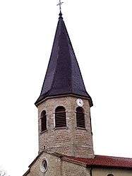
Attignat is a commune in the Ain department in eastern France.
Geography
The commune is 12 km northwest of Bourg-en-Bresse, 4 km north of the A40. The Reyssouze runs through the commune.
Population
| Historical population | ||
|---|---|---|
| Year | Pop. | ±% |
| 1793 | 1,227 | — |
| 1800 | 1,235 | +0.7% |
| 1806 | 1,192 | −3.5% |
| 1821 | 1,319 | +10.7% |
| 1831 | 1,265 | −4.1% |
| 1836 | 1,319 | +4.3% |
| 1841 | 1,340 | +1.6% |
| 1846 | 1,336 | −0.3% |
| 1851 | 1,354 | +1.3% |
| 1856 | 1,328 | −1.9% |
| 1861 | 1,369 | +3.1% |
| 1866 | 1,350 | −1.4% |
| 1872 | 1,325 | −1.9% |
| 1876 | 1,364 | +2.9% |
| 1881 | 1,360 | −0.3% |
| 1886 | 1,323 | −2.7% |
| 1891 | 1,295 | −2.1% |
| 1896 | 1,264 | −2.4% |
| 1901 | 1,305 | +3.2% |
| 1906 | 1,203 | −7.8% |
| 1911 | 1,218 | +1.2% |
| 1921 | 1,101 | −9.6% |
| 1926 | 1,111 | +0.9% |
| 1931 | 1,069 | −3.8% |
| 1936 | 1,067 | −0.2% |
| 1946 | 1,142 | +7.0% |
| 1954 | 1,117 | −2.2% |
| 1962 | 1,205 | +7.9% |
| 1968 | 1,236 | +2.6% |
| 1975 | 1,279 | +3.5% |
| 1982 | 1,682 | +31.5% |
| 1990 | 1,776 | +5.6% |
| 1999 | 1,924 | +8.3% |
| 2008 | 2,662 | +38.4% |
See also
References
External links
| Wikimedia Commons has media related to Attignat. |
This article is issued from Wikipedia - version of the 10/21/2016. The text is available under the Creative Commons Attribution/Share Alike but additional terms may apply for the media files.