Murs-et-Gélignieux
| Murs-et-Gélignieux | |
|---|---|
|
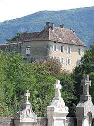
Murs chateau | |
 Murs-et-Gélignieux | |
|
Location within Auvergne-Rhône-Alpes region  Murs-et-Gélignieux | |
| Coordinates: 45°38′00″N 5°40′00″E / 45.6333°N 5.6667°ECoordinates: 45°38′00″N 5°40′00″E / 45.6333°N 5.6667°E | |
| Country | France |
| Region | Auvergne-Rhône-Alpes |
| Department | Ain |
| Arrondissement | Belley |
| Canton | Belley |
| Intercommunality | Belley Bas Bugey |
| Government | |
| • Mayor (2008–2014) | Gérard Bettant |
| Area1 | 6.46 km2 (2.49 sq mi) |
| Population (2008)2 | 238 |
| • Density | 37/km2 (95/sq mi) |
| Time zone | CET (UTC+1) |
| • Summer (DST) | CEST (UTC+2) |
| INSEE/Postal code | 01268 / 01300 |
| Elevation |
210–460 m (690–1,510 ft) (avg. 218 m or 715 ft) |
|
1 French Land Register data, which excludes lakes, ponds, glaciers > 1 km² (0.386 sq mi or 247 acres) and river estuaries. 2 Population without double counting: residents of multiple communes (e.g., students and military personnel) only counted once. | |
Murs-et-Gélignieux is a commune in the Ain department in eastern France.
Population
| Historical population | ||
|---|---|---|
| Year | Pop. | ±% |
| 1793 | 174 | — |
| 1800 | 267 | +53.4% |
| 1806 | 379 | +41.9% |
| 1821 | 324 | −14.5% |
| 1831 | 377 | +16.4% |
| 1836 | 385 | +2.1% |
| 1841 | 383 | −0.5% |
| 1846 | 337 | −12.0% |
| 1851 | 330 | −2.1% |
| 1856 | 342 | +3.6% |
| 1861 | 306 | −10.5% |
| 1866 | 310 | +1.3% |
| 1872 | 313 | +1.0% |
| 1876 | 336 | +7.3% |
| 1881 | 330 | −1.8% |
| 1886 | 311 | −5.8% |
| 1891 | 299 | −3.9% |
| 1896 | 268 | −10.4% |
| 1901 | 258 | −3.7% |
| 1906 | 288 | +11.6% |
| 1911 | 252 | −12.5% |
| 1921 | 233 | −7.5% |
| 1926 | 221 | −5.2% |
| 1931 | 205 | −7.2% |
| 1936 | 191 | −6.8% |
| 1946 | 182 | −4.7% |
| 1954 | 156 | −14.3% |
| 1962 | 150 | −3.8% |
| 1968 | 127 | −15.3% |
| 1975 | 131 | +3.1% |
| 1982 | 121 | −7.6% |
| 1990 | 188 | +55.4% |
| 1999 | 204 | +8.5% |
| 2008 | 238 | +16.7% |
See also
References
| Wikimedia Commons has media related to Murs-et-Gélignieux. |
This article is issued from Wikipedia - version of the 2/11/2016. The text is available under the Creative Commons Attribution/Share Alike but additional terms may apply for the media files.