Saint-Martin-du-Frêne
| Saint-Martin-du-Frêne | |
|---|---|
|
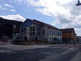
Town hall | |
 Saint-Martin-du-Frêne | |
|
Location within Auvergne-Rhône-Alpes region  Saint-Martin-du-Frêne | |
| Coordinates: 46°08′22″N 5°33′11″E / 46.1394°N 5.5531°ECoordinates: 46°08′22″N 5°33′11″E / 46.1394°N 5.5531°E | |
| Country | France |
| Region | Auvergne-Rhône-Alpes |
| Department | Ain |
| Arrondissement | Nantua |
| Canton | Nantua |
| Intercommunality | Lac de Nantua |
| Government | |
| • Mayor (2008–2014) | Dominique Turc |
| Area1 | 19.14 km2 (7.39 sq mi) |
| Population (2008)2 | 1,069 |
| • Density | 56/km2 (140/sq mi) |
| Time zone | CET (UTC+1) |
| • Summer (DST) | CEST (UTC+2) |
| INSEE/Postal code | 01373 / 01430 |
| Elevation |
476–1,125 m (1,562–3,691 ft) (avg. 516 m or 1,693 ft) |
|
1 French Land Register data, which excludes lakes, ponds, glaciers > 1 km² (0.386 sq mi or 247 acres) and river estuaries. 2 Population without double counting: residents of multiple communes (e.g., students and military personnel) only counted once. | |
Saint-Martin-du-Frêne is a commune in the Ain department in eastern France.
Population
| Historical population | ||
|---|---|---|
| Year | Pop. | ±% |
| 1793 | 860 | — |
| 1800 | 952 | +10.7% |
| 1806 | 1,015 | +6.6% |
| 1821 | 997 | −1.8% |
| 1831 | 997 | +0.0% |
| 1836 | 1,031 | +3.4% |
| 1841 | 912 | −11.5% |
| 1846 | 966 | +5.9% |
| 1851 | 940 | −2.7% |
| 1856 | 952 | +1.3% |
| 1861 | 913 | −4.1% |
| 1866 | 836 | −8.4% |
| 1872 | 868 | +3.8% |
| 1876 | 862 | −0.7% |
| 1881 | 835 | −3.1% |
| 1886 | 837 | +0.2% |
| 1891 | 803 | −4.1% |
| 1896 | 777 | −3.2% |
| 1901 | 785 | +1.0% |
| 1906 | 750 | −4.5% |
| 1911 | 691 | −7.9% |
| 1921 | 618 | −10.6% |
| 1926 | 618 | +0.0% |
| 1931 | 656 | +6.1% |
| 1936 | 585 | −10.8% |
| 1946 | 565 | −3.4% |
| 1954 | 619 | +9.6% |
| 1962 | 598 | −3.4% |
| 1968 | 623 | +4.2% |
| 1975 | 706 | +13.3% |
| 1982 | 744 | +5.4% |
| 1990 | 971 | +30.5% |
| 1999 | 1,050 | +8.1% |
| 2008 | 1,069 | +1.8% |
See also
References
| Wikimedia Commons has media related to Saint-Martin-du-Frêne. |
This article is issued from Wikipedia - version of the 2/18/2016. The text is available under the Creative Commons Attribution/Share Alike but additional terms may apply for the media files.