Amity Township, Berks County, Pennsylvania
| Amity Township | |
|---|---|
| Township | |
|
Yellow House Hotel at Yellow House | |
 Location of Pennsylvania in the United States | |
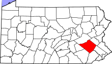
 Amity Township Location of Amity Township in Pennsylvania | |
| Coordinates: 40°17′30″N 75°45′29″W / 40.29167°N 75.75806°WCoordinates: 40°17′30″N 75°45′29″W / 40.29167°N 75.75806°W | |
| Country | United States |
| State | Pennsylvania |
| County | Berks |
| Area | |
| • Total | 18.4 sq mi (48 km2) |
| • Land | 18.3 sq mi (47 km2) |
| • Water | 0.1 sq mi (0.3 km2) |
| Elevation | 223 ft (68 m) |
| Population (2010) | |
| • Total | 12,583 |
| • Density | 680/sq mi (260/km2) |
| Time zone | EST (UTC-5) |
| • Summer (DST) | EDT (UTC-4) |
| Area code(s) | 610 |

Amity Township is a township in Berks County, Pennsylvania, United States. The population was 12,583 at the 2010 census. Amity Township, especially in the Douglassville area, is seeing growth in development.
The township was so named for the cordial relationship, or amity, between Swedish settlers and the local Native Americans.[1]
History
The boundaries of Amity Township are almost identical to the boundaries of the original area known as Swedes’ tract. During December 1699, Lutheran pastor Andreas Rudman had met with Governor William Penn. Pastor Rudman pointed out that many of the residents of the former Swedish colony of New Sweden felt cheated by the preemption of their lands for Quaker settlement. Rudman secured an order from William Penn in October 1701 setting aside 10,000 acres (40 km2) up the Schuylkill River, near Manatawny Creek, for members of his congregation.[2]
The George Douglass House, Griesemer-Brown Mill Complex, Old St. Gabriel's Episcopal Church, Old Swede's House, Rhoads-Lorah House and Barn, Weidner Mill, and White Horse Tavern are listed on the National Register of Historic Places.[3]
Geography
According to the United States Census Bureau, the township has a total area of 18.4 square miles (48 km2), of which, 18.3 square miles (47 km2) of it is land and 0.1 square miles (0.26 km2) of it (0.60%) is water.
Adjacent townships
- Exeter Township (west)
- Oley Township (northwest)
- Earl Township (north)
- Douglass Township (east)
- Union Township (south)
The census-designated place of Amity Gardens and the unincorporated community of Douglassville are both located in Amity Township, along the Schuylkill River.
Demographics
As of the census[4] of 2000, there were 8,867 people, 3,219 households, and 2,510 families residing in the township. The population density was 484.5 people per square mile (187.1/km²). There were 3,323 housing units at an average density of 181.6/sq mi (70.1/km²). The racial makeup of the township was 95.68% White, 2.04% African American, 0.19% Native American, 0.67% Asian, 0.01% Pacific Islander, 0.38% from other races, and 1.03% from two or more races. Hispanic or Latino of any race were 1.00% of the population.
There were 3,219 households, out of which 37.7% had children under the age of 18 living with them, 68.0% were married couples living together, 6.7% had a female householder with no husband present, and 22.0% were non-families. 17.1% of all households were made up of individuals, and 6.3% had someone living alone who was 65 years of age or older. The average household size was 2.75 and the average family size was 3.12.
| Historical population | |||
|---|---|---|---|
| Census | Pop. | %± | |
| 1980 | 5,883 | — | |
| 1990 | 6,434 | 9.4% | |
| 2000 | 8,867 | 37.8% | |
| 2010 | 12,583 | 41.9% | |
| Source: US Census Bureau | |||
In the township the population was spread out, with 27.7% under the age of 18, 5.6% from 18 to 24, 32.8% from 25 to 44, 24.1% from 45 to 64, and 9.8% who were 65 years of age or older. The median age was 36 years. For every 100 females there were 97.6 males. For every 100 females age 18 and over, there were 95.3 males.
The median income for a household in the township was $59,595, and the median income for a family was $67,069. Males had a median income of $47,002 versus $31,389 for females. The per capita income for the township was $24,652. About 2.5% of families and 4.8% of the population were below the poverty line, including 3.8% of those under age 18 and 9.8% of those age 65 or over.
Notable people
References
- ↑ "Local school children to hear history of Berks and deeds of noted citizens". Reading Eagle. Mar 6, 1927. p. 5. Retrieved 2 December 2015.
- ↑ Andreas Rudman and his Family (by Dr. Peter Stebbins Craig . Swedish Colonial News, Volume 2, Number 1 . Winter 2000)
- ↑ National Park Service (2009-03-13). "National Register Information System". National Register of Historic Places. National Park Service.
- ↑ "American FactFinder". United States Census Bureau. Archived from the original on 2013-09-11. Retrieved 2008-01-31.