New Morgan, Pennsylvania
| New Morgan, Pennsylvania | |
| Borough | |
| Country | United States |
|---|---|
| State | Pennsylvania |
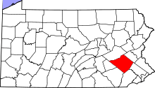
| County | Berks |
| Elevation | 630 ft (192.0 m) |
| Coordinates | 40°10′50″N 75°52′14″W / 40.18056°N 75.87056°WCoordinates: 40°10′50″N 75°52′14″W / 40.18056°N 75.87056°W |
| Area | 14.9 km2 (5.8 sq mi) |
| - land | 14.2 km2 (5 sq mi) |
| - water | 0.7 km2 (0 sq mi) |
| Population | 71 (2010) |
| Density | 5.0/km2 (12.9/sq mi) |
| Incorporated | April 1988 |
| Timezone | EST (UTC-5) |
| - summer (DST) | EDT (UTC-4) |
| Area code | 610 and 484 |
 Location of New Morgan in Pennsylvania | |
 Location of Pennsylvania in the United States | |
New Morgan is a borough in Berks County, Pennsylvania, United States.[1] The population was 71 at the 2010 census.[2]
Geography
New Morgan is located near the southern corner of Berks County at 40°10′50″N 75°52′14″W / 40.18056°N 75.87056°W (40.180693, -75.870694).[3] It is bordered to the south by Caernarvon Township and to the north by Robeson Township. The unincorporated community of Morgantown is nearby to the south.
Interstate 176, the "Morgantown Expressway", follows the western edge of the borough and joins Interstate 76, the Pennsylvania Turnpike, just south of the borough at Morgantown. I-176 leads north to Reading, 14 miles (23 km) away. Pennsylvania Route 10 (Morgantown Road) also runs north-south through the borough, connecting Reading and Morgantown.
According to the United States Census Bureau, the borough has a total area of 5.8 square miles (14.9 km2), of which 5.5 square miles (14.2 km2) is land and 0.27 square miles (0.7 km2), or 4.57%, is water.[2]
History
In 1987, Raymond Carr, the sole owner of Morgantown Properties, petitioned Berks County Court to create a new borough from 3,500 acres (14 km2) in Caernarvon and Robeson townships. The fate of the proposal was determined by the ten residents living within the boundaries of the proposed borough, most of whom were Carr's tenants. In an April 1988 election, those residents voted 9-1 in favor of forming the new borough.[4] The state's procedures on formation of a new borough have since been revised to require new boroughs to have at least 500 residents.
According to court documents, "[a]side from the landfill and trash to steam plant, Carr propose[d] to develop the new borough with a Victorian village, planned residential developments, a cultural center, a mixed use center, commercial areas, agricultural areas and open space areas. The Victorian village would include a 1,000 room hotel and 18-hole golf course, and would operate year round."[5] Most of the borough's developed land is currently taken up by the Conestoga Landfill, while the Victorian village has yet to be built.[6] There are currently plans in the works for the construction of a new residential area in the borough, called Bryn Eyre,[7] as well as a hospital.[8]
Demographics
| Historical population | |||
|---|---|---|---|
| Census | Pop. | %± | |
| 1990 | 36 | — | |
| 2000 | 35 | −2.8% | |
| 2010 | 71 | 102.9% | |
| Est. 2015 | 74 | [9] | 4.2% |
| Sources:[10][11][12] | |||
As of the census[11] of 2000, there were 35 people, 12 households, and 9 families residing in the borough. The population density was 6.3 people per square mile (2.4/km²). There were 12 housing units at an average density of 2.2 per square mile (0.8/km²). The racial makeup of the borough was 82.86% White, 5.71% African American and 11.43% Asian.
There were 12 households, out of which 50.0% had children under the age of 18 living with them, 41.7% were married couples living together, 16.7% had a female householder with no husband present, and 25.0% were non-families. 25.0% of all households were made up of individuals, and 8.3% had someone living alone who was 65 years of age or older. The average household size was 2.92 and the average family size was 3.33.
In the borough the population was spread out, with 37.1% under the age of 18, 11.4% from 18 to 24, 31.4% from 25 to 44, 11.4% from 45 to 64, and 8.6% who were 65 years of age or older. The median age was 26 years. For every 100 females there were 133.3 males. For every 100 females age 18 and over, there were 120.0 males.
The median income for a household in the borough was $45,250, and the median income for a family was $53,750. Males had a median income of $45,250 versus $22,500 for females. The per capita income for the borough was $27,769. None of the population and none of the families were below the poverty line.
References
- ↑ "New Morgan Borough Local Government Directory". township-directory.com. Retrieved 24 July 2015.
- 1 2 "Geographic Identifiers: 2010 Demographic Profile Data (G001): New Morgan borough, Pennsylvania". U.S. Census Bureau, American Factfinder. Retrieved March 7, 2014.
- ↑ "US Gazetteer files: 2010, 2000, and 1990". United States Census Bureau. 2011-02-12. Retrieved 2011-04-23.
- ↑ Conestoga Landfill, The Pottstown Mercury, Oct. 23, 2003
- ↑ In re Incorporation of Borough of New Morgan, 127 Pa.Cmwlth. 519, 562 A.2d 402 (1989)
- ↑ New Morgan Borough's History
- ↑ Bryn Eyre Vision
- ↑ Cuyler, Greta (2008-07-09). "Hospital in the plans for Bryn Eyre community in New Morgan". Reading Eagle. Retrieved 2008-07-23.
- ↑ "Annual Estimates of the Resident Population for Incorporated Places: April 1, 2010 to July 1, 2015". Retrieved July 2, 2016.
- ↑ "Census of Population and Housing". U.S. Census Bureau. Retrieved 11 December 2013.
- 1 2 "American FactFinder". United States Census Bureau. Retrieved 2008-01-31.
- ↑ "Incorporated Places and Minor Civil Divisions Datasets: Subcounty Resident Population Estimates: April 1, 2010 to July 1, 2012". Population Estimates. U.S. Census Bureau. Retrieved 11 December 2013.