Woodbine, Maryland
Coordinates: 39°21′32″N 77°03′43″W / 39.359°N 77.062°W
| Woodbine, Maryland | |
|---|---|
| Unincorporated community | |
|
Salt Box Ball Field in Woodbine | |
| Country |
|
| State |
|
| Population (2014)[1] | |
| • Total | 8,124 |
| Time zone | Eastern (UTC-5) |
| • Summer (DST) | EDT (UTC-4) |
| ZIP code | 21797 |
| Area code | 410, 443, 667 |

Woodbine is an unincorporated rural community located in Howard and Carroll counties, in the Baltimore, Maryland, metropolitan area. The unincorporated community was named for the plant, which grew in the community in fields and along riverbanks.
Background
Woodbine is located at the juncture of the Patapsco River, the B&O Railroad, and the road that runs north from Lisbon to Winfield, Maryland on Liberty Road (Maryland Route 26) and through to Westminster, Maryland. The original road from Baltimore to Frederick runs just north of Lisbon, following a slight ridge line westward half way to Woodbine (the road was finally paved in the 1960s). This was the original trail that existed before the National Road was built (the road that runs through Lisbon).
History
During the Civil War, Confederate cavalry crossed the Patapsco River at Woodbine and at Hoods Mill, just a few miles east on the river and the B&O Railroad, scouting the Union Army that was on its way to the Battle of Gettysburg. The main road at that time ran just west of the existing road and up the west side of a creek that runs south and that joins with the Patapsco River just 50 yards west of the existing road. That original road, now partly unused, runs north 100 yards from the river and then Eastward (Gum Road) to join up with the existing road today. There was no bridge across the Patapsco River at that time, just a ford in the river.
The town straddles the Patapsco River both North (into Carroll County) and South (into Howard County). A new concrete bridge was constructed between 1916 and 1917.[2] In the 1920s and 1930s the town had a large canning factory on the Carroll County side of the river . There was another small canning factory, from the turn of the century, run by water power West of Woodbine at the foot of New Port Hill. Remains of the factory still exist and the sluice where water (from Gillis Falls Run) came to run the machinery is still visible in the wooded area below New Port Hill leading north to the dam, no longer existing.
Just north, 300 yards up the hill and west of the existing road (SR 94) on John Pickett Road, was a wormseed distillery, where wormseed oil was steam-distilled. This small factory was later converted into the Woodbine Canning Factory, canning tomatoes, corn, and peas. The factory burned in June 1933 and was converted to a paper mill in the 1950s.[3]
Notable residents and natives
- Kate Chadderton, International Equestrian
- Larry E. Haines, Maryland State Senator
- Alex Horwath, soccer player
- Albin Owings Kuhn, first chancellor and chief planner of the University of Maryland, Baltimore County campus
- Albert Levitt, jurist
- Kyle Snyder, Olympic Gold Medalist wrestler
See also
References
- ↑ "Zip Code Overview". Sperling's BestPlaces. Retrieved 2010-09-19.
- ↑ Maryland State Roads Commission. Report of the State Roads Commission of Maryland for the Years 1920. p. 27.
- ↑ Howard County Historical Society. Images of America Howard County. p. 75.
- ↑ Seeking Freedom The History of the Underground Railroad in Howard County. p. 82.
External links
| Wikimedia Commons has media related to Woodbine, Maryland. |
- http://www.hometownlocator.com/City/Woodbine-Maryland.cfm
- http://www.google.com/maps?q=Woodbine,+MD,+USA&sa=X&oi=map&ct=title
Municipalities and communities of Carroll County, Maryland, United States | ||
|---|---|---|
| Cities | 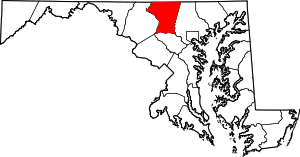 | |
| Towns | ||
| CDP | ||
| Other communities |
| |
| Footnotes | ‡This populated place also has portions in an adjacent county | |
Municipalities and communities of Howard County, Maryland, United States | ||
|---|---|---|
| CDPs | 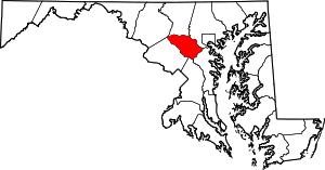 | |
| Villages | ||
| Unincorporated communities |
| |
| Footnotes | ‡This populated place also has portions in an adjacent county or counties | |