Witoka, Minnesota
| Witoka, Minnesota | |
|---|---|
| Unincorporated community | |
 Witoka, Minnesota  Witoka, Minnesota Location of the community of Witoka | |
| Coordinates: 43°56′00″N 91°37′13″W / 43.93333°N 91.62028°WCoordinates: 43°56′00″N 91°37′13″W / 43.93333°N 91.62028°W | |
| Country | United States |
| State | Minnesota |
| County | Winona County |
| Township | Wilson Township and Wiscoy Township |
| Elevation | 1,335 ft (407 m) |
| Time zone | Central (CST) (UTC-6) |
| • Summer (DST) | CDT (UTC-5) |
| ZIP code | 55987 |
| Area code(s) | 507 |
| GNIS feature ID | 654296[1] |
Witoka is an unincorporated community in Winona County, Minnesota, United States.
Geography
The community is located near the junction of Winona County Roads 9, 12, 15, and 17. Interstate 90 and State Highway 76 (MN 76) are nearby. Witoka is located within Wilson Township and Wiscoy Township. Nearby places include Winona, Wilson, Centerville, and Ridgeway. Cedar Creek, Money Creek, and Pleasant Valley Creek all flow nearby.
History
Witoka was platted in 1855, and named for the daughter of an Indian chief.[2] A post office was established at Witoka in 1857, and remained in operation until 1918.[3]
References
- ↑ "Witoka, Minnesota". Geographic Names Information System. United States Geological Survey.
- ↑ Upham, Warren (1920). Minnesota Geographic Names: Their Origin and Historic Significance. Minnesota Historical Society. p. 585.
- ↑ "Winona County". Jim Forte Postal History. Retrieved 15 August 2015.
Municipalities and communities of Winona County, Minnesota, United States | ||
|---|---|---|
| Cities | 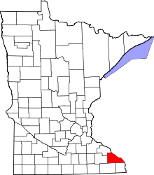 | |
| Townships | ||
| CDP | ||
| Unincorporated communities | ||
| Ghost towns | ||
| Footnotes | ‡This populated place also has portions in an adjacent county or counties | |
This article is issued from Wikipedia - version of the 10/29/2016. The text is available under the Creative Commons Attribution/Share Alike but additional terms may apply for the media files.