Minnesota State Highway 76
| ||||
|---|---|---|---|---|
|
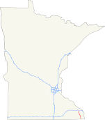
MN 76 highlighted in red | ||||
| Route information | ||||
| Defined by MS § 161.115(7) | ||||
| Maintained by Mn/DOT | ||||
| Length: | 36.767 mi[1] (59.171 km) | |||
| Existed: | 1933 – present | |||
| Major junctions | ||||
| South end: |
| |||
| North end: |
at Pleasant Hill Township | |||
| Location | ||||
| Counties: | Houston, Winona | |||
| Highway system | ||||
| ||||

Minnesota State Highway 76 (MN 76) is a highway in southeast Minnesota, which runs from Iowa Highway 76 at the Iowa state line (near Eitzen), and continues north to its northern terminus at its interchange with Interstate Highway 90 in Pleasant Hill Township near Winona.
Highway 76 is 37 miles (60 km) in length.
Route description
Highway 76 serves as a north–south route in southeast Minnesota between Caledonia, Houston, and Interstate 90.
The route passes through the Richard J. Dorer State Forest.
Beaver Creek Valley State Park is located 4 miles west of the junction of Highway 76 and Houston County Road 1 at Caledonia. The park entrance is located on County Road 1.[2]
Highway 76 parallels State Highway 26 and State Highway 43 throughout its route.
The route is legally defined as Legislative Route 76 in the Minnesota Statutes.[3]
History
Highway 76 was authorized in 1933.[4]
By 1953, only the section in Houston County was paved. All of Highway 76 was paved by 1963.[4]
Major intersections
| County | Location | mi[1] | km | Destinations | Notes |
|---|---|---|---|---|---|
| Houston | Winnebago Township | 0.000 | 0.000 | Continuation into Iowa | |
| Caledonia Township | 7.830 | 12.601 | South end of MN 44 overlap | ||
| Caledonia | 10.949 | 17.621 | North end of MN 44 overlap | ||
| Houston Township | 22.170 | 35.679 | East end of MN 16 overlap | ||
| Houston | 23.039 | 37.078 | West end of MN 16 overlap | ||
| Winona | Pleasant Hill Township | 36.691 | 59.048 | Interchange | |
| 36.767 | 59.171 | ||||
1.000 mi = 1.609 km; 1.000 km = 0.621 mi
| |||||
References
- 1 2 Minnesota Department of Transportation (August 14, 2014). "Statewide Trunk Logpoint Listing" (PDF). St. Paul: Minnesota Department of Transportation. Retrieved November 14, 2015.
- ↑ Minnesota DNR website for Beaver Creek Valley State Park - Link
- ↑ "161.115, Additional Trunk Highways". Minnesota Statutes. Office of the Revisor of Statutes, State of Minnesota. 2010. Retrieved November 1, 2010.
- 1 2 Riner, Steve. "Details of routes 76–100". The Unofficial Minnesota Highways Page. Self-published. Retrieved November 1, 2010.