Wilson, Minnesota
This article is about the unincorporated community in Winona County. For the city in southwest Minnesota named Lake Wilson, see Lake Wilson, Minnesota.
| Wilson, Minnesota | |
|---|---|
| Unincorporated community | |
 Wilson, Minnesota  Wilson, Minnesota Location of the community of Wilson | |
| Coordinates: 43°57′36″N 91°41′05″W / 43.96000°N 91.68472°WCoordinates: 43°57′36″N 91°41′05″W / 43.96000°N 91.68472°W | |
| Country | United States |
| State | Minnesota |
| County | Winona County |
| Township | Wilson Township |
| Elevation | 1,335 ft (407 m) |
| Time zone | Central (CST) (UTC-6) |
| • Summer (DST) | CDT (UTC-5) |
| ZIP code | 55987 |
| Area code(s) | 507 |
| GNIS feature ID | 655015[1] |
Wilson is an unincorporated community in Wilson Township, Winona County, Minnesota, United States.
The community is located at the junction of Interstate 90 and State Highway 43 (MN 43).
Winona County Roads 12, 21, and 44 are also in the immediate area. Wilson had a post office from 1872 to 1928.
Nearby places include Winona, Wyattville, Centerville, and Witoka.
Gilmore Creek, West Burns Valley Creek, and East Burns Valley Creek all flow nearby.
References
Municipalities and communities of Winona County, Minnesota, United States | ||
|---|---|---|
| Cities | 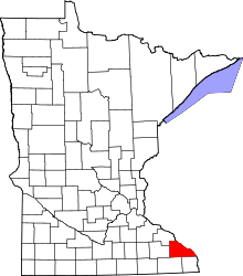 | |
| Townships | ||
| CDP | ||
| Unincorporated communities | ||
| Ghost towns | ||
| Footnotes | ‡This populated place also has portions in an adjacent county or counties | |
This article is issued from Wikipedia - version of the 7/28/2016. The text is available under the Creative Commons Attribution/Share Alike but additional terms may apply for the media files.