Wellpinit, Washington
| Wellpinit, Washington | |
|---|---|
| Unincorporated community | |
 Wellpinit, Washington | |
| Coordinates: 47°53′17″N 117°59′17″W / 47.88806°N 117.98806°WCoordinates: 47°53′17″N 117°59′17″W / 47.88806°N 117.98806°W | |
| Country | United States |
| State | Washington |
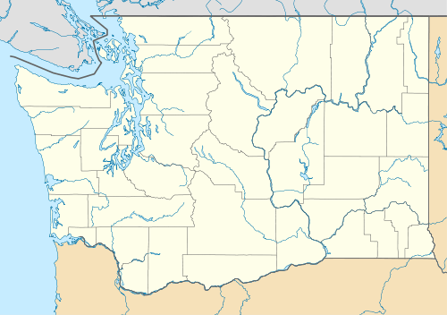
| County | Stevens |
| Elevation | 2,411 ft (735 m) |
| Time zone | Pacific (PST) (UTC-8) |
| • Summer (DST) | PDT (UTC-7) |
| Area code(s) | 509 |
| GNIS feature ID | 1512786[1] |
Wellpinit is an unincorporated community in Stevens County, Washington, United States. Wellpinit has a post office with ZIP code 99040.[2] The population of the ZIP Code Tabulation Area for 99040 was 930 at the 2000 census.[3]
The community is located on the Spokane Indian Reservation.
Notable residents
- Sherman Alexie - Native American author
Climate
This climatic region is typified by large seasonal temperature differences, with warm to hot (and often humid) summers and cold (sometimes severely cold) winters. According to the Köppen Climate Classification system, Wellpinit has a dry-summer humid continental climate, abbreviated "Dsb" on climate maps.
| Climate data for Wellpinit | |||||||||||||
|---|---|---|---|---|---|---|---|---|---|---|---|---|---|
| Month | Jan | Feb | Mar | Apr | May | Jun | Jul | Aug | Sep | Oct | Nov | Dec | Year |
| Record high °F (°C) | 56 (13) |
64 (18) |
72 (22) |
88 (31) |
98 (37) |
98 (37) |
104 (40) |
105 (41) |
104 (40) |
84 (29) |
65 (18) |
53 (12) |
105 (41) |
| Average high °F (°C) | 31.9 (−0.1) |
38.4 (3.6) |
48.1 (8.9) |
57.9 (14.4) |
66.5 (19.2) |
75 (24) |
84.4 (29.1) |
84 (29) |
73.2 (22.9) |
58.6 (14.8) |
41 (5) |
31.8 (−0.1) |
57.6 (14.2) |
| Average low °F (°C) | 19.7 (−6.8) |
23.9 (−4.5) |
28.9 (−1.7) |
34.7 (1.5) |
41.1 (5.1) |
47.8 (8.8) |
52.7 (11.5) |
51.8 (11) |
44.2 (6.8) |
35.4 (1.9) |
28.2 (−2.1) |
21.8 (−5.7) |
35.8 (2.1) |
| Record low °F (°C) | −22 (−30) |
−25 (−32) |
2 (−17) |
15 (−9) |
20 (−7) |
23 (−5) |
29 (−2) |
24 (−4) |
20 (−7) |
7 (−14) |
0 (−18) |
−29 (−34) |
−29 (−34) |
| Average precipitation inches (mm) | 2.2 (56) |
1.69 (42.9) |
1.65 (41.9) |
1.44 (36.6) |
1.65 (41.9) |
1.4 (36) |
0.65 (16.5) |
0.7 (18) |
0.98 (24.9) |
1.45 (36.8) |
2.49 (63.2) |
2.66 (67.6) |
18.95 (481.3) |
| Average precipitation days | 9 | 7 | 7 | 6 | 7 | 6 | 3 | 3 | 4 | 6 | 9 | 10 | 77 |
| Source: [4] | |||||||||||||
References
- ↑ U.S. Geological Survey Geographic Names Information System: Wellpinit, Washington
- ↑ ZIP Code Lookup
- ↑ "American FactFinder". United States Census Bureau. Retrieved 2008-01-31.
- ↑ "WELLPINIT, WASHINGTON (459058)". Western Regional Climate Center. Retrieved November 18, 2015.
Municipalities and communities of Stevens County, Washington, United States | ||
|---|---|---|
| Cities | 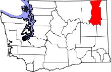 | |
| Towns | ||
| CDPs | ||
| Other unincorporated communities | ||
| Ghost towns | ||
This article is issued from Wikipedia - version of the 11/19/2015. The text is available under the Creative Commons Attribution/Share Alike but additional terms may apply for the media files.