Northport, Washington
| Northport | |
|---|---|
| Town | |
| Northport, Washington | |
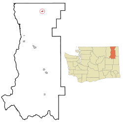 Location of Northport, Washington | |
| Coordinates: 48°54′52″N 117°46′56″W / 48.91444°N 117.78222°WCoordinates: 48°54′52″N 117°46′56″W / 48.91444°N 117.78222°W | |
| Country | United States |
| State | Washington |
| County | Stevens |
| Area[1] | |
| • Total | 0.58 sq mi (1.50 km2) |
| • Land | 0.58 sq mi (1.50 km2) |
| • Water | 0 sq mi (0 km2) |
| Elevation | 1,365 ft (416 m) |
| Population (2010)[2] | |
| • Total | 295 |
| • Estimate (2015)[3] | 288 |
| • Density | 508.6/sq mi (196.4/km2) |
| Time zone | Pacific (PST) (UTC-8) |
| • Summer (DST) | PDT (UTC-7) |
| ZIP code | 99157 |
| Area code | 509 |
| FIPS code | 53-50045 |
| GNIS feature ID | 1523920[4] |
| Website | Town of Northport |
Northport is a town in Stevens County, Washington, United States. The population was 295 at the 2010 census.[5]
History
Northport was given its name since it was once the northernmost town on the Spokane Falls and Northern Railway.[6] It was officially incorporated on June 1, 1898 but has a history stretching back to the 1880s when it was a port and shipbuilding center for steamboat services running northwards into British Columbia during construction of the Canadian Pacific Railway, related to its location at a stretch of the Columbia known as the Little Dalles, a rapids and narrows that was a barrier to navigation and which also was an alternate name for Northport itself.[7][8][9]
Geography
Northport is located at 48°54′52″N 117°46′56″W / 48.91444°N 117.78222°W (48.914460, -117.782331).[10]
According to the United States Census Bureau, the town has a total area of 0.58 square miles (1.50 km2), all of it land.[1]
Climate
This climatic region is typified by large seasonal temperature differences, with warm to hot (and often humid) summers and cold (sometimes severely cold) winters. According to the Köppen Climate Classification system, Northport has a humid continental climate, abbreviated "Dfb" on climate maps.[11]
| Climate data for Northport | |||||||||||||
|---|---|---|---|---|---|---|---|---|---|---|---|---|---|
| Month | Jan | Feb | Mar | Apr | May | Jun | Jul | Aug | Sep | Oct | Nov | Dec | Year |
| Record high °F (°C) | 57 (14) |
60 (16) |
76 (24) |
92 (33) |
102 (39) |
107 (42) |
110 (43) |
109 (43) |
105 (41) |
87 (31) |
69 (21) |
58 (14) |
110 (43) |
| Average high °F (°C) | 31.7 (−0.2) |
38.7 (3.7) |
50.6 (10.3) |
63.1 (17.3) |
72.7 (22.6) |
79.3 (26.3) |
88.1 (31.2) |
86.5 (30.3) |
75.9 (24.4) |
59.2 (15.1) |
42.1 (5.6) |
33.5 (0.8) |
60.1 (15.6) |
| Average low °F (°C) | 19.2 (−7.1) |
22.1 (−5.5) |
28 (−2) |
34.3 (1.3) |
41.1 (5.1) |
47.2 (8.4) |
50.6 (10.3) |
49.1 (9.5) |
42.6 (5.9) |
35.2 (1.8) |
28.9 (−1.7) |
22.9 (−5.1) |
35.1 (1.7) |
| Record low °F (°C) | −32 (−36) |
−27 (−33) |
−11 (−24) |
12 (−11) |
20 (−7) |
26 (−3) |
30 (−1) |
26 (−3) |
17 (−8) |
6 (−14) |
−11 (−24) |
−28 (−33) |
−32 (−36) |
| Average precipitation inches (mm) | 2.06 (52.3) |
1.39 (35.3) |
1.41 (35.8) |
1.38 (35.1) |
1.8 (46) |
2.09 (53.1) |
1.06 (26.9) |
1.03 (26.2) |
1.15 (29.2) |
1.52 (38.6) |
2.14 (54.4) |
2.38 (60.5) |
19.4 (493) |
| Average snowfall inches (cm) | 18.1 (46) |
8.7 (22.1) |
2.7 (6.9) |
0.1 (0.3) |
0 (0) |
0 (0) |
0 (0) |
0 (0) |
0 (0) |
0.2 (0.5) |
6.1 (15.5) |
17.2 (43.7) |
53.2 (135.1) |
| Average precipitation days | 12 | 9 | 9 | 8 | 10 | 10 | 5 | 5 | 6 | 9 | 12 | 12 | 107 |
| Source: [12] | |||||||||||||
Demographics
| Historical population | |||
|---|---|---|---|
| Census | Pop. | %± | |
| 1900 | 787 | — | |
| 1910 | 476 | −39.5% | |
| 1920 | 906 | 90.3% | |
| 1930 | 391 | −56.8% | |
| 1940 | 427 | 9.2% | |
| 1950 | 487 | 14.1% | |
| 1960 | 482 | −1.0% | |
| 1970 | 423 | −12.2% | |
| 1980 | 368 | −13.0% | |
| 1990 | 308 | −16.3% | |
| 2000 | 336 | 9.1% | |
| 2010 | 295 | −12.2% | |
| Est. 2015 | 288 | [13] | −2.4% |
| U.S. Decennial Census[14] 2015 Estimate[3] | |||
2010 census
As of the census[2] of 2010, there were 295 people, 139 households, and 76 families residing in the town. The population density was 508.6 inhabitants per square mile (196.4/km2). There were 168 housing units at an average density of 289.7 per square mile (111.9/km2). The racial makeup of the town was 94.2% White, 0.3% African American, 1.7% Native American, 0.7% Asian, 1.0% from other races, and 2.0% from two or more races. Hispanic or Latino of any race were 4.1% of the population.
There were 139 households of which 24.5% had children under the age of 18 living with them, 38.1% were married couples living together, 11.5% had a female householder with no husband present, 5.0% had a male householder with no wife present, and 45.3% were non-families. 38.1% of all households were made up of individuals and 14.4% had someone living alone who was 65 years of age or older. The average household size was 2.12 and the average family size was 2.75.
The median age in the town was 48.5 years. 21% of residents were under the age of 18; 6.5% were between the ages of 18 and 24; 18.3% were from 25 to 44; 35.9% were from 45 to 64; and 18.3% were 65 years of age or older. The gender makeup of the town was 50.2% male and 49.8% female.
2000 census
As of the census of 2000, there were 336 people, 151 households, and 83 families residing in the town. The population density was 592.7 people per square mile (227.6/km²). There were 179 housing units at an average density of 315.8 per square mile (121.2/km²). The racial makeup of the town was 94.94% White, 0.60% Native American, 0.60% Asian, 0.30% Pacific Islander, 0.30% from other races, and 3.27% from two or more races. Hispanic or Latino of any race were 5.36% of the population.
There were 151 households out of which 22.5% had children under the age of 18 living with them, 47.0% were married couples living together, 5.3% had a female householder with no husband present, and 44.4% were non-families. 36.4% of all households were made up of individuals and 12.6% had someone living alone who was 65 years of age or older. The average household size was 2.23 and the average family size was 3.01.
In the town the age distribution of the population shows 25.0% under the age of 18, 5.7% from 18 to 24, 22.0% from 25 to 44, 30.1% from 45 to 64, and 17.3% who were 65 years of age or older. The median age was 43 years. For every 100 females there were 100.0 males. For every 100 females age 18 and over, there were 95.3 males.
The median income for a household in the town was $21,719, and the median income for a family was $26,875. Males had a median income of $28,929 versus $16,000 for females. The per capita income for the town was $11,679. About 15.9% of families and 27.7% of the population were below the poverty line, including 38.5% of those under age 18 and 17.4% of those age 65 or over.
Janni’s chimney
Peter Janni was born in Italy in 1874 and came to America to work on the railroad. Eventually he ended up in Northport and in 1923 purchased a limestone quarry south of Northport.[15] Janni shipped limestone all over Washington from the quarry. The quarry was located in the center of the tetrahedrite mineralized zone of Northern Stevens County.[15] Ore deposits in the district occur in “Vugs” or “Chimneys” usually narrow veins of galena with high silver content. In 1953 Janni’s crew discovered a chimney of galena with silver, 6 feet by 5 feet on the second level of the quarry. They followed it down and shipped nearly forty tons of high grade galena to CM&S Company’s lead refinery in nearby Trail. After following it down 15 feet Janni came and said “cover the damn thing up”.[15] Janni’s men pleaded to follow the chimney further, but Janni refused saying “maybe someday we will dig her up again”.[15] Why he abandoned the chimney remains a mystery. According to some old timers in Northport the rich chimney is still at the quarry buried under tons of limestone located on the second level.[15]
References
- 1 2 "US Gazetteer files 2010". United States Census Bureau. Retrieved 2012-12-19.
- 1 2 "American FactFinder". United States Census Bureau. Retrieved 2012-12-19.
- 1 2 "Population Estimates". United States Census Bureau. Retrieved July 14, 2016.
- ↑ "US Board on Geographic Names". United States Geological Survey. 2007-10-25. Retrieved 2008-01-31.
- ↑ "2010 Census Redistricting Data (Public Law 94-171) Summary File". American FactFinder. United States Census Bureau. Retrieved 17 September 2012.
- ↑ Majors, Harry M. (1975). Exploring Washington. Van Winkle Publishing Co. p. 58. ISBN 978-0-918664-00-6.
- ↑ "Steamboats of the Columbia" article in Trails In Time website by Walter Volovsek
- ↑ Mills, Randall V., Sternwheelers up Columbia, page 86, University of Nebraska, Lincoln 1947 ISBN 0-8032-5874-7
- ↑ Turner, Robert D., Sternwheelers and Steam Tugs, page 1, Sono Nis Press, Victoria, BC 1984 ISBN 0-919203-15-9
- ↑ "US Gazetteer files: 2010, 2000, and 1990". United States Census Bureau. 2011-02-12. Retrieved 2011-04-23.
- ↑ Climate Summary for Northport, Washington
- ↑ "NORTHPORT, WASHINGTON (455946)". Western Regional Climate Center. Retrieved November 18, 2015.
- ↑ "Annual Estimates of the Resident Population for Incorporated Places: April 1, 2010 to July 1, 2015". Retrieved July 2, 2016.
- ↑ United States Census Bureau. "Census of Population and Housing". Retrieved October 4, 2013.
- 1 2 3 4 5 N.L. Barlee, Gold Creeks and Ghost Towns of Northeastern Washington., Hancock House Publishers., 2004
External links
| Wikimedia Commons has media related to Northport, WA. |
Municipalities and communities of Stevens County, Washington, United States | ||
|---|---|---|
| Cities | 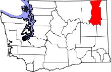 | |
| Towns | ||
| CDPs | ||
| Other unincorporated communities | ||
| Ghost towns | ||