Wellington, Nevada
| Wellington | |
|---|---|
| unincorporated town | |
 Wellington Location within the state of Nevada | |
| Coordinates: 38°45′20″N 119°22′34″W / 38.75556°N 119.37611°WCoordinates: 38°45′20″N 119°22′34″W / 38.75556°N 119.37611°W | |
| Country | United States |
| State | Nevada |
| County | Lyon |
| Elevation | 4,836 ft (1,474 m) |
| Time zone | Pacific (PST) (UTC-8) |
| • Summer (DST) | PDT (UTC-7) |
| ZIP codes | 89444 |
| GNIS feature ID | 848674 |
Nevada Historical Marker | |
| Reference no. | 74 |
Wellington (also Wellingtons or Wellingtons Station) is an unincorporated town in southwestern Lyon County, Nevada, United States. It lies along State Route 208, southwest of the city of Yerington, the county seat of Lyon County.[1] Its elevation is 4,836 feet (1,474 m).[2] As of 2009 it had a resident population of 1103 and had a post office with the ZIP code of 89444,[3] a health clinic with dental services, a grocery-gas station, a complete public school (K-12), a historical society and a volunteer fire department within the town limits. Three Protestant churches are in or near the town as well. There are no industries or corporate offices. It is in Smith Valley, for which it serves as the source of essential services, and is very close to the town of Smith itself.
References
- ↑ Rand McNally. The Road Atlas '08. Chicago: Rand McNally, 2008, p. 64.
- ↑ U.S. Geological Survey Geographic Names Information System: Wellington, Nevada, Geographic Names Information System, 1980-12-12. Accessed 2008-02-27.
- ↑ Zip Code Lookup
External links
Municipalities and communities of Lyon County, Nevada, United States | ||
|---|---|---|
| Cities | 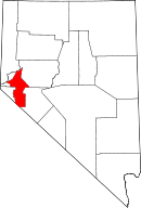 | |
| CDPs | ||
| Other unincorporated communities | ||
| Ghost towns | ||
| Indian reservation | ||