Stagecoach, Nevada
| Stagecoach, Nevada | |
|---|---|
| Census-designated place | |
 Stagecoach Location within the state of Nevada | |
| Coordinates: 39°22′26″N 119°22′27″W / 39.37389°N 119.37417°WCoordinates: 39°22′26″N 119°22′27″W / 39.37389°N 119.37417°W | |
| Country | United States |
| State | Nevada |
| County | Lyon |
| Area | |
| • Total | 8.3 sq mi (21.6 km2) |
| • Land | 8.3 sq mi (21.6 km2) |
| • Water | 0 sq mi (0 km2) |
| Elevation | 4,347 ft (1,325 m) |
| Population (2010) | |
| • Total | 1,874 |
| • Density | 220/sq mi (87/km2) |
| Time zone | Pacific (PST) (UTC-8) |
| • Summer (DST) | PDT (UTC-7) |
| ZIP codes | 89429 |
| FIPS code | 32-68800 |
| GNIS feature ID | 0850746 |
Stagecoach is an unincorporated community and census-designated place (CDP) in Lyon County, Nevada, United States, located east of Reno.[1] Its name is likely derived from its place as the Overland Stagecoach station at Desert Well. Typically, the mail that was heading towards California was delivered on a steamship through Panama. But in 1857, the Overland mail company was created, and the Desert Well station was a dual stop for both the stagecoach line and the Pony Express.
As of the 2010 census, the population of Stagecoach was 1,874.[2]
Geography
Stagecoach is located along U.S. Route 50, 9 miles (14 km) west of Silver Springs, 16 miles (26 km) northeast of Dayton and 27 miles (43 km) east of Carson City. According to the U.S. Census Bureau, the Stagecoach CDP has an area of 8.3 square miles (21.6 km2), all land.[2]
References
- ↑ http://stagecoachnv.com/
- 1 2 "Geographic Identifiers: 2010 Demographic Profile Data (G001): Stagecoach CDP, Nevada". U.S. Census Bureau, American Factfinder. Retrieved January 25, 2013.
Municipalities and communities of Lyon County, Nevada, United States | ||
|---|---|---|
| Cities | 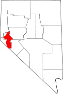 | |
| CDPs | ||
| Other unincorporated communities | ||
| Ghost towns | ||
| Indian reservation | ||