U.S. Route 31 in Indiana
| ||||
|---|---|---|---|---|
_map.svg.png) | ||||
| Route information | ||||
| Maintained by INDOT | ||||
| Length: | 266.02 mi (428.12 km) | |||
| Existed: | October 1, 1926[1] – present | |||
| Major junctions | ||||
| South end: |
| |||
|
| ||||
| North end: |
| |||
| Location | ||||
| Counties: | Clark, Scott, Jackson, Bartholomew, Johnson, Marion, Hamilton, Tipton, Howard, Miami, Fulton, Marshall, St. Joseph | |||
| Highway system | ||||
| ||||

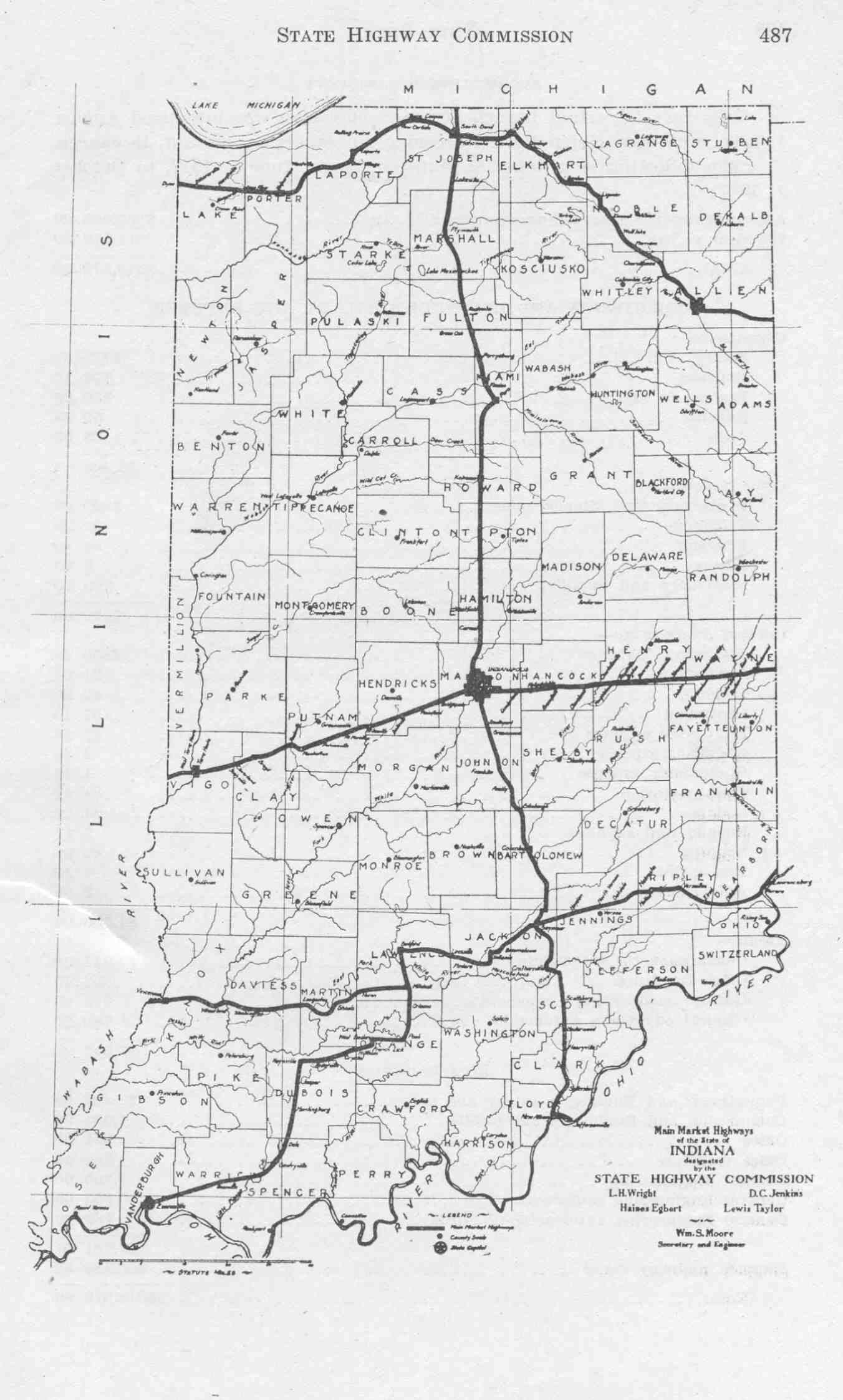
U.S. Route 31 (US 31) is a part of the United States Numbered Highway System that runs from Spanish Fort, Alabama, to the Mackinaw City, Michigan. In the U.S. state of Indiana, it is a State Road that enters the state via the George Rogers Clark Memorial Bridge between Louisville, Kentucky, and Clarksville, Indiana. The 266.02 miles (428.12 km) of US 31 that lie within Indiana serve as a major conduit. Some of the highway is listed on the National Highway System. Various sections are rural two-lane highway and urbanized four-lane divided expressway. The northernmost community along the highway is South Bend near the Michigan state line.
US 31 was first designated as a US Highway in October 1926. A northern (from Rochester to South Bend) and very far south section (on old US 31 W into Louisville on the K&I Bridge) of the highway originally served as part of the Dixie Highway. US 31 was the Jackson Highway from Indianapolis to Seymour. US 31 replaced the original State Road 1 (SR 1) designation of the highway which dated back to the formation of the Indiana State Road system. SR 1 ran from Clarksville through Indianapolis to South Bend and ended at the Michigan state line.
Route description
Only the segment of US 31 that is north of Indianapolis is included as a part of the National Highway System (NHS).[2] The NHS is a network of highways that are identified as being most important for the economy, mobility and defense of the nation.[3] The highway is maintained by the Indiana Department of Transportation (INDOT) like all other U.S. Routes in the state. The department tracks the traffic volumes along all state highways as a part of its maintenance responsibilities using a metric called average annual daily traffic (AADT). This measurement is a calculation of the traffic level along a segment of roadway for any average day of the year. In 2010, INDOT figured that lowest traffic levels were the 3,690 personal vehicles and 160 commercial vehicles that used the highway daily near Memphis. The peak traffic volume was 168,770 personal vehicles and 18,090 commercial vehicles along the section of US 31 concurrent with Interstate 465 (I–465).[4]
Jeffersonville to Columbus
US 31 overlaps I-65 in Jeffersonville, after crossing the George Rogers Clark Memorial Bridge from Kentucky. It then diverges as the access frontage lanes before splitting off north of Jeffersonville at Clarksville and proceeding to Indianapolis. US 31 was widened to two lanes in both directions for its length through Columbus in the early 2000s.
Columbus to Indianapolis
At I-465 on the south side of Indianapolis, US 31 is routed onto I-465 on the east side of the city. This is the closest approach the highway makes to downtown Indianapolis. Previously the northbound route of the highway through Indianapolis was on East Street, Madison Avenue, Delaware Street, North Street, and onto Meridian Street; southbound was on Meridian Street, North Street, Pennsylvania Street, Madison Avenue, and onto East Street.
Indianapolis to Michigan
US 31 exits I-465 (coincidentally at Exit 31) in southern Hamilton County, and continues northward, primarily as a divided highway. US 31 then passes through or near Carmel, Kokomo, Rochester, Plymouth, and Lakeville. As US 31 approaches South Bend, the route converges with US 20/St. Joseph Valley Parkway and proceeds west and then north, bypassing South Bend and proceeding into Michigan. (See U.S. Route 31 in Michigan.)
History
US 31 was signed into law by the Governor on March 7 of 1917, as Main Market Highway 1, and signs were installed on June 1 of that year.[5][6] The name was changed to Indiana State Road 1 within a year when Indiana began the state road system.[6][7] By 1924, most of the route was paved, leaving only from Columbus to Franklin and from Peru to Plymouth that was unpaved.[8] On October 1, 1926, US 31 was designated along what was SR 1 at the time.[1]
Freeway upgrades for northern sections
Three sections of US 31 in Northern Indiana between I-465 and US 20 have been or are being relocated or upgraded, part of the INDOT Major Moves Project designed to convert US 31 to Interstate-grade freeway from South Bend to Indianapolis. Funding has yet to be approved for the 78 miles of US 31 between these three segments[9] except for an interchange at SR 28 in Tipton County, which opened November 22, 2016.[10]
Hamilton County
The New US 31 Hamilton County project has upgraded US 31 to freeway standards from Interstate 465 near the Marion County line and Indianapolis to a point near SR 38 north of Westfield.
Kokomo
The Kokomo Corridor Project covered 14 miles (23 km) of new highway primarily in Howard County. The limited-access highway was built east of Kokomo and has five interchanges at SR 26, E. Boulevard (CR 100S), US 35/SR 22 (Markland Avenue), Touby Pike and US 35 north of Kokomo. Groundbreaking for the project occurred in the afternoon of September 17, 2008.[11][12] This section of highway had been scheduled to be completed in December 2013[13][14][15] but it opened ahead of schedule with a ribbon-cutting ceremony on November 26, 2013.[16][17] The former section of US 31 was redesignated as State Road 931.
Plymouth to South Bend
The US 31 Plymouth to South Bend project relocated US 31 on primarily new alignment from US 30 near Plymouth to US 20/St. Joseph Valley Parkway south of South Bend. Groundbreaking for the project occurred on September 17, 2008,[11][18][19] only hours before the groundbreaking for the Kokomo stretch, and initial construction was in northern Marshall County.[20] This section of highway opened on August 21, 2014,[21][22] and a portion was dedicated as the Richard W. Mangus Memorial Highway, in honor of the local state representative who supported the freeway's construction, at the ribbon-cutting ceremony on August 27.[23][24] As of the time of the freeway opening a designation for the state-maintained portion of the former route had not been decided[25] but it was later designated as another segment of SR 931.
Major intersections
| County | Location | mi[26] | km | Exit | Destinations | Notes |
|---|---|---|---|---|---|---|
| Ohio River | 0.00 | 0.00 | Clark Memorial Bridge | |||
| Clark | Clarksville | 1.51 | 2.43 | Old SR 62 – New Albany, Clarksville, Indiana | Former SR 62 | |
| 1.59 | 2.56 | 1 | Southern end of I-65 concurrency | |||
| 3.71 | 5.97 | 2 | Northern end of I-65 concurrency; US 31 serves as collector-distributor lane for I-65 until exit 4 | |||
| Jeffersonville Township | 6.16 | 9.91 | Eastern end of SR 60 | |||
| Sellersburg | 9.28 | 14.93 | Old SR 311 | Former SR 311 | ||
| 10.02– 10.05 | 16.13– 16.17 | Old SR 403 | Former SR 403 | |||
| Henryville | 19.58 | 31.51 | ||||
| Scott | Vienna Township | 27.19 | 43.76 | Western end of SR 356 | ||
| Scottsburg | 29.76 | 47.89 | ||||
| Austin | 34.25 | 55.12 | ||||
| Jackson | Crothersville | 37.14– 37.30 | 59.77– 60.03 | Exit 36 on I-65 | ||
| 42.07 | 67.71 | |||||
| Seymour | 50.42 | 81.14 | ||||
| Bartholomew | Columbus | 64.86 | 104.38 | |||
| 65.28 | 105.06 | |||||
| Taylorsville | 77.13– 77.60 | 124.13– 124.89 | Exit 76 on I-65 | |||
| Johnson | Edinburgh | 81.39 | 130.98 | Southern end of SR 252 concurrency | ||
| Blue River Township | 85.11 | 136.97 | Northern end of SR 252 concurrency | |||
| Franklin | 91.24 | 146.84 | ||||
| Marion | Indianapolis | Southern end of Freeway | ||||
| 107.17 | 172.47 | 2 | Southern and western end of I-465, I-69 (future), I-74, US 36, US 40, SR 37, SR 67 concurrencies | |||
| 53 | ||||||
| 49 | Northern end of I-74 concurrency; southern end of US 421 concurrency | |||||
| 47 | Southern end of US 52 concurrency | |||||
| 46 | Northern end of US 40 concurrency | |||||
| 44 | ||||||
| Lawrence | 42 | Northern end of US 36/SR 67 concurrency | ||||
| Indianapolis | 37 | Northern end of SR 37 concurrency; current southern end of I-69 (future end of concurrency) | ||||
| 33 | Keystone Avenue – Carmel | Former SR 431 | ||||
| Hamilton | Carmel | 123 | Western and northern end of I-465, US 52, and US 421 concurrency | |||
| 124 | 106th Street | Roundabout exit | ||||
| 125 | 116th Street | Roundabout exit | ||||
| 126 | Old Meridian Street | northbound exit only | ||||
| 127 | W Main Street | Roundabout exit | ||||
| 128 | 136th Street | Roundabout exit | ||||
| 137.60 | 221.45 | 129 | 146th Street – Carmel, Indianapolis | Signed as exits 129A (146th St) and 129B (Keystone Pkwy) Southbound; (Keystone Pkwy) southbound exit and northbound entrance | ||
| Westfield | 131 | 161st Street | Roundabout exit | |||
| 140.65 | 226.35 | 132 | ||||
| 134 | 191st Street | |||||
| 144.26 | 232.16 | 136 | ||||
| Northern end of Freeway | ||||||
| Tipton | Jefferson Township | 156.72 | 252.22 | Interchange opened November 2016 | ||
| Sharpsville | Southern end of Freeway | |||||
| 156 | Southern terminus of SR 931; northbound exit and southbound entrance | |||||
| Howard | Kokomo | 166.58 | 268.08 | 158 | ||
| 161 | CR 100S | |||||
| 170.91 | 275.05 | 162 | Southern end of US 35 concurrency | |||
| 165 | Touby Pike | |||||
| 175.52 | 282.47 | 166 | Northern end of US 35 concurrency; northbound exit and southbound entrance | |||
| 167 | Northern terminus of SR 931; southbound exit and northbound entrance | |||||
| Northern end of Freeway | ||||||
| Miami | Deer Creek Township | 178.50 | 287.27 | |||
| Pipe Creek Township | 183.73 | 295.68 | Southern end of SR 218 concurrency | |||
| 184.83 | 297.46 | Northern end of SR 218 concurrency | ||||
| Peru | 190.96– 191.71 | 307.32– 308.53 | ||||
| Denver | 197.88 | 318.46 | ||||
| Fulton | Rochester | 211.58– 212.36 | 340.51– 341.76 | |||
| 213.18 | 343.08 | No access due to grade separation | ||||
| Richland Township | 221.37 | 356.26 | Fulton–Marshall county line | |||
| Marshall | Argos | 226.08 | 363.84 | |||
| Plymouth | ||||||
| Southern end of Freeway | ||||||
| 233.67– 234.17 | 376.06– 376.86 | 225 | Signed as Exits 225A(US 30 East to Warsaw) and 225B(US 30 West to Valparaiso) | |||
| 228 | Veterans Parkway | |||||
| La Paz | 241.27 | 388.29 | 233 | |||
| St. Joseph | Lakeville | 247.66 | 398.57 | 239 | Eastern end of the western section SR 4 | |
| South Bend | 245 | Kern Road | ||||
| 262.27 | 422.08 | 246 | Southern end of US 20 concurrency; Signed as Exits 246A(US 20 East to Elkhart) and 246B(US 31 North to Niles/US 20 West to Michigan City) Northbound; Signed as Exit 79 Southbound | |||
| 76 | ||||||
| 74 | Mayflower Road | No northbound exit to southbound Mayflower Road or southbound entrance from northbound Mayflower Road | ||||
| 73 | Eastern terminus of SR 2; signed as 73A (west) and 73B (east) | |||||
| 262.24 | 422.03 | 263 | Northern end of US 20 concurrency; signed as 263A (east) and 263B (west) | |||
| 264A | Nimtz Parkway | Signed as Exit 264B southbound | ||||
| 263.43– 263.60 | 423.95– 424.22 | 264B | Signed as exit 264A southbound; exit 72 on the Indiana Toll Road | |||
| 265 | Cleveland Road, Brick Road | |||||
| 266.02 | 428.12 | Michigan state line; St. Joseph Valley Parkway continues into Michigan | ||||
1.000 mi = 1.609 km; 1.000 km = 0.621 mi
| ||||||
Supplemental routes
See also
References
- 1 2 "Road Numbers to Be Changed". The Hancock-Democrat. The Indianapolis News. September 30, 1926. Retrieved June 9, 2016 – via Newspapers.com.

- ↑ National Highway System: Indiana (PDF) (Map). Federal Highway Administration. December 2003. Retrieved July 20, 2012.
- ↑ "National Highway System". Federal Highway Administration. August 26, 2010. Retrieved July 20, 2012.
- ↑ "INDOT Traffic Zones". Indiana Department of Transportation. 2010. Retrieved July 9, 2012.
- ↑ 1917 Indiana State Highway Map and State Highway Commission (Map). Indiana State Highway Commission. 1917.
- 1 2 Indiana Transportation Map (jpg) (Map). Indiana State Highway Commission. 1917. Retrieved July 20, 2012.
- ↑ Indiana Transportation Map (Map). Indiana State Highway Commission. 1918.
- ↑ Indiana Transportation Map (pdf) (Map). Indiana State Highway Commission. 1924. Retrieved July 20, 2012.
- ↑ "U.S. 31 bypass around Kokomo is running 2 years early". The Elkhart Truth. 2010-01-13. Retrieved 2010-07-09.
- ↑ Pemberton, Caele (November 21, 2016). "Tipton interchange to open Tuesday". Kokomo Tribune. Retrieved December 4, 2016.
- 1 2 Platt, Sarah (September 17, 2008). "Governor Daniels breaks ground on new U.S. 31 in Lakeville". WNDU-TV. Retrieved September 18, 2008.
- ↑ Smith, Scott (September 17, 2008). "Ceremony for new U.S. 31 corridor draws crowd". Kokomo Tribune. Retrieved September 19, 2008.
- ↑ Smith, Scott (April 10, 2012). "Coalition Planners Look to Remaining U.S. 31 Areas". Kokomo Tribune. Retrieved April 12, 2012.
- ↑ Smith, Scott (January 12, 2010). "U.S. 31 bypass work moving along". Kokomo Tribune. Retrieved January 13, 2010.
- ↑ Smith, Scott (August 6, 2013). "Bypass or Boulevard?". Kokomo Tribune. Retrieved October 23, 2013.
- ↑ McFeely, Dan (November 26, 2013). "Kokomo U.S. 31 bypass should cut commutes". The Indianapolis Star. Retrieved November 26, 2013.
- ↑ Smith, Scott (November 27, 2013). "On Cruise Control". Kokomo Tribune. Retrieved November 27, 2013.
- ↑ Jackson, Adam (September 18, 2008). "Ground Breaks on U.S. 31 Work". South Bend Tribune. Retrieved April 12, 2012.
- ↑ Grove, Dustin (September 17, 2008). "New U.S. 31 Project Underway". WSBT-TV. Archived from the original on September 21, 2008. Retrieved April 12, 2012.
- ↑ Sulok, Nancy J. (January 27, 2008). "Bridges to signal start of new U.S. 31 freeway". South Bend Tribune. Retrieved January 30, 2008.
- ↑ Indiana Department of Transportation Northwest District [INDOTNorthwest] (August 21, 2014). "And we have liftoff!" (Tweet). Retrieved January 19, 2016 – via Twitter.
- ↑ Gray, Amanda (August 22, 2014). "Driving the New U.S. 31 Is Smooth Sailing". South Bend Tribune. Retrieved August 22, 2014.
- ↑ "Governor Pence Officially Opens New U.S. 31 Plymouth to South Bend" (Press release). Indiana Department of Transportation. August 27, 2014. Retrieved August 28, 2014.
- ↑ Meenan, Jim (August 28, 2014). "Pence Officially Opens new U.S. 31". South Bend Tribune. Retrieved August 28, 2014.
- ↑ New US 31 Already Impacting Business (Video). WSBT-TV. August 21, 2014. Event occurs at 3:02. Retrieved August 22, 2014.
- ↑ "INDOT Roadway Referencing System" (PDF). staff.
External links
| Previous state: Kentucky |
Indiana | Next state: Michigan |