Stránecká Zhoř
| Stránecká Zhoř | |||
|---|---|---|---|
| Municipality | |||
 | |||
| |||
 Stránecká Zhoř | |||
| Coordinates: 49°22′50″N 15°55′41″E / 49.38056°N 15.92806°ECoordinates: 49°22′50″N 15°55′41″E / 49.38056°N 15.92806°E | |||
| Country |
| ||
| Region | Vysočina | ||
| District | Žďár nad Sázavou | ||
| Area | |||
| • Total | 11.91 km2 (4.60 sq mi) | ||
| Elevation | 497 m (1,631 ft) | ||
| Population (1.1.2014) | |||
| • Total | 608 | ||
| • Density | 51/km2 (130/sq mi) | ||
| Postal code | 594 01 to 594 42 | ||
| Website | http://www.straneckazhor.cz | ||

Stránecká Zhoř is a village and municipality (obec) in Žďár nad Sázavou District in the Vysočina Region of the Czech Republic.
The municipality covers an area of 11.91 square kilometres (4.60 sq mi), and has a population of 582 (as at 3 July 2006).
Stránecká Zhoř lies approximately 21 kilometres (13 mi) south of Žďár nad Sázavou, 25 km (16 mi) east of Jihlava, and 134 km (83 mi) south-east of Prague.
Gallery
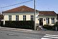 Municipal office
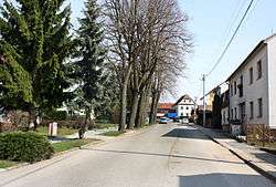
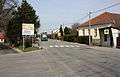 Road No 602
References
| Wikimedia Commons has media related to Stránecká Zhoř. |
This article is issued from Wikipedia - version of the 4/8/2016. The text is available under the Creative Commons Attribution/Share Alike but additional terms may apply for the media files.