Stone County, Missouri
Coordinates: 36°44′N 93°28′W / 36.74°N 93.47°W
| Stone County, Missouri | |
|---|---|
 Stone County Courthouse in Galena | |
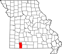 Location in the U.S. state of Missouri | |
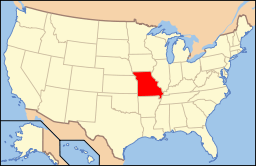 Missouri's location in the U.S. | |
| Founded | February 10, 1851 |
| Named for | William Stone, English pioneer and an early settler in Maryland |
| Seat | Galena |
| Largest city | Kimberling City |
| Area | |
| • Total | 511 sq mi (1,323 km2) |
| • Land | 464 sq mi (1,202 km2) |
| • Water | 47 sq mi (122 km2), 9.2% |
| Population (est.) | |
| • (2015) | 30,943 |
| • Density | 69/sq mi (27/km²) |
| Congressional district | 7th |
| Time zone | Central: UTC-6/-5 |
| Website |
www |
Stone County is a county located in the southwestern portion of the U.S. state of Missouri. As of the 2010 census, the population was 32,202.[1] Its county seat is Galena.[2] The county was officially organized on February 10, 1851, and is named after William Stone, an English pioneer and an early settler in Maryland who also served as Taney County Judge.[3]
Stone County is part of the Branson, MO Micropolitan Statistical Area, which is also included in the Springfield-Branson, MO Combined Statistical Area.
Geography
According to the U.S. Census Bureau, the county has a total area of 511 square miles (1,320 km2), of which 464 square miles (1,200 km2) is land and 47 square miles (120 km2) (9.2%) is water.[4]
Adjacent counties
- Christian County (north)
- Taney County (east)
- Carroll County, Arkansas (south)
- Barry County (west)
- Lawrence County (northwest)
National protected area
- Mark Twain National Forest (part)
Demographics
| Historical population | |||
|---|---|---|---|
| Census | Pop. | %± | |
| 1860 | 2,400 | — | |
| 1870 | 3,253 | 35.5% | |
| 1880 | 4,404 | 35.4% | |
| 1890 | 7,090 | 61.0% | |
| 1900 | 9,892 | 39.5% | |
| 1910 | 11,559 | 16.9% | |
| 1920 | 11,941 | 3.3% | |
| 1930 | 11,614 | −2.7% | |
| 1940 | 11,298 | −2.7% | |
| 1950 | 9,748 | −13.7% | |
| 1960 | 8,176 | −16.1% | |
| 1970 | 9,921 | 21.3% | |
| 1980 | 15,587 | 57.1% | |
| 1990 | 19,078 | 22.4% | |
| 2000 | 28,658 | 50.2% | |
| 2010 | 32,202 | 12.4% | |
| Est. 2015 | 30,943 | [5] | −3.9% |
| U.S. Decennial Census[6] 1790-1960[7] 1900-1990[8] 1990-2000[9] 2010-2015[1] | |||
As of the census[10] of 2000, there were 28,658 people, 11,822 households, and 8,842 families residing in the county. The population density was 62 people per square mile (24/km²). There were 16,241 housing units at an average density of 35 per square mile (14/km²). The racial makeup of the county was 97.64% White, 0.07% Black or African American, 0.61% Native American, 0.18% Asian, 0.03% Pacific Islander, 0.25% from other races, and 1.20% from two or more races. Approximately 1.04% of the population were Hispanic or Latino of any race. Among the major first ancestries reported in Stone County were 24.3% American, 20.4% German, 11.3% English, and 10.8% Irish ancestry.
There were 11,822 households out of which 25.60% had children under the age of 18 living with them, 64.70% were married couples living together, 7.20% had a female householder with no husband present, and 25.20% were non-families. 21.40% of all households were made up of individuals and 10.30% had someone living alone who was 65 years of age or older. The average household size was 2.40 and the average family size was 2.76.
In the county the population was spread out with 21.40% under the age of 18, 6.20% from 18 to 24, 23.80% from 25 to 44, 29.70% from 45 to 64, and 18.90% who were 65 years of age or older. The median age was 44 years. For every 100 females there were 96.20 males. For every 100 females age 18 and over, there were 93.10 males.
The median income for a household in the county was $40,487, and the median income for a family was $46,675. Males had a median income of $26,224 versus $19,190 for females. The per capita income for the county was $21,813. About 8.50% of families and 12.80% of the population were below the poverty line, including 19.00% of those under age 18 and 8.10% of those age 65 or over.
Education
Of adults 25 years of age and older in Stone County, 80.4% possesses a high school diploma or higher while 14.2% holds a bachelor's degree or higher as their highest educational attainment.
Public schools
- Blue Eye R-V School District - Blue Eye
- Blue Eye Elementary School (PK-04)
- Blue Eye Middle School (05-08)
- Blue Eye High School (09-12)
- Crane R-III School District - Crane
- Crane Elementary School (K-06)
- Crane High School (07-12)
- Galena R-II School District - Galena
- Galena-Abesville Elementary School (PK-06)
- Galena High School (07-12)
- Hurley R-I School District - Hurley
- Hurley Elementary School (K-05)
- Hurley High School (06-12)
- Reeds Spring R-IV School District - Reeds Spring
- Reeds Spring Primary School (PK-01)
- Reeds Spring Elementary School (02-04)
- Reeds Spring Intermediate School (05-06)
- Reeds Spring Middle School (07-08)
- Reeds Spring High School (09-12)
Private schools
- Apostolic Christian School - Reeds Spring - (05-12) - Non-denominational Christian
Alternative & vocational schools
- Gibson Technical Center - Reeds Spring - (09-12) - Vocational/Technical
- New Horizons Alternative School - Reeds Spring - (06-12) - Alternative/Other
- Tri-Lakes Special Education Cooperative - Blue Eye - (K-12) - Special Education
- Lives Under Construction Boys Ranch [Lampe, Missouri]-(07-18)-Vocational/Special education/Correctional
Politics and Government
Government
Stone County is a third-class county located in Southwest Missouri. The county's government includes a 3-person County Commission (Presiding Commissioner, Northern District Commissioner, Southern District Commissioner), several elected officials, and a Road Commission consisting of the 3 County Commissioners as well as a Northern Road Commissioner and a Southern Road Commissioner. The County Commission also oversees the Planning and Zoning Department, Senior Citizens' Services Board, a Law Enforcement Restitution Board, and neighborhood improvement districts. All elected Officials in Stone County serve 4 year terms.[11]The county employed 170 full-time employees (including elected officials) and 10 part-time employees on December 31, 2014.[12]
The Government primarily operates out of the County Seat of Galena, Missouri. The offices of the County Commission, County Clerk, Collector of Revenue, Collector of Deeds, Treasurer as well as the University of Missouri Extension Office all operate out of the Historic Courthouse in the center of the square. The Stone County Sheriff's office, Judiciary, Circuit Clerk, and Jail are all in the Stone County Judicial Center on the east side of the square. The Assessor and Planning and Zoning offices are located in buildings on the south side of the square.
The Republican Party completely controls politics at the local level in Stone County. All current office holders are members of the Republican Party. Elected Officials in Stone County on average have a long tenure one elected to office.
| Office | Office Holder | Since | Party |
|---|---|---|---|
| Assessor | Brad Hudson | 2009 | Republican |
| Circuit Clerk | Deborah Scobee | 2011 | Republican |
| County Clerk | Cindy Elmore | 2015 | Republican |
| Collector of Revenue | Vicky A. May | 2001 | Republican |
| Coroner | Rick Stumpff | 1991 | Republican |
| Prosecuting Attorney | Matt Selby | 2000 | Republican |
| Public Administrator | Glenda (Wendy) Metcalf | 1991 | Republican |
| Recorder of Deeds | Amy Jo Larson | 2007 | Republican |
| Sheriff | Doug Rader | 2013 | Republican |
| Surveyor | Rick Kemp | 2009 | Republican |
| Treasurer | Kristi Stephens | 2000 | Republican |
| Presiding Commissioner | Dennis Wood | 2009 (Appointed) 2011 (Elected) | Republican |
| Northern Commissioner | Mark W. Maples | 2013 | Republican |
| Southern Commissioner | Jerry Dodd | 2001 | Republican |
| Northern Road Commissioner | James Gold | 2005 (Appointed) 2007 (Elected) | Republican |
| Southern Road Commissioner | Vacant | N/A | N/A |
| Circuit Court Judge | Jack Goodman | 2013 | Republican |
| Associate Circuit Court Judge Division I | Alan Blankenship | 2003 | Republican |
| Associate Circuit Court Judge Division II | Mark Stephens | 2009 | Republican |
State
| Year | Republican | Democratic | Third Parties |
|---|---|---|---|
| 2008 | 49.53% 8,043 | 47.46% 7,708 | 3.01% 489 |
| 2004 | 67.23% 10,176 | 31.66% 4,791 | 1.11% 168 |
| 2000 | 60.91% 7,338 | 37.22% 4,484 | 1.87% 225 |
| 1996 | 58.55% 5,886 | 38.11% 3,831 | 3.34% 336 |
Stone County is divided into four legislative districts in the Missouri House of Representatives, all of which are held by Republicans.
Stone County is divided into four legislative districts in the Missouri House of Representatives, all of which are held by Republicans.
- District 62 Donald E. Phillips (R-Kimberling City). Consists of all of the communities of Branson West, Coney Island, Indian Point, Kimberling City, and Reeds Springs.
| Party | Candidate | Votes | % | ± | |
|---|---|---|---|---|---|
| Republican | Donald E. Phillips | 7,297 | 100.00 | ||
- District 68 David Sater (R-Cassville). Consists of all of the community of Shell Knob.
| Party | Candidate | Votes | % | ± | |
|---|---|---|---|---|---|
| Republican | David Sater | 89 | 100.00 | ||
- District 141 Kevin Elmer (R-Nixa). Consists of all of the communities of Crane, Galena, Hurley, and McCord Bend.
| Party | Candidate | Votes | % | ± | |
|---|---|---|---|---|---|
| Republican | Kevin Elmer | 2,427 | 78.70 | ||
| Democratic | Bob Rubino | 657 | 21.30 | ||
- District 143 Lyle Rowland (R-Cedar Creek). Consists of all of the community of Blue Eye.
| Party | Candidate | Votes | % | ± | |
|---|---|---|---|---|---|
| Republican | Lyle Rowland | 635 | 67.12 | ||
| Independent | Michael Chipman | 311 | 32.88 | ||
All of Stone County is a part of Missouri’s 29th District in the Missouri Senate and is currently represented by Jack Goodman (R-Mount Vernon).
| Party | Candidate | Votes | % | ± | |
|---|---|---|---|---|---|
| Republican | Jack Goodman | 13,484 | 100.00 | ||
Federal
All of Stone County is included in Missouri's 7th Congressional District and is currently represented by Billy Long (R-Springfield) in the U.S. House of Representatives.
| Party | Candidate | Votes | % | ± | |
|---|---|---|---|---|---|
| Republican | Billy Long | 8,345 | 66.26 | ||
| Democratic | Scott Eckersley | 3,396 | 26.97 | ||
| Libertarian | Kevin Craig | 853 | 6.77 | ||
Political culture
| Year | Republican | Democratic | Third Parties |
|---|---|---|---|
| 2008 | 67.78% 11,147 | 30.58% 5,029 | 1.64% 269 |
| 2004 | 69.35% 10,534 | 30.14% 4,578 | 0.51% 77 |
| 2000 | 64.13% 7,793 | 33.37% 4,055 | 2.50% 303 |
| 1996 | 51.40% 5,223 | 34.42% 3,497 | 14.18% 1,441 |
Like most counties situated in Southwest Missouri, Stone County is a Republican stronghold in presidential elections. George W. Bush carried Stone County in 2000 and 2004 by more than two-to-one margins, and like many other rural counties throughout Missouri, Stone County strongly favored John McCain over Barack Obama in 2008. No Democratic presidential nominee has won Stone County in over 50 years.
Like most rural areas throughout the Bible Belt in Southwest Missouri, voters in Stone County traditionally adhere to socially and culturally white-conservative principles which tend to strongly influence their Republican leanings. In 2004, Missourians voted on a constitutional amendment to define marriage as the union between a man and a woman—it overwhelmingly passed Stone County with 79.87 percent of the vote. The initiative passed the state with 71 percent of support from voters as Missouri became the first state to ban same-sex marriage. In 2006, Missourians voted on a constitutional amendment to fund and legalize embryonic stem cell research in the state—it narrowly failed in Stone County with 52.80 percent voting against the measure. The initiative narrowly passed the state with 51 percent of support from voters as Missouri became one of the first states in the nation to approve embryonic stem cell research. Despite Stone County’s longstanding tradition of supporting socially conservative platforms, voters in the county have a penchant for advancing populist causes like increasing the minimum wage. In 2006, Missourians voted on a proposition (Proposition B) to increase the minimum wage in the state to $6.50 an hour—it passed Stone County with 76.72 percent of the vote. The proposition strongly passed every single county in Missouri with 78.99 percent voting in favor as the minimum wage was increased to $6.50 an hour in the state. During the same election, voters in five other states also strongly approved increases in the minimum wage.
2008 Missouri Presidential Primary
- Democratic
Former U.S. Senator and now Secretary of State Hillary Rodham Clinton (D-New York) won Stone County over now President Barack Obama (D-Illinois) by an almost two-to-one margin with 61.76 percent of the vote while Obama received 35.17 percent of the vote. Although he withdrew from the race, former U.S. Senator John Edwards (D-North Carolina) still received 2.16 percent of the vote in Stone County.
- Republican
Former Governor Mike Huckabee (R-Arkansas) won Stone County with 45.01 percent of the vote. U.S. Senator John McCain (R-Arizona) finished in second place in Stone County with 31.82 percent. Former Governor Mitt Romney (R-Massachusetts) came in third place, receiving 18.80 percent of the vote while libertarian-leaning U.S. Representative Ron Paul (R-Texas) finished fourth with 2.74 percent in Stone County.
- Mike Huckabee received more votes, a total of 2,528, than any candidate from either party in Stone County during the 2008 Missouri Presidential Primaries.
Transportation
Major highways
Airports
Branson West Airport,[13] also known as Branson West Municipal Airport,[14][15] is a public-use general aviation airport in Stone County. It is located two nautical miles (3.7 km) west of the central business district of the Branson West, which owns the airport.[13]
Communities
See also
References
- 1 2 "State & County QuickFacts". United States Census Bureau. Retrieved September 14, 2013.
- ↑ "Find a County". National Association of Counties. Retrieved 2011-06-07.
- ↑ "The History of Stone County". The History of Stone County. Retrieved 24 February 2014.
- ↑ "2010 Census Gazetteer Files". United States Census Bureau. August 22, 2012. Retrieved November 22, 2014.
- ↑ "County Totals Dataset: Population, Population Change and Estimated Components of Population Change: April 1, 2010 to July 1, 2015". Retrieved July 2, 2016.
- ↑ "U.S. Decennial Census". United States Census Bureau. Retrieved November 22, 2014.
- ↑ "Historical Census Browser". University of Virginia Library. Retrieved November 22, 2014.
- ↑ "Population of Counties by Decennial Census: 1900 to 1990". United States Census Bureau. Retrieved November 22, 2014.
- ↑ "Census 2000 PHC-T-4. Ranking Tables for Counties: 1990 and 2000" (PDF). United States Census Bureau. Retrieved November 22, 2014.
- ↑ "American FactFinder". United States Census Bureau. Retrieved 2008-01-31.
- ↑ Galloway, Nicole. "Stone County Audit" (PDF). Missouri State Auditor. State of Missouri. Retrieved 18 May 2016.
- ↑ Galloway, Nicole. "Stone County Audit" (PDF). Missouri State Auditor. State of Missouri. Retrieved 18 May 2016.
- 1 2 FAA Airport Master Record for FWB (Form 5010 PDF). Federal Aviation Administration. Effective 11 February 2010.
- ↑ "Branson West Municipal Airport". City of Branson West. Retrieved March 3, 2010.
- ↑ "Branson West airport runway open for business". Associated Press. December 18, 2009.
External links
- Digitized 1930 Plat Book of Stone County from University of Missouri Division of Special Collections, Archives, and Rare Books
- Stone County, Missouri Census Report
- http://2010.census.gov/2010census/popmap/
 |
Lawrence County | Christian County | Christian County | |
| Barry County | |
Taney County | ||
| ||||
| | ||||
| Carroll County, Arkansas | Carroll County, Arkansas | Boone County, Arkansas |
Municipalities and communities of Stone County, Missouri, United States | ||
|---|---|---|
| Cities | | |
| Villages | ||
| CDP | ||
| Unincorporated communities | ||
| Footnotes | ‡This populated place also has portions in an adjacent county or counties | |