Nixa, Missouri
| Nixa, Missouri | |
|---|---|
| City | |
 Location of Nixa, Missouri | |
| Coordinates: 37°2′43″N 93°17′56″W / 37.04528°N 93.29889°WCoordinates: 37°2′43″N 93°17′56″W / 37.04528°N 93.29889°W | |
| Country | United States |
| State | Missouri |
| County | Christian |
| Area[1] | |
| • Total | 8.48 sq mi (21.96 km2) |
| • Land | 8.48 sq mi (21.96 km2) |
| • Water | 0 sq mi (0 km2) |
| Elevation | 1,296 ft (395 m) |
| Population (2010)[2] | |
| • Total | 19,022 |
| • Estimate (2013[3]) | 20,195 |
| • Density | 2,243.2/sq mi (866.1/km2) |
| Time zone | Central (CST) (UTC-6) |
| • Summer (DST) | CDT (UTC-5) |
| ZIP code | 65714 |
| Area code(s) | 417 |
| FIPS code | 29-52616[4] |
| GNIS feature ID | 0723380[5] |
| Website |
www |
Nixa is a suburban city in Christian County, Missouri, United States. As of the 2010 census, the city population was 19,022.[6] It is part of the Springfield, Missouri Metropolitan Statistical Area.
History
The area was first settled by farmers who located their farms along the wooded streams near present-day Nixa.[7] The area became a crossroads as it was a half-day ride with a team of horses from Springfield.[7] Teamsters found it a convenient stopover site when hauling freight between Springfield and Arkansas.[7] The village became known as Faughts.[8] An early resident, Nicholas A. Inman, was a blacksmith from Tennessee who set up a shop in 1852.[7] When a post office was opened, a town meeting was held to decide on a name for the new community. Because of his years of service to the community it was suggested the town be named for him.[7] Another suggestion was "nix" because the community was "nothing but a crossroads".[7] It was finally decided to take the name Nix and add Inman's middle initial "a" to get the unique name of Nixa.[7] The village incorporated on June 10, 1902.[7]
Geography
Nixa is located at 37°2′43″N 93°17′56″W / 37.04528°N 93.29889°W (37.045253, -93.298755).[9] According to the United States Census Bureau, the city has a total area of 8.48 square miles (21.96 km2), all of it land.[1] The modern day city rests on and around seven hills.
Demographics
| Historical population | |||
|---|---|---|---|
| Census | Pop. | %± | |
| 1910 | 276 | — | |
| 1920 | 370 | 34.1% | |
| 1930 | 307 | −17.0% | |
| 1940 | 370 | 20.5% | |
| 1950 | 509 | 37.6% | |
| 1960 | 994 | 95.3% | |
| 1970 | 1,636 | 64.6% | |
| 1980 | 2,662 | 62.7% | |
| 1990 | 4,707 | 76.8% | |
| 2000 | 12,124 | 157.6% | |
| 2010 | 19,022 | 56.9% | |
| Est. 2015 | 20,984 | [10] | 10.3% |
| U.S. Decennial Census | |||
2000 census
As of the US Census[4] of 2000, there were 12,124 people, 4,654 households, and 3,448 families residing in the city. The population density was 1,969.1 people per square mile (759.9/km²). There were 4,962 housing units at an average density of 805.9 per square mile (311.0/km²). The racial makeup of the city was 97.43% White, 0.46% African American, 0.36% Native American, 0.43% Asian, 0.02% Pacific Islander, 0.30% from other races, and 1.01% from two or more races. Hispanic or Latino of any race were 1.26% of the population.
There were 4,654 households out of which 40.4% had children under the age of 18 living with them, 58.3% were married couples living together, 12.4% had a female householder with no husband present, and 25.9% were non-families. 20.7% of all households were made up of individuals and 7.6% had someone living alone who was 65 years of age or older. The average household size was 2.56 and the average family size was 2.95.
In the city the population was spread out with 28.4% under the age of 18, 8.5% from 18 to 24, 34.5% from 25 to 44, 17.2% from 45 to 64, and 11.4% who were 65 years of age or older. The median age was 32 years. For every 100 females there were 89.2 males. For every 100 females age 18 and over, there were 84.9 males.
The median income for a household in the city was $37,655, and the median income for a family was $44,556. Males had a median income of $33,636 versus $21,737 for females. The per capita income for the city was $17,774. About 8.1% of families and 9.7% of the population were below the poverty line, including 14.3% of those under age 18 and 6.7% of those age 65 or over.
2010 census
As of the census[2] of 2010, there were 19,022 people, 7,264 households, and 5,280 families residing in the city. The population density was 2,243.2 inhabitants per square mile (866.1/km2). There were 7,871 housing units at an average density of 928.2 per square mile (358.4/km2). The racial makeup of the city was 94.4% White, 0.9% African American, 0.7% Native American, 0.8% Asian, 0.1% Pacific Islander, 0.9% from other races, and 2.2% from two or more races. Hispanic or Latino of any race were 3.1% of the population.
There were 7,264 households of which 41.6% had children under the age of 18 living with them, 56.0% were married couples living together, 12.6% had a female householder with no husband present, 4.0% had a male householder with no wife present, and 27.3% were non-families. 22.8% of all households were made up of individuals and 8.9% had someone living alone who was 65 years of age or older. The average household size was 2.59 and the average family size was 3.03.
The median age in the city was 34.2 years. 28.8% of residents were under the age of 18; 7.2% were between the ages of 18 and 24; 30.4% were from 25 to 44; 21.2% were from 45 to 64; and 12.3% were 65 years of age or older. The gender makeup of the city was 47.4% male and 52.6% female.
Education
All the schools in Nixa are public. Currently, the Nixa R-2 School District operates four elementary schools for students in kindergarten through fourth grade: Matthews, Espy, Century, and the newest, High Pointe Elementary (named so because it sits on the highest elevation in Christian County), opened in August 2007. There are also two intermediate schools for students in the fifth and sixth grades—Inman and Summit; one junior high school; and one high school. There is also a magnet school for Kindergarten through 6th grade- John Thomas School of Discovery (JTSD). The old Main Street Elementary School building has become an administrative building, named Faught Administration Center.[11] The district is widely considered one of the best in Missouri, receiving the Missouri Department of Elementary and Secondary Education's Distinction in Performance Award for each of the last five years. Its Missouri Assessment Program (MAP) scores surpassed state averages in all 10 assessments.
Festivals
Nixa Sucker Day - A local barber named Finis Gold started Nixa Sucker Day in 1957, and it has since been a longstanding tradition with the people of Nixa, Missouri. Locals would often close up shop and skip school for the day to go grabbin’ for Suckers. The fish were then frozen until there was enough for a big fish fry. Nixa Sucker Day was the result of this annual tradition. This event provides fun for the whole family, along with good food and lots of entertainment. The event is held during the month of May. Sucker Day isn’t just about the great food and fun activities here in Nixa. Proceeds from Sucker Day activities are used to assist many worthwhile projects right here in our fair city, such as:
   Scholarships awarded to graduates from Nixa High School.
   Donations to Project Graduation.
   Donations to Nixa JROTC.
   Donations to various organizations in the Nixa Community.[12]
Film and TV references
In the Robert Ludlum novels and films (fiction), Nixa, Missouri is the birthplace of Jason Bourne/David Webb. It was revealed in The Bourne Supremacy that Bourne's real name was David Webb and that he was born in Nixa, Missouri.[13]
Several streets in a residential neighborhood northeast of downtown are named for performers on ABC-TV's Ozark Jubilee, including Nixa native Slim Wilson. They include Slim Wilson Boulevard, Red Foley Court, Zed Tennis Street, Bill Ring Court, (Speedy) Haworth Court and Ozark Jubilee Drive. M[14]
A 2013 episode of the Investigation Discovery television series Beauty Queen Murder featured a murder in Nixa—the 1985 death of Jackie Johns was not settled until 2010, when DNA evidence proved that fellow Nixa resident Gerald Carnahan had raped and murdered the young lady.
References
- 1 2 "US Gazetteer files 2010". United States Census Bureau. Retrieved 2012-07-08.
- 1 2 "American FactFinder". United States Census Bureau. Retrieved 2012-07-08.
- ↑ "Population Estimates". United States Census Bureau. Retrieved 2013-05-30.
- 1 2 "American FactFinder". United States Census Bureau. Retrieved 2008-01-31.
- ↑ "US Board on Geographic Names". United States Geological Survey. 2007-10-25. Retrieved 2008-01-31.
- ↑ "2010 City Population and Housing Occupancy Status". U.S. Census Bureau. Retrieved July 9, 2012.
- 1 2 3 4 5 6 7 8 "History of Nixa". City of Nixa, Missouri. Retrieved 12 February 2016.
- ↑ by Michelle Korgis-Fitzpatrick (July 2002). "A Trip Back into the History of Time". Michelle Korgis-Fitzpatrick. Retrieved 12 February 2016.
- ↑ "US Gazetteer files: 2010, 2000, and 1990". United States Census Bureau. 2011-02-12. Retrieved 2011-04-23.
- ↑ "Annual Estimates of the Resident Population for Incorporated Places: April 1, 2010 to July 1, 2015". Retrieved July 2, 2016.
- ↑ Nixa Public Schools. p. http://www.nixapublicschools.net/pages/nixapublicschools/District/4667987281162954434/Contact_Info. Missing or empty
|title=(help); - ↑ http://www.nixasuckerday.org/
- ↑ "Bourne in Missouri". The Pitch/KC Communications, LLC. 16 August 2007. Retrieved 12 February 2016.
- ↑ "Google Maps". Google, Inc. Retrieved 2009-10-20.
External links
Municipalities and communities of Christian County, Missouri, United States | ||
|---|---|---|
| Cities | 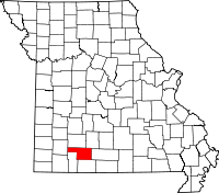 | |
| Village | ||
| CDP | ||
| Unincorporated communities | ||
| Ghost towns | ||
| Footnotes | ‡This populated place also has portions in an adjacent county or counties | |