Gasconade County, Missouri
| Gasconade County, Missouri | |
|---|---|
 Gasconade County Courthouse in Hermann | |
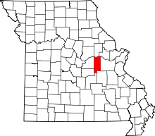 Location in the U.S. state of Missouri | |
 Missouri's location in the U.S. | |
| Founded | November 25, 1820 |
| Named for | Gasconade River |
| Seat | Hermann |
| Largest city | Owensville |
| Area | |
| • Total | 524 sq mi (1,357 km2) |
| • Land | 518 sq mi (1,342 km2) |
| • Water | 6.6 sq mi (17 km2), 1.3% |
| Population (est.) | |
| • (2015) | 14,858 |
| • Density | 29/sq mi (11/km²) |
| Congressional district | 3rd |
| Time zone | Central: UTC-6/-5 |
Gasconade County is a county located in the east-central portion of the U.S. state of Missouri. As of the 2010 census, the population was 15,222.[1] The county seat is Hermann.[2] The county was named after the Gasconade River.
The county is located on the south side of the Missouri River, which once served as the chief route of transportation in the state. It is located in the area known as the Missouri Rhineland. Because of its distinctive conditions, the Hermann area was designated an American Viticultural Area (AVA) in 1983. The southern part of the county is within the larger Ozark Highlands AVA, established in 1987.
Etymology
Gasconade County (and the Gasconade River) received its name from French-speaking settlers.[3] They came from the Gascony region in southwestern France during French colonial rule of New France (Louisiana Territory).
The French colonial inhabitants of this region had the same boastful character as the inhabitants of Gascony in France, hence the name Gasconade, meaning 'Gascony-like.'[4]
Geography
According to the U.S. Census Bureau, the county has a total area of 524 square miles (1,360 km2), of which 518 square miles (1,340 km2) is land and 6.6 square miles (17 km2) (1.3%) is water.[5]
Adjacent counties
- Montgomery County (north)
- Warren County (northeast)
- Franklin County (east)
- Crawford County (southeast)
- Phelps County (south)
- Maries County (southwest)
- Osage County (west)
- Callaway County (northwest)
Major highways
Demographics
| Historical population | |||
|---|---|---|---|
| Census | Pop. | %± | |
| 1830 | 1,545 | — | |
| 1840 | 5,330 | 245.0% | |
| 1850 | 4,996 | −6.3% | |
| 1860 | 8,727 | 74.7% | |
| 1870 | 10,093 | 15.7% | |
| 1880 | 11,153 | 10.5% | |
| 1890 | 11,706 | 5.0% | |
| 1900 | 12,298 | 5.1% | |
| 1910 | 12,847 | 4.5% | |
| 1920 | 12,381 | −3.6% | |
| 1930 | 12,172 | −1.7% | |
| 1940 | 12,414 | 2.0% | |
| 1950 | 12,342 | −0.6% | |
| 1960 | 12,195 | −1.2% | |
| 1970 | 11,878 | −2.6% | |
| 1980 | 13,181 | 11.0% | |
| 1990 | 14,006 | 6.3% | |
| 2000 | 15,342 | 9.5% | |
| 2010 | 15,222 | −0.8% | |
| Est. 2015 | 14,858 | [6] | −2.4% |
| U.S. Decennial Census[7] 1790-1960[8] 1900-1990[9] 1990-2000[10] 2010-2015[1] | |||
As of the census[11] of 2000, there were 15,342 people, 6,171 households, and 4,288 families residing in the county. The population density was 30 people per square mile (11/km²). There were 7,813 housing units at an average density of 15 per square mile (6/km²). The racial makeup of the county was 98.69% White, 0.12% Black or African American, 0.18% Native American, 0.16% Asian, 0.01% Pacific Islander, 0.14% from other races, and 0.70% from two or more races. Approximately 0.42% of the population were Hispanic or Latino of any race.
There were 6,171 households out of which 31.00% had children under the age of 18 living with them, 58.00% were married couples living together, 7.60% had a female householder with no husband present, and 30.50% were non-families. 27.00% of all households were made up of individuals and 14.60% had someone living alone who was 65 years of age or older. The average household size was 2.44 and the average family size was 2.95.
In the county the population was spread out with 24.80% under the age of 18, 6.90% from 18 to 24, 25.90% from 25 to 44, 23.70% from 45 to 64, and 18.80% who were 65 years of age or older. The median age was 40 years. For every 100 females there were 94.60 males. For every 100 females age 18 and over, there were 92.90 males.
The median income for a household in the county was $35,047, and the median income for a family was $41,518. Males had a median income of $29,659 versus $20,728 for females. The per capita income for the county was $17,319. About 7.00% of families and 9.50% of the population were below the poverty line, including 11.20% of those under age 18 and 10.00% of those age 65 or over.
Politics
Local
The Republican Party predominantly controls politics at the local level in Gasconade County. Republicans hold all but two of the elected positions in the county.
| Gasconade County, Missouri | ||||
|---|---|---|---|---|
| Elected countywide officials | ||||
| Assessor | Joseph M. Mundwiller | Democratic | ||
| Circuit Clerk | Joyce Gabathuler | Republican | ||
| County Clerk | Lesa Lietzow | Republican | ||
| Collector | Shawn Schlottach | Republican | ||
| Commissioner (Presiding) |
Nicholas H. "Nick" Baxter | Democratic | ||
| Commissioner (District 1) |
Matthew Penning | Republican | ||
| Commissioner (District 2) |
Jerry D. Lairmore | Republican | ||
| Coroner | Benjamin D. Grosse | Republican | ||
| Prosecuting Attorney | Ada Brehe-Kreuger | Republican | ||
| Public Administrator | Fay Owsley | Republican | ||
| Recorder | Joyce Gabathuler | Republican | ||
| Sheriff | Randy Esphorst | Republican | ||
| Surveyor | Paul Dopuch | Republican | ||
| Treasurer | Joey R. Gross | Republican | ||
State
| Year | Republican | Democratic | Third Parties |
|---|---|---|---|
| 2012 | 53.18% 3,775 | 44.55% 3,162 | 2.27% 161 |
| 2008 | 55.78% 4,307 | 42.90% 3,313 | 1.32% 102 |
| 2004 | 65.36% 4,696 | 33.57% 2,412 | 1.07% 77 |
| 2000 | 61.83% 4,091 | 35.31% 2,336 | 2.86% 189 |
| 1996 | 50.99% 3,042 | 46.36% 2,766 | 2.65% 158 |
Gasconade County is divided into two legislative districts in the Missouri House of Representatives.
- District 61 - Justin Alferman (R-Herman). Consists of the communities of Gasconade, Herman, Morrison, and Mt. Sterling.
| Party | Candidate | Votes | % | ± | |
|---|---|---|---|---|---|
| Republican | Justin Alferman | 1,341 | 75.34 | +6.58 | |
| Democratic | Tom Smith | 439 | 24.66 | -6.58 | |
| Party | Candidate | Votes | % | ± | |
|---|---|---|---|---|---|
| Republican | Dave Schatz | 2,067 | 68.76 | ||
| Democratic | Michael Sage | 939 | 31.24 | ||
| Party | Candidate | Votes | % | ± | |
|---|---|---|---|---|---|
| Republican | Tom Hurst | 1,953 | 100.00 | +30.28 | |
| Party | Candidate | Votes | % | ± | |
|---|---|---|---|---|---|
| Republican | Tom Hurst | 2,701 | 69.72 | ||
| Democratic | Greg Stratman | 1,173 | 30.28 | ||
Gasconade County is a part of Missouri's 6th District in the Missouri Senate and is currently represented by Mike Kehoe (R-Jefferson City).
| Party | Candidate | Votes | % | ± | |
|---|---|---|---|---|---|
| Republican | Mike Kehoe | 3,105 | 78.49% | ||
| Democratic | Mollie Freebairn | 851 | 21.51% | ||
Federal
| Party | Candidate | Votes | % | ± | |
|---|---|---|---|---|---|
| Republican | Todd Akin | 3,603 | 51.30 | ||
| Democratic | Claire McCaskill | 2,927 | 41.68 | ||
| Libertarian | Jonathan Dine | 493 | 7.02 | ||
Gasconade County is included in Missouri's 3rd Congressional District and is represented by Blaine Luetkemeyer (R-St. Elizabeth) in the U.S. House of Representatives.
| Party | Candidate | Votes | % | ± | |
|---|---|---|---|---|---|
| Republican | Blaine Luetkemeyer | 3,083 | 77.25 | +1.83 | |
| Democratic | Courtney Denton | 783 | 19.62 | -2.81 | |
| Libertarian | Steven Hedrick | 125 | 3.13 | +0.98 | |
| Party | Candidate | Votes | % | ± | |
|---|---|---|---|---|---|
| Republican | Blaine Luetkemeyer | 5,272 | 75.42 | ||
| Democratic | Eric Mayer | 1,568 | 22.43 | ||
| Libertarian | Steven Wilson | 150 | 2.15 | ||
Political culture
| Year | Republican | Democratic | Third Parties |
|---|---|---|---|
| 2012 | 68.62% 4,895 | 29.42% 2,099 | 1.96% 140 |
| 2008 | 61.29% 4,763 | 37.31% 2,899 | 1.40% 109 |
| 2004 | 66.28% 4,753 | 32.84% 2,355 | 0.88% 63 |
| 2000 | 63.21% 4,190 | 34.05% 2,257 | 2.74% 182 |
| 1996 | 50.19% 2,997 | 35.24% 2,104 | 14.57% 870 |
At the presidential level, Gasconade County is one of the most reliably Republican strongholds in the state of Missouri. The Republican presidential nominee has won Gasconade County in every presidential election since 1860, giving the county the longest active Republican voting streak for presidential elections in the United States.
Like most rural areas throughout Northeast Missouri, voters in Gasconade County generally adhere to socially and culturally conservative principles which tend to influence their Republican leanings. In 2004, Missourians voted on a constitutional amendment to define marriage as the union between a man and a woman—it overwhelmingly passed Gasconade County with 76.48 percent of the vote. The initiative passed the state with 71 percent of support from voters as Missouri became the first state to ban same-sex marriage. In 2006, Missourians voted on a constitutional amendment to fund and legalize embryonic stem cell research in the state—it failed in Gasconade County with 58.61 percent voting against the measure. The initiative narrowly passed the state with 51 percent of support from voters as Missouri became one of the first states in the nation to approve embryonic stem cell research. Despite Gasconade County's longstanding tradition of supporting socially conservative platforms, voters in the county have a penchant for advancing populist causes like increasing the minimum wage. In 2006, Missourians voted on a proposition (Proposition B) to increase the minimum wage in the state to $6.50 an hour—it passed Gasconade County with 74.74 percent of the vote. The proposition strongly passed every single county in Missouri with 78.99 percent voting in favor. (During the same election, voters in five other states also strongly approved increases in the minimum wage.)
Missouri Presidential Preference Primary (2008)
- Former U.S. Senator Hillary Rodham Clinton (D-New York) received more votes, a total of 848, than any candidate from either party in Gasconade County during the 2008 Missouri Presidential Preference Primary.
| Gasconade County, Missouri | ||
|---|---|---|
| 2008 Republican primary in Missouri | ||
| John McCain | 793 (40.25%) | |
| Mike Huckabee | 514 (26.09%) | |
| Mitt Romney | 536 (27.21%) | |
| Ron Paul | 75 (3.81%) | |
| Gasconade County, Missouri | ||
|---|---|---|
| 2008 Democratic primary in Missouri | ||
| Hillary Clinton | 848 (53.54%) | |
| Barack Obama | 692 (43.69%) | |
| John Edwards (withdrawn) | 25 (1.58%) | |
Education
Public schools
- Gasconade County R-I School District - Hermann
- Hermann Elementary School (K-03)
- Hermann Middle School (04-08)
- Hermann High School (09-12)
- Gasconade County R-II School District - Owensville
- Gerald Elementary School (K-05) - Gerald
- Owensville Elementary School (K-05)
- Owensville Middle School (06-08)
- Owensville High School (09-12)
Private schools
- St. George School – Hermann (PK-08) – Roman Catholic
- Immanuel Lutheran School – Rosebud (PK-08) – Lutheran
Communities
- Bland
- Gasconade
- Hermann (county seat)
- Morrison
- Mount Sterling
- Owensville
- Redbird
- Rosebud
See also
References
- 1 2 "State & County QuickFacts". United States Census Bureau. Retrieved September 8, 2013.
- ↑ "Find a County". National Association of Counties. Retrieved 2011-06-07.
- ↑ Gannett, Henry (1905). The Origin of Certain Place Names in the United States. Govt. Print. Off. p. 135.
- ↑ Eaton, David Wolfe (1916). How Missouri Counties, Towns and Streams Were Named. The State Historical Society of Missouri. pp. 168–169.
- ↑ "2010 Census Gazetteer Files". United States Census Bureau. August 22, 2012. Retrieved November 15, 2014.
- ↑ "County Totals Dataset: Population, Population Change and Estimated Components of Population Change: April 1, 2010 to July 1, 2015". Retrieved July 2, 2016.
- ↑ "U.S. Decennial Census". United States Census Bureau. Retrieved November 15, 2014.
- ↑ "Historical Census Browser". University of Virginia Library. Retrieved November 15, 2014.
- ↑ "Population of Counties by Decennial Census: 1900 to 1990". United States Census Bureau. Retrieved November 15, 2014.
- ↑ "Census 2000 PHC-T-4. Ranking Tables for Counties: 1990 and 2000" (PDF). United States Census Bureau. Retrieved November 15, 2014.
- ↑ "American FactFinder". United States Census Bureau. Retrieved 2008-01-31.
External links
- CountyNewsLIVE.com (Hermann)
- Gasconade County Republican (Owensville)
- Digitized 1930 Plat Book of Gasconade County from University of Missouri Division of Special Collections, Archives, and Rare Books
- Gasconade County Sheriff's Office
 |
Montgomery County | Warren County | | |
| Osage County | |
Franklin County | ||
| ||||
| | ||||
| Maries County | Phelps County | Crawford County |
Municipalities and communities of Gasconade County, Missouri, United States | ||
|---|---|---|
| Cities | | |
| Townships | ||
| Unincorporated community | ||
| Ghost towns | ||
| Footnotes | ‡This populated place also has portions in an adjacent county or counties | |
Coordinates: 38°26′N 91°31′W / 38.44°N 91.51°W